
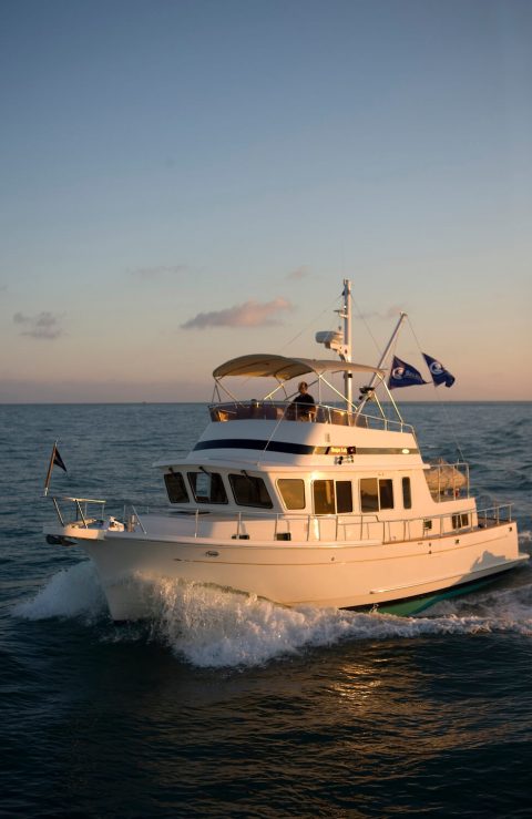
A Guide to Sailing Pilotage and Passage Planning

In 1979, an artist named Christopher Cross wrote and recorded a song called ‘Sailing’. Highly popular, it won the prestigious ‘Song of the Year’ category at Grammy Awards in 1981.
A soft rock song, it sang of the joy, tranquility, and freedom found while sailing. Let’s explore this serene hobby in more detail, in particular, what it means to sail pilotage and the importance of passage planning.
Right now you may be wondering to yourself, “what is pilotage in reference to sailing?” Piloting (or pilotage) is navigating by eye, compass, and chart, using fixed points of reference, to determine a vessel’s location.
It is the skill of recognizing where you are by reading a map and comparing it with the surrounding landscape.
Pilotage aims to determine a series of ‘safe tracks’ (without plotting a position on a chart), confirming at any time that the vessel is on (or close to) these tracks.
Marine pilotage is used when entering or leaving a harbor, when time does not allow for fixed-point plotting on a chart and where an error of just a few boat lengths can have grave consequences.
What You Need for Safe Pilotage and Passage Planning
Navigating pilotage is actually quite simple. In local waters, pilotage is done with little conscious effort as a sailor is very familiar with the buoys and landmarks that point out one’s position.
However, in strange waters, it is crucial to creating an easy pilotage plan by combining information available from pilot books, sailing charts, and nautical almanacs.
Pilotage should be assembled in a clear and concise manner. Do not write information in essay format but rather illustrate in pictorial form. This is simple to do and easier to understand.
The key to pilotage is planning ahead. You will need the following:
- Pilot books (also known as ‘sailing directions’ or ASD’s)
- Sailing charts (up-to-date and informatively correct)
- Nautical Almanac ( Reed’s Nautical Almanac , for example, for the current year)
A passage plan is a way of navigating (from berth to berth) to ensure a safe voyage by:
- Acknowledging possible hazards and assessing associated risks
- Monitoring water depth/sufficient sea room
- Choosing the best course according to the appropriate position
- Reporting any and all necessary requirements and taking routing measures
- Acting responsibly and respectfully towards other vessels
- Being aware of current and changing weather conditions
- Following all pertinent safety measures
Pilot Books
Pilot books contain information that will help you decide, for example, which approach channel to use if there is more than one option.
One channel may be preferable to another if the wind is coming in at a certain angle or when the tide is setting in a particular direction.
Not all channels are marked with lit buoys at night or have sufficient water depth at low tide. Subsequently, these channels can only be navigated safely with local knowledge.
The British Admiralty publishes pilot books covering the majority of the world. BA Pilots are primarily intended for commercial use by shipping vessels, however in recent years, have included information on small boat navigation as well.
Cruising clubs will also produce pilot books and sailing instructions for local areas. An example of this would the Florida Cruising Directory which contains instructions on how to properly navigate the marinas and other areas off the coast.
The National Ocean Service (NOS) publishes a series of excellent United States Coast pilot books covering the United States coastal waters at around $25 each (2018/2019 editions), according to MDNAUTICAL.COM The nine pilot books are available as follows:
- Coast Pilot 1 – Atlantic Coast: Eastport, ME to Cape Cod, MA
- Coast Pilot 2 – Atlantic Coast: Cape Cod, MA to Sandy Hook, NJ
- Coast Pilot 3 – Atlantic Coast: Sandy Hook, NJ to Cape Henry, VA
- Coast Pilot 4 – Atlantic Coast: Cap Henry, VA to Key West, FL
- Coast Pilot 5 – Gulf of Mexico, Puerto Rico, and the Virgin Islands
- Coast Pilot 6 – Great Lakes and the Connecting Waterways
- Coast Pilot 7 – Pacific Coast: California, Oregon, Washington, Hawaii, and Pacific Islands
- Coast Pilot 8 – Alaska: Dixon Entrance to Cape Spencer
- Coast Pilot 9 – Pacific and Arctic Coasts, Alaska: Cape Spencer to the Beaufort Sea
Sailing Directions
Sailing directions, both ‘Planning’ and ‘Enroute’ is published by The Defense Mapping Agency and contains pertinent information on harbors, coasts, and waters around the world.
Sailing directions are published in written form and gives detailed information on port approaches and the general coastline. It also contains some sketches, small charts, and photographs. Let’s explore these in more detail below.
Planning Guides
Planning guides assist a sailor in preparing for an extensive oceanic voyage. They also provide vital information on individual countries and all ports applicable to those countries.
Each volume consists of a pre-determined area by covers an arbitrary division of the world seas.
Individual planning guides are divided into countries and ocean basins as follows:
- Pub. 120 – fifty-one countries and one ocean basin (Pacific Ocean)
- Pub. 140 – eighty-seven countries and six ocean basins (Baltic Sea, Black Sea, Caribbean Sea, Mediterranean Sea, North Atlantic Ocean, and the North Sea/English Channel)
- Pub. 160 – sixty-one countries and three ocean basins (Indian Ocean, South Atlantic Ocean, and the Red Sea/Persian Gulf)
- Pub. 180 – five countries and one ocean basin (Arctic Ocean)
Information on specific countries in each volume includes the following:
- Buoyage systems
- Fishing zones
- Firing areas
- Mining areas
- Popular industries
- Navigational information
- Pilotage information
- Offshore drilling
- Prohibited areas
- Pollutions issues
- Search and rescue operations
- Submarine operating areas
- Regulations
- Traffic separation schematics
- Vessel traffic systems
- U.S. embassy
Ocean basin information included in each volume outlines the following:
- Climatology
- Geophysical features
- Magnetic fields
- Ionospheric disturbance
- Meteorology
- Optical illusion phenomena
- Surface temperature
- Ship reporting systems
Enroute Guides
Enroute guides contain numbered regions along a coast or through a strait. Each region is reviewed in turn.
It also contains a preface with detailed information about authorities, treaties, and references for each coastal area.
A table showing conversions between feet, fathoms, and meters is also included. Each volume also provides a list of commonly used abbreviations for the various terms used in the text.
The first items shown are chart information graphics, which depict digital nautical charts (DNC) pertaining to each region.
The sequence of the chartlets enables navigators to locate the largest scale chart for a location as well as find a specific feature listed in the index-gazetteer.
A glossary of foreign terms and a complete index-gazetteer follows the regional descriptions. The index-gazetteer is an alphabetical listing of described and charted features present in the Enroute guide. It lists each feature by its geographical coordinates and sector-paragraph number.
A majority of nations publish sailing directions for their local waters. The most commonly used is the United Kingdom Hydrographic Office’s ‘Admiralty Sailing Directions’ or ASD’s.
These provide the most detailed geographic coverage of coastal routes around the world. They are designed to supplement the data found on British Admiralty Nautical Charts.
By outlining routes for seagoing vessels, relative to coastal features, ASD’s are essential for sailing pilotage.
The Admiralty book entitled ‘Ocean Passage for the World’ is also helpful as it outlines offshore routes for power-driven vessels and low-powered sailing boats separately. ASD’s are also commonly used by naval and government vessels.
Nautical Almanacs
There are many nautical almanacs available today. These range from the small, inexpensive, local versions to the well-known Reed’s Nautical Almanac . Let’s explore these pilotage necessities in more detail below.
Local nautical almanacs usually consist of tide tables and briefly outlined items of general interest. Reed’s, however, is one of the best almanacs on the market today and contains many pages of valuable information.
Reed’s publishes almanacs for the majority of ports in the United States, from the East coast to the West coast and also the Caribbean.
Common details found in Reed’s Nautical Almanac includes navigation and general information such as shelter areas, landmarks, VHF radio channels, telephone numbers, town facilities, fuel availability, etc.
Also included are tidal height data, current tables for reference ports, and subordinate station differences for most areas outlined in the almanac.
The 2019 version of Reed’s Nautical Almanac in paperback form is great. Almanacs must be replaced each year to be sure the information included is up-to-date.
Reed’s will also issue corrections each year, which are mailed out, free of charge upon request. It is recommended that you submit the corrections request form immediately and once received, keep it handy with your almanac.
Eldridge Tide and Pilot Book covers tides and currents from Nova Scotia to Key West on the East Coast and is often referred to as ‘the mariner’s bible’.
It includes useful information on GPS and electronic navigation, marine weather patterns, Federal regulations, navigation rules, coastal pilotage tips, and emergency first aid instructions. In addition, it provides interesting articles on fishing, nautical astronomy, and maritime traditions.
The 2019 version is available through Amazon in paperback form. It is a valuable resource at a reasonable price but does not, however, include harbor entrance charts.
As mentioned earlier, almanacs must be replaced every year. Eldridge, like Reed’s, will also mail a supplement to you upon request, listing changes to lights, buoys, fog signals, etc.
Planning a Passage
It is important to plan a passage ahead of time. If you are planning the pilotage for entry to a harbor that has a channel marked with buoys, using a pilot book as well as sailing charts will help you achieve this.
An example of how to do this is outlined below:
- Choose the best channel to use, based on the pilot books, if indeed there is a choice.
- Decide on a definite starting point (such as a cardinal mark or buoy) at the beginning of the channel.
- Draw the planned route on the chart from start to finish. Note that this will include a number of different tracks rather than a single straight line.
- Draw the tracks in a way that clearly shows any turning points represented by a cardinal mark or buoy.
- Make sure that you have utilized any and all marks that could be potentially useful.
- If you are passing through an area requiring you to pilot without stopping at a port, be sure to highlight a buoy or bearing that can be clearly defined in your completed pilotage plan.
- If tidal heights are a factor, illustrate the tidal curve beforehand and do the same for any tidal streams.
- Include any and all bearing variations and/or deviations and be sure they relate to the boat’s compass.
- Wherever possible, use suitable ranges (rather than courses) to navigate. It is easier to pilot a vessel on a precise heading (by keeping two objects inline) rather than attempting to steer a course using a compass. A boat held on a range is automatically compensating for such factors as the tide, leeway, etc.
- Try to put all this information into a pictorial form so it is easily understood and can be quickly accessed.
Note: If you are entering a harbor, be aware of any signals used by the harbor to regulate traffic and switch your VHF to the channel the harbor or marina uses.
Some of the busier ports require you to call them in advance on VHF and request permission to enter. Check the almanac for additional information.
Routine for Navigating a Vessel on a Coastal Passage
- Stick to your pilotage plan. Do not take shortcuts. The area will likely appear differently than what you envisioned in your mind. This is why you created the pilotage plan and why it is so important.
- Begin at the first mark and clearly identify it. This will ensure you that have the right one when coming to it.
- Check the identification of each mark as you pass it and check it off on your pilotage plan.
- Do not automatically assume that the mark ahead is the next one. Compare its bearing to your notes.
- As soon as you change course and are in line with the next mark, choose a fixed object or shore light directly in line with the mark and use it as a range to steer past. Note that the object does not have to be on the chart but it does have to be fixed.
- Keep a watchful eye on the depth sounder. This will identify any errors in your pilotage.
- Set the depth sounder’s shallow alarm (provided it has one) to a reasonable safety margin.
- It is better if you have someone else in charge of the helm and/or sails . This frees you up to concentrate solely on the pilotage plan.
- Make sure that your instructions to whoever is in charge of the helm are clear and concise. Do not give vague or ambiguous instructions such as “head for that light”. Instead, pick a suitable range and ensure your directions are clearly understood.
Points of Reference
Common types of visual reference points used for piloting (pilotage) include:
- Natural features such as mountains, hills, cliffs, rocks, beaches, lakes, and rivers
- Navigational tools such as sea marks (buoys and beacons) and landmarks
- Other land structures such as cities, highways, airports, dams, and radio antennas
- Lit-up navigational tools such as lighthouses, lighted vessels, and lighted sea marks
- Lit-up man-made structures including airports, towers, and buildings
- A depth sounder used to measure depth as well as identify a bathymetric contour/crossing point This allows the navigator to confirm safe passage over areas of obstruction
Port Control
When approaching a harbor, it is recommended that you switch your VHF (very high frequency) to dual.
Observe the port working channel and inquire if it is mandatory to contact the port authority.
If so, then contact them and ask for permission to enter. Also, ask if they have any additional navigating instructions or recommendations.
Lock Gates and Marinas
If there are lock gates or a sill at the entrance to the harbor or marina, inquire as to whether or not you can go directly in or if you will have to wait. If you must wait, refer to the almanac on where you can ‘tie up’, moor or anchor.
If a marina is your last stop, contact them on their working channel and arrange your docking site together as well as any other directions you may need.
Be sure to also ask on which side to place your fenders to avoid the hassle of having to change them all around at the last minute.
If you need assistance at the docking site, ask the berthing master on the pontoon. Check-in with the harbor master or the marine office as soon as possible to complete any and all necessary paperwork.
Customs and Immigration – Crew and Passenger Lists
By law, it is required that all vessels clear customs and immigration upon entry into a foreign port.
This is not unlike what you would expect to do upon arrival at any international airport. Customs forms are provided at the port you are visiting by a customs officer.
It is essential that you have both your vessel’s documentation and registration upon clearing customs.
The boat master must provide Immigration with a list of all passengers and crew. The crew list must include the following information: name, nationality, passport number, and date of birth.
It is important to note that any and all fees (for both customs and immigration authorities) are usually charged in the local currency.
Be sure to plan for this in advance and have the money ready. Cruising permits may also be required in some countries. These allow you to travel legally in their territorial waters. There is usually a fee associated with this permit as well so be prepared.
Related Questions
What are some other types of charts used in navigation? Along with nautical charts, there are other forms of cartography (using natural and man-made features as points of reference appropriate to a specific type of navigation) useful in navigation. These include:
- Aeronautical charts. These are pictorial representations of the earth’s surface including terrain and other geographical features. They vary in scale from 1:1,000,000 (world aeronautical charts) all the way to 1:250,000.
- Topographic maps. These outline basic land formations, terrain, lakes, rivers, forested areas, roadways and railways, and other man-made landmarks. These use large-scale detail and contour lines to depict both natural and man-made features.
What is course tracking vs ground tracking? The line connecting reference points (or fixes) is the track over the ground (or sea bottom). The navigator compares the ground (sea bottom) track with the navigational course for a specific leg of the intended route.
This is done to a needed correction in ‘heading’ (the direction the vessel is pointed to maintain its course in the face of cross-currents of wind or water) that otherwise might carry the boat off-course.
What is a Maritime pilot and how much would one earn in wages? A maritime pilot (also known as a marine pilot, harbor pilot, or bar pilot) is a sailor who safely steers vessels through congested waters, such as harbors or river mouths.
They are navigational experts and possess in-depth knowledge and understanding of a particular waterway including its depth, currents, etc. They earn a salary ranging anywhere from $100,000 to $400,000 per year.
In conclusion, upon reading this article, you should now have a better understanding of how to sail pilotage and the importance of passage planning in advance.
It is necessary to use pilot books, sailing charts, and nautical almanacs when piloting a vessel in open waters. A sailor should have these resources ready before setting out on an oceanic voyage.
Upon arrival at your destination, understanding the specific docking requirements is crucial. Ports, lock gates, and marinas all have safety procedures in place that need to be followed.
There is also strict policy when dealing with customs and immigration so do your research and be prepared. The better prepared you are, the easier the disembarkation.
Get the very best sailing stuff straight to your inbox
Nomadic sailing.
At Nomadic Sailing, we're all about helping the community learn all there is to know about sailing. From learning how to sail to popular and lesser-known destinations to essential sailing gear and more.
Quick Links
Business address.
1200 Fourth Street #1141 Key West, FL 33040 United States
Copyright © 2024 Nomadic Sailing. All rights reserved. Nomadic Sailing is a participant in the Amazon Services LLC Associates Program, an affiliate advertising program designed to provide a means to earn fees by linking to Amazon.com and affiliated sites.
Yachting Monthly
- Digital edition

How to plan and sail an offshore passage
- Chris Beeson
- July 8, 2015
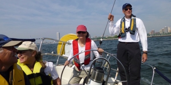
James Stevens stands by as Becca Morley steps up to plan and sail her first big offshore passage as skipper

Mid-Channel, away from the hazards, the sailing is carefree and easy Credit: Pete Oswald/YM

James Stevens, author of the Yachtmaster Handbook, spent 10 years as the RYA’s Training Manager and Yachtmaster Chief Examiner
Crossing the English Channel, North or Irish Seas for the first time as skipper is a daunting prospect. You’ll be sailing out of sight of land, crossing busy shipping lanes and tackling ripping tides before you arrive. These are challenges, but not insurmountable ones. A competent coastal skipper handles those situations most weekends. Crossing the Channel is about doing the same things on a bigger scale. If your preparation is good – passage plan, weather, tides and boat checks – there’s no reason you shouldn’t succeed. And, as a first-time skipper, the sense of achievement of arriving safely in another country is like nothing else.
Confidence is a hurdle, but as soon as you have one crossing under your keel, you’ll be ready to go again and again. The aim of this article is to help build that confidence by explaining what’s involved in making a successful crossing. To do this, we needed a first-time skipper, so Yachting Monthly asked Becca Morley, 24, an experienced crew studying for her RYA Yachtmaster qualification, to skipper a boat from Cowes to St Vaast on the Cherbourg peninsula. The boat under her command would be Tamora, a Hallberg-Rassy 34 with Tamora’s owner, James Stevens, Sophie, who had some crewing experience, and Pete, the photographer, as crew.
Why would I want to cross the Channel?
We’ll steer clear of the obvious – pretty harbours, lovely anchorages, a bilge full of keenly-priced wine and a fridge bursting with cheese – and look at the challenge itself. I think the best part of cruising is arriving – and it’s even better if the arrival is in a foreign port. You feel like you’ve actually gone somewhere and achieved something.
If things go wrong, it’s the skipper’s fault, so when they go right the skipper can justifiably bask in having planned and executed a passage that gets boat and crew to a foreign destination. It’s a thorough examination of your judgement and ability as a skipper, and to pass it will boost your confidence in your own abilities and leave you with an immense sense of self-sufficiency.
Skippering is not crewing

A crew may have crossed oceans, but that doesn’t mean they’ll be any good as a skipper
There is a huge difference between being the crew and being the skipper. Most crew have very little idea of how much is involved in taking charge of an offshore passage. They stow their bags and they’re ready to go, whereas the skipper started passage planning a month ago and has spent the last week scanning the internet for forecasts, fretting about the drip from the stern gland and wondering about the state of the jib clew.
The paperwork

You’ll need the right paperwork if you’re planning to arrive in a foreign country
It’s the skipper’s job to make sure the paperwork for the boat and the crew is in order. The chances are it will go unexamined but if an official does ask for it and you can’t deliver, you could be in a world of bureaucratic and potentially financial pain. Add it to your winter checklist, when there is plenty of time for updating any certificates.
- SSR Registration
- Bill of Sale, as the SSR does not technically prove ownership
- Invoice showing that VAT was paid in the EU
- Insurance certificate
- Ship’s VHF Radio Licence
- Short Range Certificate – authority to operate VHF radio
- Certificate of Competence (not actually required in coastal France but well worth having)
- European Health Insurance Card (EHIC – the successor to the old E111)
- Courtesy ensign
Navigation essentials
You’ll need the right charts and reference books for the passage. For our passage, we made sure we had:
- Electronic chartplotter with C-map charts and a back-up GPS unit
- The Solent Admiralty Small Craft Folio for Solent pilotage
- The Channel Islands Admiralty small craft folio passage chart
- The Mid Channel Admiralty passage chart as back-up
- Imray C32 pilotage chart for St Vaast
- Reeds Nautical Almanac
- Shell Channel Pilot
- Admiralty Channel tidal stream atlas
- An RYA plastic chart plotter
- Dividers, 18 inch ruler, lots of pencils and an eraser
Our first time skipper – Becca Morley

Becca Morley
‘This isn’t my first crossing,’ said Becca, 24. ‘I have crossed the Channel dozens of times: it comes with my job. What made this trip so special, and slightly terrifying, is that this time I was in charge!’
After graduating from the University of Sheffield, Becca volunteered as bosun on Provident, a 70 ft sailing trawler that operates sail training for young people. This not only fulfils Becca’s enthusiasm for sailing but also provides challenge and adventure for young people, some of whom are from disadvantaged backgrounds.
Becca has completed the RYA courses up to Yachtmaster Coastal with financial assistance from the Association of Sail Training Organisations and a grant from Trinity House.
Although she lives afloat she has very little opportunity to skipper and practice taking command on small boats.
Preparation and planning

St Vaast, with its locked basin surrounded by oyster beds, is one of the most interesting landfalls on the French Channel coast
This breaks down into three stages: passage planning, which can be tackled a month or more beforehand; checking forecasts from three days out; and boat preparation, which takes place the day before. As this was her first time skippering, Becca and I went through each stage together.

Becca planned a passage from Cowes to St Vaast
One month before
The proposed trip is from Tamora’s home port of Cowes to St Vaast, on the east side of the Cherbourg peninsula. The best day for the crew is 28 April, if the weather suits.
First, look at the passage chart to get an idea of the whole trip. I prefer a paper chart for this. The shortest route is via the eastern Solent: 69 miles from the Nab Tower to St Vaast. Our destination is a locked basin and there are strong tidal streams near the headland of Barfleur, up to 5.6 knots at springs (28 April is two days before), so it’s important to arrive with a favourable, easterly stream to St Vaast. Fortunately that’s also a flood tide, so we should not have to wait too long for the lock gates to open.
The tidal stream atlas gives favourable east-going tide at Barfleur from six hours before HW Dover (2243 UT, or 2343 BST) on 28 April, so from 1730 BST. It is also favourable the next morning from 0600 but we want a daylight trip.
On average Tamora cruises at 5-6 knots, so from the entrance of the Eastern Solent to 10 miles off Barfleur, 50 miles, will take 8-10 hours. We need to leave the Solent around 0600. The stream east down the Solent is with us four hours after HW Portsmouth (2207 UT, or 2307 BST, the previous day) so from 0300 BST. Wake early and we have favourable tide for the 11 miles to Bembridge Ledge buoy.
The almanac tells us St Vaast lock is open HW-2hr 15 to +3hr 30, or 1915-0100 BST. Note that the tide table for the French standard port Cherbourg is UT-1, which is BST. British tide tables are in UT (GMT). I prefer to stay in BST until we find we have arrived at a restaurant one hour late for dinner, French local time being one hour ahead. If we arrive off Barfleur at about 1730, we should cover the last 15 miles or so at 7 knots with a fair tide and arrive in time for the lock to open. If we miss the tide off Barfleur, or St Vaast looks exposed, we can divert to Cherbourg. The pilot book gives useful hints about the dangers off Barfleur and advice on approaching and berthing in the harbour.
How Becca planned her passage

The key is arriving at Barfleur with favourable tide, so Becca plans back from that

Plan to arrive off Barfleur with a favourable easterly stream

Find HW for the reference port to find out when the easterly stream begins

Leaving via the Eastern Solent is shorter and a fair tide would be helpful

The reference port shows that an early start gives a favourable stream

You’ll find the information you need, lock opening times for instance, in your Reeds almanac
First time skipper’s thoughts
While planning, an unexpected problem was which time zone to use. I have been taught to do all my calculations in UT, amending for British Summer Time at the end. This works well in home waters. I wasn’t expecting the confusion that arose when working out tides and heights in French Summer Time to ensure I’d get the lock timings right at St Vaast, but I also wanted to convert all my results into BST so that I would be working in one time zone on the day. Cue pages of scribbles and a tide-related headache.
Three days before
Look for a stable forecast. If it keeps changing, the outlook is unsettled. A reliable forecast doesn’t change. For this trip, you need to know the weather for at least 12 hours and preferably beyond. There are plenty of forecasts on the internet but, if in doubt, use the Met Office. It’s the one that is used by the enquiries and disciplinary panels, as I remind my crew.
The forecast is north-east Force 4, becoming variable, not ideal but no reason to delay – we can always motor if the wind dies. Visibility is moderate becoming good – again, it could be better but not a cancelling issue. Had the wind been south-westerly, I might have planned to leave via the Western Solent for a more comfortable wind angle, but it looks like we’ve got lucky!
One day before

With four crew aboard and fading winds forecast, Becca victualled for two days
Becca victualled for four crew for two days. None of the meals requires much prep, and we could eat from bowls if it’s rough. We have snacks and hot drinks too, and topped up the gas because Tamora’s 4.5kg butane cylinders are difficult to buy in France.

Top up your fuel and water tanks and make sure there’s enough gas on board
We filled water and fuel tanks, and carried emergency jerry cans of fuel and bottles of water and spares for the engine. Tamora has a decent toolkit and sail repair kit. We checked engine oil, gearbox oil, fresh water in the header tank, drive belt tension, saltwater filter and, once started, that there was cooling water in the exhaust.

Go through all the basic engine checks while you’re still alongside
The rig was checked a couple of days earlier, the winches had recently been serviced but we missed the broken drive belt in the self-steering system. With four aboard it shouldn’t be a problem but it does need adding to the maintenance list.
We haven’t formally post a passage plan but Tamora’s nominated contact, whose name and number was given to Falmouth Coastguard when her EPIRB was registered, knew when and where we were going and we’d call them when we arrived. Tamora is registered under the Coastguard CG66 scheme.
It looks like an early start so Becca needs to get the crew onboard the night before, talk them through her passage plan and give a safety briefing. As it’s a daylight crossing the watch system is fairly informal: one hour each on the helm in rotation, with another crew on hand. Becca needs to listen to the forecast, estimate passage time and therefore finalise when we need to leave the Solent.

Becca briefs the crew on her plans for the crossing, including shipping lanes and landfall

The crew needs to know where the safety kit is and how it works. Walk through the boat and show them
I’m sure I’ve thought of everything, but as I chat through my plan with James I’m worried he’ll think I’ve never sailed before. I talk the crew through the safety briefing, explain our passage plan and that we are to leave at 0530 the following morning, then I’ll settle down to share a relaxed dinner with my crew before an early night.
The crossing – first time skipper’s thoughts

After successfully springing out of Tamora’s tight Cowes berth, the passage begins
After what feels like 10 minutes in bed, it’s 0500 and the kettle’s on. It’s misty on deck but we can see far enough so, after checking today’s weather, we get ready to go. At 0530, racked with nerves, I spring Tamora out of her berth.

A tense Becca helms Tamora out of Cowes and into the Solent
I’m so focussed that small details like setting sails almost escape me. I have courses to steer from buoy to buoy and I’ve made sure there’s enough water outside the channel in case Something Big comes along. Right on cue a pilot boat passes, indicating Something Big. We move out of the main channel and a car carrier steams west up the Solent.
We’re exactly where I planned at 0730. At 5 knots we should be in St Vaast for a late dinner but I’m unfamiliar with Tamora’s performance. If we’re faster, we’ll anchor off until the lock opens; if slower, we have a long tide window but will arrive in the dark.
Once past the Bembridge Ledge buoy, I didn’t spend long plotting a course to steer and just aimed slightly uptide of Pointe de Barfleur. I’ll monitor progress and adjust as necessary. My course takes us into a roadstead of tankers and one starts moving erratically ahead of us. Five hoots of Tamora’s squeaky little horn probably won’t cut it.

In the roadstead east of Wight, Becca hails a ship manoeuvring unpredictably and arranges a safe passage past
The tanker is fine on our starboard bow, making way slowly on the same heading as us. If he turns to port, avoiding action will be tricky under spinnaker. We call him on channel 16, then switch to 72. I identify Tamora and ask if he’s happy for us to overtake to port. A guttural accent says yes, so I thank him and we continue.
Though I’m sick with nerves playing tanker avoidance, the crew needs breakfast. Bacon butties arrive as we pass the last tanker and the ‘fun sailing’ can begin.

Once south of the island, Tamora’s course to steer is west of south, to counter the east-running tide
The wind is perfect. Tamora makes 6 knots under spinnaker and my crew seems happy in the sun. Each takes an hour on the helm and keeps a lookout. All seems well, so I rest below decks before we reach the traffic separation scheme. Though tired, I don’t sleep. I listen for talk of shipping on deck, worry about Barfleur, or the wind veering. I go back on deck to find that we’ve slowed to under 4 knots. It’s time to take the spinnaker down and put the engine on.
We have lunch and numerous cups of tea. I’m pleased with how it’s going and starting to enjoy it. However, it’s cooler now, the novelty is fading as the engine rattles on and we’re all fidgety.

As she usually crews a 70ft steel sailing trawler, Becca underestimated Tamora’s manoeuvrability for giving way as the shipping lanes loomed
We reach the shipping lanes. Without AIS, the crew checks collision bearings with the handheld compass. It doesn’t take long to get the hang of it, deviate less from our course, and we’re soon across the lanes unscathed.
Closing land – first time skipper’s thoughts

Barfleur light, visible 15 miles out, signals landfall and the passage’s final stage
We sight Barfleur light on the horizon at 1615. The tricky bit is about to begin. Against instinct, we’re still aiming uptide of the lighthouse to keep it on our port side. Turn too early and we’ll be swept east, resulting in a tedious motor uptide or a different port.

Becca runs up the French courtesy flag as Tamora closes the coast
To my delight we are closing the coast exactly when I’d hoped we would, giving us the most advantageous tide. It’s how I planned it! Barfleur whizzes past, looking just as the pilot book promised it would.

With the light fading, Becca searches for Le Gavendest south cardinal
I’m following the 20m contour line to avoid rocks and we’re sluicing along at 10 knots. I grasp the binoculars and search for Le Gavendest cardinal, where we turn west, but there are too many other things scattered around. Despite my preparation I can’t make out anything useful. A glance at the chart suggests we should be off St Vaast in 20 minutes. I still can’t see it! At last I spot my cardinal, hidden in a tangle of lobster pots. Suddenly I’m very pleased we chose a daylight crossing.
It’s 1900 BST. I reckon the lock opens at 1915 – hopefully BST, not local. The theory of time zones seems simple; in practice it’s less so. We motor up to the entrance to find a couple of yachts anchored off the breakwater.

Tamora’s young skipper helms her past the breakwater and into St Vaast just as the lock gates open – perfect timing!
I’m about to suggest a brew at anchor when the lock opens. I’ve done it! My crew congratulate me on getting us here safely, with almost precision timing.

James and Sophie secure Tamora as Becca looks on
I point out that I still need to park us alongside in the marina. After what has been an exhausting 15-hour journey I’m not particularly looking forward to switching back into exam mode and putting Tamora on a finger berth.

Becca celebrates after her first successful Channel crossing

James and Becca visit St Vaast’s Capitanerie du Port to take care of the paperwork
The debrief
The critical decision was the arrival time off Barfleur and Becca got that spot on. On the day, navigation, decision-making, meals and living aboard were fine mid-Channel. The hardest part of the trip was the last unfamiliar 15 miles. For would-be offshore skippers, the lessons are: practice inshore pilotage skills, practice boat handling, and stay rested because the hardest part of the trip is likely to be the end.

Becca’s log was brief but covered the passage in enough detail
Becca sensibly planned backwards from arrival off the French coast. Though she was optimistic in hoping to arrive as the lock gate opened, to her credit, she did. Leaving the eastern Solent Becca successfully avoided ships by keeping out of the main channel and negotiated her way through a roadstead. Victualling, and keeping us happy and fed was not a problem for her as she looks after 12 trainees on board Provident, and she completed the log and kept a record of our position every hour on the paper chart throughout the trip.

Becca’s first Channel crossing as skipper is marked on the chart
Tom Cunliffe’s Shell Channel Pilot (Imray, £35) describes Pointe de Barfleur as a ‘chamber of horrors’, so Becca was wary, but on the day it was benign. She understood the difficulties of the change in time zones but took a while to realise that the reference port for the pilotage chart was Cherbourg and not Dover, as on the passage chart.

Arriving somewhere new needs lots of concentration, so stay rested
Becca kept us safely offshore to avoid offlying rocks, but not so far off that the yacht was swept past St Vaast. Spotting the buoys against the land is difficult. It’s easier to use the plotter to indicate range and bearing so you know where to look, and binoculars with a built-in compass help.

Tamora arrived at Barfleur just as the tide turned easterly –exactly as Becca had planned a month earlier
She worked out the lock opening times and we arrived soon after it opened. Berthing required two attempts but boat handling is always a challenge for the novice skipper.
There were some minor points. Before leaving, she did the final navigation based on the current weather conditions, but could have saved time by getting the crew to prepare the yacht while she did. She helmed for the first hour when she could have delegated that and checked pilotage.

Good weather meant the watch system was more or less redundant
Once clear of land we settled into a watch system, but fine weather meant we were all on deck for most of the trip. Becca rested twice but doing so with ships on the horizon, and again when making landfall, wasn’t the best timing. She found it difficult to judge ships’ range and altered course very early.
Once successfully secured and squared away, Becca heaved a big sigh of relief and downed a well-earned beer. She is well on the way to becoming a Yachtmaster Offshore.

Successfully completing your first offshore passage is an unforgettable feeling
For all the latest from the sailing world, follow our social media channels Facebook, Twitter and Instagram .
Have you thought about taking out a subscription to Yachting Monthly magazine?
Subscriptions are available in both print and digital editions through our official online shop Magazines Direct and all postage and delivery costs are included.
- Yachting Monthly is packed with all the information you need to help you get the most from your time on the water.
- Take your seamanship to the next level with tips, advice and skills from our expert skippers and sailors
- Impartial in-depth reviews of the latest yachts and equipment will ensure you buy the best whatever your budget
- If you are looking to cruise away with friends Yachting Monthly will give you plenty of ideas of where to sail and anchor
The Figure 8 Voyage
Passage making faqs.
Below are some common questions about solo passage making.
Why do you sail alone?

Heading out to Sea.
For me these adventures are less about being away from people and more about being close to the elements and enjoying the practice of self-reliance. When sailing with another aboard, much of the passage ends up being about your relationship with that person—it just can’t be helped on something so small as a sailboat. That’s not the experience I’m after. You could say I solo because I’m selfish. I want to do all the sailing, make all the decisions, do all the work, and see the entire ocean myself. That’s where the fun is. Read more on being alone…
What do you find most challenging about long distance sailing?
Getting up the courage to go. After the years of dreaming and months of preparation, all the expectation set with oneself and others tend to come crashing in just as I am ready to raise anchor. That’s when I experience the most self-doubt, knowing of the challenges ahead. Did I plan well enough? Am I smart enough and strong enough to survive? Will I meet some big, unavoidable event that simply wipes me out?
But once out there, each day unfolds in its own way. It’s just you and the boat and the ocean. The problems that arise must be solved with your own ingenuity and the tools you have and nothing else … because there is nothing else. Operating in a world of such simplicity is deeply satisfying. Sure, there is plenty of fear and hardship, but for me at least, those experiences are balanced by an immense sense of beauty and wonder, and an understanding that this, this moment, is exactly what I was made for.
What’s been your scariest moment at sea?
Collecting Tsunami Debris in the North Pacific
In my view, there are just two rules to successful passage making: one, keep the boat going in the right direction; two, stay on board. On my way to Alaska in 2012, I broke the second rule when I fell off the boat reaching for an object in the water. I was collecting debris from the middle of the Pacific for scientists at the University of Hawaii, who were modeling debris distribution resulting from the Japanese Tsunami in 2011. On this morning I had encountered a bag with Japanese script on it floating at water top, my first provable tsunami artifact. I had to untether from the boat to reach it, but I lost my grip when the boat lurched. Instant panic as I fell in. The nearest land was over 1000 miles away at that point. Get separated from the boat and you drowned: end of story. As it turned out the boat was moving very slowly, and I was able to scramble back aboard pretty easily, but it was a sobering moment. Read more about the day I fell overboard…
Can you catch enough fish to live on while making a passage?
I can’t. I drag a hook and lure constantly but only catch a few fish a month. I’m probably a poor fisherman, but also there are vast areas in the middle of the ocean that are like an aquatic desert where fish are rare.
See a video on how to handle a very large fish…
Where do you pull into port for provisions?
You don’t. There’s no stopping, so you pack all the food you’ll need along with you. Because boats have lots of storage space, you can take quite a variety, but I end up eating much the same as I do on land. Cereal (with water, not milk—I don’t have refrigeration) in the morning; nuts, cheese and crackers for lunch or a can of soup or stew, and for dinner a meal made of dried goods, like rice and lentils. The big drawback, of course, is that after a couple of weeks I run out of fresh vegetables and fruits, so the bulk of my diet is canned and dried, and I have to take vitamin C tablets to keep from getting scurvy. This is what makes catching a fish so nice: fresh, tasty, vitamin-rich meat.
How do you communicate with those at home?
Cell phones don’t work more than a few miles off shore and I don’t have a satellite phone. Instead I use old but clever technology that connects my laptop with land-based servers via high frequency AM (HAM) radio signals. The connection is very slow; sending a simple text message, all I can do, can often take a minute or more and there’s no surfing the internet. But the technology is pretty reliable and inexpensive to operate.
Do you sleep normally while at sea?
Propped into my bunk in rough weather
When I’m in known shipping lanes or other areas that I consider risky, I sleep in intervals of 30 minutes or less. Otherwise I sleep in one hour intervals. An hour at a time is not much sleep, so I’ve made a deal with myself that I can sleep for one hour as many times in a day as I like. Oddly, on average I tend to sleep the same number of hours per day at sea as I do on land, and I do most of my sleeping at night.
Because the boat is underway 24 hours a day, how long to sleep and when is a hotly contested question among solo sailors. The main concern is collision with objects in the water, collision with debris like lost shipping containers, large logs or icebergs in the extreme north and southern oceans, or worst of all, other ships. From the deck of my small boat, the furthest I can see to the horizon is about 4 miles. The bridge on a large container ship may be seen from, at most, about 10 miles away. Ships travel quickly compared to small boats, often as much as 25 miles an hour to my average of 5 miles per hour, and can go from below the horizon to on top of you in less, sometimes much less, than half an hour. A solo sailor is his only watch-keeper, so how long to sleep and when is a decision with important consequences. Read more about one night’s fitful sleep…
Where do you get your drinking water?
Because it’s so salty, sea water is potable only in tiny quantities and only in survival situations. And because marine desalination devices tend to use a lot of electricity, a thing I don’t have in surplus, I usually carry all my water and replenish my supplies with rain water when I can. If I use fresh water only for drinking and use salt water for washing and even for cooking, I know from practice that I can survive handily on much less than a gallon a day. On my Pacific passages I carried 70 gallons of water but never used more that about 30 gallons.
How do you know where you are?
Working up my position after shooting the sun
GPS navigation is as common at sea as it is on land, and for safety purposes I have several units on board. But for me it has been important to learn the old methods, like using a sextant, the sun and stars to find my position. Electronic devices are delicate and can fail, so these methods are essential from the perspective of survival, and learning them is deeply satisfying.
See a short video on shooting the sun…
Share this:
- Click to email this to a friend (Opens in new window)
- Click to share on Facebook (Opens in new window)
- Click to share on Twitter (Opens in new window)
Copyright © 2024 · All Rights Reserved · The Figure 8 Voyage
Adventure Theme by Organic Themes · WordPress Hosting · RSS Feed · Log in

Top Ten Tips for Ocean Passage Making

It took an enormous planning effort. Not only did we have to plan the usual things like navigation, provisions, fuel, etc., but also, we were actively working while crossing, so we needed to have good communication. We used a software called OCENS with our Iridium Satellite phone to send and receive email and for making calls, as well as getting the weather forecast. That was back in 2005. Today it is much easier and cheaper to do. As we all know, good seamanship requires numerous preparations especially for successful ocean passage making. Stephen and I each have our own dedicated areas of responsibility to prepare the boat and the crew. That way we know what is expected of each crew member and there is no confusion about who did what. We then double check to make sure all items have been taken care of before we cast off. Our key planning activities are outlined below.
1. Plan Your Passage

2. Wait For A Weather Window
The basic rule we use to avoid trouble is to wait for a weather window for the upcoming passage. Usually we wait for light conditions to ease into a trip (Estelle usually feels a little queasy the first day out), other times we leave on the tail of a weather system that will help us along for a day or so. The general rule is that most forecasts today are fairly accurate for 3-5 days. Beyond that it is unpredictable and one should plan for unexpected conditions. We have learned over the years that setting a specific date for departure or having a schedule getting to places is complete folly. Leaving in adverse conditions to meet a deadline is asking for trouble.
3. Offshore Sailing Preparation Checklist

4. Check And Test Emergency Gear
Renew EPIRB with updated information with NOAA. Check that MOB strobe light batteries are good and flares are in date. Make sure that the MOB horseshoe ring and lifesling is attached properly, life jackets and harnesses are easily accessible and that all crewmembers know where they are stowed. Make sure that your life raft is in date and easily accessible and that every crewmember knows how to operate it. Check your ditchbag and medical kit and replenish or replace supplies. Again, make sure it is easily accessible and that the crew knows where it is stowed. Make sure that your crew knows how to do a crash stop and what to do to retrieve a man over board.
5. Navigation Gear
Test the VHF and have at least one hand held VHF for emergencies. Check that the autopilot functions well and if possible, carry a spare. Radar is good to have, specially if you plan to sail in areas with heavy fog or busy shipping channels and it is invaluable for tracking squalls. Make sure your GPS functions correctly and have a spare handheld just in case. ALWAYS have paper charts in case all electronics fail and log the trip in your ship’s log. We used our iPads for navigation and plotted ourselves every 6 hours on the paper chart. We particularly liked the BoatBeacon App on the iPad that functions as an AIS Marine navigation system, tracking shipping traffic on the Cheaspeake Bay.
6. Boat Provisioning

Make sure that the crew is properly fed. It is good for morale and makes for a happy environment on board. Make up an informal menu for the approximate number of days on passage and add 20% plus some emergency food items like canned tuna, chicken, corned beef, and beans or whatever you prefer, we like protein. In dire situations, if all goes wrong on board, one can easily eat these items cold and from the can if need be. Also stock up on some protein bars. Make an inventory of food aleady on board and add ingredients on the menu to shop for.
I usually purchase the dry goods on the menu first and stow. The day before we leave, I get the perishable items. This makes for a less overwhelming task. Organize galley lockers or pantry with food items to be used on the passage in easily reachable places to minimize looking for ingredients all over the boat. I usually buy tomatoes, avocado, pineapple, mangoes and bananas as green as possible to ripen over time. Potatoes and onions get stowed in a dark dry place. Oranges, lemons, apples, cabbage, carrots, squash etc. last a long time and mostly does not need refrigeration, so I get a fair amount of it instead of things like lettuce.
We like eggs for breakfast so I buy fresh eggs for a few days and eggbeaters to make scrambled egg or omelets. I usually plan simple, easy to prepare meals for our passages, especially for the first few days out. I pre-prepare at least three simple but satisfying meals ( chicken curry , meatloaf, shepards pie, pasta Bolognese, etc.) and freeze it for bad weather days. I always have a few steaks in the freezer for a nice day when we can BBQ off the back of the boat and of course when we catch fish, we like to make sashimi or grill the fish straight away. If conditions are good, I will bake bread every 3-4 days. We tend to snack during night watches, so I bake cookies before we leave and have some candy bars stowed away. Check out the Boatgalley.com provisioning tips .
Feel free to contact me for comprehensive provisioning planning.
7. Fishing Gear

8. Watch Keeping
Our watch keeping system is simple. We ALWAYS have someone on watch but since we rely on the autopilot to steer the boat, we only have to watch for ships, obstructions, make log entries and check our sails occasionally. We do not rotate our watches because our bodies adjust better to watches if we do the same ones every night.
When it is only the two of us, we do three hours on and three hours off but we make it shorter with more crew so that we get some decent rest in between watches. During the day it’s sort of a loose system with one or the other or both on watch while we tend to our chores like cooking, navigation etc. Stephen usually makes the rounds on deck inspecting for chafe and other areas of concern during the day. In particularly bad weather, we will do 1-hour watches if the autopilot labors too hard and we are required to hand steer. Stephen’s method of using an egg timer seems to work really well for night time watches.
He sets the timer for 14 minutes at which time he gets up, checks for lights and generally makes sure that everything is as it should be for about 3 minutes and goes back to reading or taking a nap. It helps break up the time and after a night or two, your body gets used to the routine.
9. Water Management On Board

10. Marine Fuel And Batteries
We had our tanks cleaned out and fuel polished this season after we detected some nasty critters and water in the fuel filters. This can become a real issue so make sure that your fuel is as clean as possible. Fill fuel tanks and manage this resource. Figure out what distance you can motor (we do under a gallon per hour per engine and we run only one engine at a time) and make sure that you conserve enough fuel to motor into a harbor or motor yourself out of a sticky situation. Running the tanks dry will lead to having to bleed the fuel system, not a difficult thing to do but very unpleasant at sea. We usually have emergency fuel in jerry cans in case we motor more than expected and we run out. Make sure that you carry spare impellers, fan belts and fuel filters and know how to change them, usually a fairly simple procedure. It is advisable that you do an engine course to understand the basics about your engine. Manage your charging system diligently. We use approximately 15- 20 amps per hour with the autopilot, fridge / freezer, lights and other stuff. We usually keep our batteries maintained by charging 2 hours per day (by generator as it uses less fuel) and have solar panels that will give us a further 60-80 amps per day, unless overcast. That seems to keep us going pretty well but we are always very careful not to waste this resource.
Here’s more info on power management on modern cruising catamarans .
| : Free worldwide 7-day Wind, Wave and Weather Forecasts.
Global wind speed, direction, wave height, direction, cloud cover and rain. : Provides 7 day text forecasts, passage outlooks, weather charts anywhere on earth. : Daily Email Forecast, Weather Routing.
: Weather routing and forecasts for cruisers. |
Check out our photo slideshow .
Read the Trip Report from the crew onboard catamaran Zuri on our offshore ocean passage.
Contact us for more in depth information or leave a comment with your tips on ocean passage making.

Estelle Cockcroft
Join our community.
Get the latest on catamaran news, sailing events, buying and selling tips, community happenings, webinars & seminars, and much more!
Leave a Comment Cancel Reply
Your email address will not be published. Required fields are marked *
Save my name, email, and website in this browser for the next time I comment.
Recent Posts

Top 10 Reasons to Sell (and Sail) Your Catamaran in Annapolis, MD
We have a new home in Annapolis! The office is located in Annapolis, Maryland

Top 10 Reasons to Sell (and Sail) Your Catamaran in Texas
Our Texas Office is located in the Watergate Marina Center in Clear Lake Shores,

Annapolis Boat Show 2024
Meet with our team! Want to learn more about the Bali and Catana

Exploring the Catana OC 50 Catamaran: A Comprehensive Overview
The Catana OC 50 Catamaran, the latest addition to the Catana Ocean Class series,

For more than 30 years, we have been a part of the catamaran community and created Catamaran Guru™ to encourage and educate all the aspiring sailing out there. We understand the dream of traveling the world by catamaran and created a one-stop-shop to make that dream a reality for you.
- Stephen & Estelle
- Testimonials
Get Started
- Yacht Sales
- Used Yachts
- Charter Management
- Boat as Business Programs
- Seminars & Events

Home Education Adult Sailing Sailing Certification Courses & Endorsements Coastal Passage Making
Sailing Certification Courses & Endorsements
Coastal passage making, coastal passage making graduates will have successfully demonstrated their ability to responsibly skipper and crew an inboard auxiliary powered cruising sailboat during passages on coastal waters, in all weather conditions, including all levels of visibility and all hours of the day and night..
Find a school near you
Recommended Equipment: It is recommended that Coastal Passage Making Certification courses and examinations be conducted on 30’ to 50’ sloop-rigged cruising keelboats with wheel steering and auxiliary diesel power, and with adequate equipment inventory to complete all required certification outcomes.
Prerequisites : The prerequisites for Coastal Passage Making Certification are both US Sailing Bareboat Cruising and Coastal Navigation Certifications.
Certification Requirements : Coastal Passage Making Certification requires the successful completion of the following knowledge and skill requirements. These requirements are expected to be performed safely with confident command of the boat, for a distance of at least 50 nautical miles upon coastal waters, with a wind speed of at least 15 knots, including an overnight passage.
Practical Skills
Preparation to sail:.
- Inspect the vessel for the proposed passage: hull, spars, deck, rigging, hardware, sails, engine, internal mechanical and electrical systems, head systems, freshwater systems, navigation systems, anchoring systems, galley and provisions, and stowage.
- Check the inventory, locate and inspect all required safety and emergency equipment, tools, and spare parts.
- Perform the correct lashing of the life raft or dinghy and other necessary equipment for deck stowage.
- Check the inventory of sails and their condition for the proposed passage, and justify your selection based on the expected sailing conditions.
Crew Operations and Skills:
- Demonstrate a comprehensive understanding of and correct operating procedures for Radar and GPS.
- Demonstrate a high level of seamanship skills.
- Demonstrate the ability to direct the crew and make decisions to benefit the passage goals in consideration of the weather and sea conditions, crew welfare, proper navigation, and safety.
Leaving the Dock or Mooring:
- Develop a departure plan for the vessel and crew, and demonstrate appropriate helmsman and crew coordination and skills for leaving the dock.
Boat Control in Confined Waters:
- Demonstrate boat control in close quarters in adverse conditions (actual or simulated) as you leave the harbor.
Navigation:
- Demonstrate the proper use of a thoroughly documented ship’s log.
- Demonstrate the use of tide and current tables.
- Demonstrate the use of the Light List and Coast Pilot.
- Plot danger bearings.
- Demonstrate the correct method of taking a running fix.
- Successfully navigate a passage of at least 10 miles without Radar or GPS.
- Successfully navigate a passage of at least 10 miles with Radar or GPS.
Boat Control in Open Water:
- Demonstrate leadership skills during a night passage.
- Demonstrate command and control of the vessel under all wind and sea conditions encountered during the passage.
- Demonstrate seamanship skills during a headsail change.
Heavy Weather Sailing:
- Demonstrate working on deck at night or under heavy weather conditions (actual or simulated) while using a safety harness and jacklines.
- Demonstrate the use of a boom preventer and explain how to overcome its inherent dangers.
Overboard Rescue Methods:
- Demonstrate both the Quick-Stop and Lifesling methods of overboard rescues, both day and night. Choose one of the above methods that is most appropriate for the current wind and sea conditions.
Safety and Emergency Procedures:
- Simulate a plan of action should your vessel be in danger due to fire, water intake, dismasting, steerage failure or other disasters. Demonstrate all safety considerations given the situation.
Anchoring Techniques:
- Demonstrate the ability to anchor or recover anchor while the vessel is under sail.
- Demonstrate the ability to properly execute a Mediterranean Mooring.
- Demonstrate the use of a tripline/anchor buoy.
Returning to the Dock:
- Develop an approach plan for the vessel and crew, and demonstrate appropriate helmsman and crew coordination and skills for returning to the dock.
Securing the Boat Properly:
- Coordinate the crew and demonstrate the stowing of equipment and cleaning of the vessel after returning to the dock.
- Check the vessel before leaving the dock: determine and report any required maintenance; check docklines, spring lines, and fenders; check through-hull valves, electrical system, bilge pumps, and overall security of the boat.
- Develop a detailed passage plan to include weather forecasts, strategies and tactics for all potential conditions, and navigation strategies.
- Coordinate the crew with a watch schedule and responsibilities during the passage.
Weather Forecasting:
- Describe the progression of cloud formations, and the weather associated with each, for both a warm and a cold front.
- Describe the function of a barometer and barograph as they relate to weather forecasting.
- Explain how high and low-pressure systems are formed, why they generate wind, and how the wind is affected by geography.
- Describe the different factors responsible for both advection and radiation types of fog.
- Identify at least five sources for gathering accurate weather information.
- It is recommended that all candidates have current First Aid and CPR certifications.
- Demonstrate a comprehensive knowledge of onboard systems and their maintenance, types of distress flares, and the contents and stowage of an abandon-ship “grab bag”.
Navigation Rules, International-Inland:
- Be familiar with the application of all the Navigation Rules, International-Inland.
- Describe your concerns about and reactions to the following issues: breaking waves in inlets, shoals, bars and lee shores.
- Describe the causes of and your concerns about dangerous and uncomfortable sea states.
- Understand the procedures for overboard rescue in a larger cruising boat in coastal waters under all weather conditions. Understand the Quick-Stop and Lifesling-type overboard rescue methods under sail: constant visual contact with the person in water, communications, rescue plan, sequence of maneuvers, boat handling, course sailed, pickup approach, and coming alongside the person in water (or simulated object).
- Describe methods of getting a person in water back on deck after the vessel is stopped alongside.
- Explain when overboard rescue should be done under power.
- Describe emergency procedures in the event that your vessel has been holed by a submerged object.
- Explain the proper procedures for protection against lightning strikes.
- Describe the procedures involved in an air rescue operation.
- Understand the benefits and limitations of EPIRB’s, PLB’s and personal AIS transponders.
- Describe an appropriate plan of action for anchoring under high wind conditions.
- Describe an anchor watch schedule and explain the watch’s responsibilities.
Returning to the Dock or Mooring:
- Describe the difficulties and procedures of returning to the dock in adverse conditions.
Safety at Sea
- Safety at Sea Planning
- Hosting a US Sailing Championship

Andrew Clouston SVP Programs & Services Email Andrew Clouston

Betsy Alison Adult Director Email Betsy Alison 401-342-7914

Diana Emmanuelli Competition Manager Email Diana Emmanuelli 401-342-7912

Karen Davidson Adult Program Coordinator Email Karen Davidson (401) 342-7934
Copyright ©2018-2024 United States Sailing Association. All rights reserved. US Sailing is a 501(c)3 organization. Website designed & developed by Design Principles, Inc. -->
- All Selene Yachts
ALL SELENE YACHTS
From our Selene 38 Voyager Aft-cabin luxury pocket-yacht to our Selene 128 super Expedition Yacht, Selene Yachts has the boat which will be perfect for your sailing plans… Sailing in the fast lane with our Artemis line, enjoying family coastal cruising on a Selene Voyager or contemplating a circumnavigation with one of our beautifully appointed Ocean Explorer, let’s talk about your dream…
Selene Voyager

- Selene 38 Voyager Aft-cabin
- Selene 42 Voyager Aft-cabin
- Selene 42 Voyager Sedan
- Selene 50 Voyager Sedan
Selene Classic Explorer
Selene Ocean Explorer
- Selene 60 Ocean Explorer
- Selene 72 Ocean Explorer
- Selene 78 Ocean Explorer
- Selene 92 Ocean Explorer
- Selene 98 Ocean Explorer
Selene 62 Ocean Explorer
Selene ocean explorer bi-hull, selene ocean clipper, legacy selene ocean yachts.
- The Selene Advantage
- Download Yacht brochures
- Howard Chen
- Interview with Howard Chen
- The Selene People
- News & Events
- Testimonials
- Construction details
- Press Articles
- Video Channel
- Selene Family Album
- Selene Rendezvous
- Selene Yachts Routes
- Meet John and Tracey
- Meet Captain Joël Marc
- Meet the Gulledges
- Find A School
- Certifications
- North U Sail Trim
- Inside Sailing with Peter Isler
- Docking Made Easy
- Study Quizzes
- Bite-sized Lessons
- Fun Quizzes
- Sailing Challenge

ASA 108, Offshore Passagemaking
Able to skipper a sailing vessel on extended offshore passages requiring celestial navigation. Knowledge of long-term passage planning, offshore vessel selection, sail repair, offshore first aid, watch-keeping, emergency procedures, abandon ship protocols, safety and seamanship.
| Prerequisites | and the ability to demonstrate competencies in all knowledge and skills elements of those Standards. It is possible to fulfill the prerequisites with or the . |
|---|---|
| Study Materials |
Ready to get started?
Asa 108, offshore passagemaking standards, passage planning, 1. plan a passage across the north atlantic or pacific and state the advantages, disadvantages and hazards of various routes, utilizing ocean passages for the world , climatic charts, great circle plotting charts, plotting instruments, etc., 2. plot a series of rhumb lines on a mercator chart to approximate a great circle route., 3. describe the publications required for prudent navigation on an offshore passage including:.
- Coastal charts and publications
- Work sheets
- Ocean Passages for the World
- Nautical almanac
- Sight reduction tables
- Plotting sheets
Voyage Preparation
4. describe the effect of the following factors when selecting a vessel for an offshore ocean passage of at least 1000 miles:.
- Hull construction
- Displacement
- Water capacity
- Fuel capacity
- Interior layout
5. List essential items for minor repairs to vessel, rigging and sails.
6. describe various items required to prevent chafe., 7. describe the advantages and disadvantages of three self steering methods/devices., 8. plan meals for a minimum of four people on a seven day offshore passage., 9. describe proper methods for preserving/storing food and the expected storage life of different types of food., 10. describe the following factors to be considered when selecting crew members for an offshore passage:.
- Compatibility
- Physical capability
11. Describe suitable clothing for an offshore voyage.
12. state a source of obtaining advanced first aid information while on an offshore passage., 13. identify and describe the basic treatment of potential medical problems., 14. describe methods of preventing injury to the cook or nearby persons while cooking at sea., 15. list items carried in an offshore first aid kit., 16. prepare and file a passage plan., shipboard routines, 17. describe three (3) watch-keeping systems and the advantages and disadvantages of each., 18. describe alternate watch-keeping arrangements in the event crew members are incapacitated., 19. describe the duties of the on-watch and off-watch crew., 20. establish a routine maintenance schedule to periodically check the following items:.
- Galley & supplies
- Fuel and water
- Safety equipment
- Electronic equipment
21. Set up a routine vessel cleaning schedule.
Emergency procedures, 22. describe how to rig a trailing man overboard (mob) line with an alarm., 23. describe an alternative method of alerting the crew to mob situation. state other emergency situations when you should limit the use of this device., 24. describe what actions should be taken when a mob is not located on the first pass., 25. describe how to organize the crew for a routine fire drill., 26. describe possible methods of jury rigging a vessel in the event of dismasting and what course should then be assumed., 27. describe proper actions to be taken after a vessel has been struck by lightning., 28. list essential survival items to be kept in a standby kit in the event the vessel must be abandoned offshore., 29. describe additional useful survival and rescue items., 30. state the dangers that might be encountered in a small life raft at sea., 31. list safety equipment that should be carried in addition to federally required items., navigation rules, 32. describe, using diagrams as appropriate, the applicable rules for an offshore sailing vessel, as found in the uscg navigation rules and regulations handbook ., 33. list the 16 international distress signals found in rule 37 of the uscg navigation rules and regulations handbook ., 34. act as skipper and crew on an offshore passage of no less than 72 hours and 100nm without touching land., 35. obtain a celestial fix using a sun-run-sun or three (3) celestial bodies., 36. obtain a celestial heading check., 37. apply all elements of asa 107, asa celestial navigation, asa certified sailing schools.
There are 28 ASA Certified Sailing Schools that teach ASA 108, Offshore Passagemaking
Show List Of Schools
Aoki yacht school sennan-gun, japan, 072-465-8192 aoki.us.

As an American Sailing Association affiliate our courses are designed to give students internationally recognized ASA certification for the various levels of achievement. Successful completion of these courses qualify students to operate boats and equipment as outlined. The classes listed on this page are being offered from our beautiful Osaka bay location. Aoki School is also a government certified boat license school for the class 1 and class 2. We offer in-house trainings and exams. You don’t have to take Government tests any more. The classes for the Japan Boat License of the Class 1 grade lesson and the Class …
More Information
Aventura Sailing Academy Dana Point, Southern California
(949) 493-9493 aventurasailing.com.
Aventura Sailing Academy is Dana Point Harbor’s Premier Sailing Club and Academy. For over 44 years we have been successfully teaching students, from the beginner to the advanced. We are a West Coast leader in producing well trained Sailors.
USCG Master Class 100T Captain Ric Dahlin (Director of Academy) is also a Collegiate level sailing instructor, and as a professional educator, Aventura’s classroom and lectures have been providing “best in class” sailing instruction with top results. All of our Certified ASA instructors are friendly and dedicated to your sailing instruction. Aventura Academy’s classes are challenging, fun and engaging but most importantly highly effective.
Barefoot Offshore Sailing School (BOSS) Kingstown, Saint Vincent and the Grenadines
(784) 456-9526 barefootoffshore.com.

Barefoot Offshore Sailing School (B.O.S.S.) is the longest-established (more than 20 years) and most active American Sailing Association (ASA) sailing school in the south-eastern Caribbean. BOSS is a subsidiary of Barefoot Yacht Charters, owned and run by folks who have been sailing and living here for more than 3 generations, and this gives us the unusual advantages of insight and local knowledge that most charter companies, no matter how experienced, simply cannot offer.
BE-Nautical Wilmette, Illinois
(847) 917-7245 www.be-nautical.com.
Learning is a continuum. At BE-Nautical we seek to understand your educational and sailing goals to provide a curriculum rich with learning. Learn individually, as a couple or as a family – BE-Nautical has a course of learning to meet your specific sailing goals and needs.
Blue Water Sailing School Fort Lauderdale, South East Florida
(954) 763-8464 bwss.com.

Sailing Education is All We Do We are exclusively a sailing school. One hundred percent of our efforts are devoted to sailing education and training. Many other schools are adjuncts of charter companies, whose primary goal is to drive as many people as possible to their charter fleet. Widely Recognized for Excellence We were recently ranked by readers of Practical Sailor magazine as one of the best sailing schools in the United States, and we were the highest rated American Sailing Association (ASA) school in their survey. We received ASA’s annual Outstanding School award (Southeast Region) in 2000, 2001, 2002, …
Delmarva Sailing School Rock Hall, Maryland
(410) 810-4230 delmarvasailingschool.com.
Take fun and informative sailing classes and enjoy just the right mix of education and fun that most students are looking for when learning to sail. Although our classes emphasize educational content, when the day is done you will likely find yourself in a fun location with time to explore and kick back.
Fair Winds Sailing Greece Corfu Town, Greece
(+30) 6932755635 fairwindssailinggreece.com.

Fair Winds Sailing Greece is located in Corfu Island – one of the finest destinations in the Med with lots of sailing options in the Ionian Sea. The west Greek mainland and the Ionian Islands form an extensive coastline that provides countless protected bays and beaches of rare beauty, ideal for swimming, snorkeling and scuba diving.
Flagship Sailing School Ruskin, Central West Florida
(727) 946-6542 www.flagshipsailing.com.
Freeman Marine Institute Newport Beach, California
(916) 792-8478.
Freeman Marine Institute is devoted to excellence in teaching, learning, and helping students gain access to the amazing world of Sailing.
GoBaja Sailing La Paz, Mexico
(949) 322-7006 gobajasailing.com.

Visit the hidden gems of Baja California Sur and the Sea of Cortez! Discover these pristine, protected islands, jam-packed with marine life. Our all-inclusive sailing certification course involves living onboard for 6 days / 7 nights and includes ASA 101, 103 and 104 certifications.
Island Cruising Sidney, Canada
(250) 656-7070 www.islandcruising.ca.

Fun, Learning and Safety! We teach from sailing fundamentals to Offshore . We are experienced sailors and our Outstanding ASA Instructors know how to tune in to each sailor’s individual learning style.
Maryland School of Sailing Rock Hall, Maryland
(410) 639-7030 mdschool.com.
At the Maryland School of Sailing and Seamanship, helping people become exceptional sailors is our passion. That’s why our reputation as a serious school for serious sailors follows our students wherever they go. We don’t cut corners or compromise safety to sell certifications. We simply offer the best sailing instruction and turn out the finest sailors found anywhere. Since 1991, we’ve completed more than 240 long distance ocean training cruises and are known worldwide for our advanced program. However, like all pursuits, achieving a standard of excellence requires a thorough mastery of basic skills, and this is what we do …
Modern Sailing School & Club Sausalito, Northern California
(415) 331-8250 modernsailing.com.

Since 1983, Modern Sailing School & Club has been introducing people to sailing from our headquarters in Sausalito, California. Even if you have never set foot on a boat, we can teach you everything you need to know to build a strong foundation in this rewarding and life long sport.
Modern Sailing School & Club Berkeley, Northern California
Our East Bay location at the Berkeley Marina is situated at the end of “The Slot,” the center of action in San Francisco Bay’s famous wind patterns. Unique to our Berkeley location, our fleet of nimble and sporty J/24s and J/80s provide you with the option of taking your first courses on either the Sportboat or the Cruising Boat learning path.
Naos Yachts Marina del Rey, Southern California
(310) 821-8446 naosyachts.com.

The Naos Yachts team consists of offshore, coastal and dinghy racers, as well as long distance cruisers. Our instructors are all ASA certified and we provide instruction on brand new Beneteau yachts and Lagoon catamarans.
New England Sailing Center Jamestown, Rhode Island
(401) 619-1697 nesailingcenter.com.

Considered by many to be the sailing capital of the world, Newport-Jamestown offers unsurpassed sailing conditions on Narragansett Bay. Sailors in training enjoy their beautiful surroundings while cruising scenic Newport Harbor and the many lovely harbors throughout the Bay.
Northern Breezes Sailing School – Bayfield Bayfield, Wisconsin
(763) 542-9707 northernbreezessailing.com, northern breezes sailing school – minneapolis minneapolis, minnesota, puget sound sailing institute tacoma, washington, 253-383-1774 pugetsoundsailing.com.
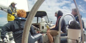
PSSI has one of the most complete and varied programs in the country. Classes can be taken in challenging Puget Sound or on one of our Exotic Sailing Vacations in the Caribbean, Sea of Cortez, South Pacific or Greek Islands!
R&R Charters and Sail School Grasonville, Maryland
(570) 690-3645 randrchartersandsailschool.net.
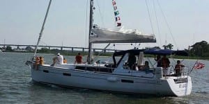
We own three boats, a Cal 22, a Hunter 28, and a new Beneteau Oceanis 41 for our 104 and 106 classes. Our beginning courses are taught over three days in the peaceful Chester River just off the Chesapeake Bay. For our 104 class we explore the calm rural anchorage areas of the Eastern Shore and visit Annapolis. Our 106 class does a Delmarva circumnavigation of approximately 450-500 nm with lots of night and ocean sailing experience.
Sail Dallas Dallas, Dallas / Ft. Worth Area, Texas
(214) 215-7245 www.saildallas.com.
Mastering the sport of sailing requires a knowledge of sailing techniques, safety procedures, and, most importantly, actual sailing experience. We are leaders in promoting safe, competent boating. We are, and always have been, the Metroplex’s premier sailing school. Our curriculum has been developed over many years of experience in teaching and our program continues to set the standard. From time to time, you may notice other sailing schools attempting to emulate our program. Remember, at their best, they will only be as good as we were last year. If you are not willing to settle for second best, seek out …
Sail Solomons Solomons, Maryland
(410) 326-4917 sailsi.com.
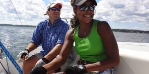
Our racing and cruising and chartering experience enables us to target the training to our student’s particular requirements. We truly love our jobs, but we take our sailing seriously so you will be safe on the water.
Sonset Sailing School Port Sanilac, Michigan
(989) 635-2696 sonsetmarine.com.

Located in the summer vacation resort village of Port Sanilac, we can certify you and prepare you for your next sailing adventure. Capt’n John Diel has over 40 years of sailing experience and almost 100,000 miles of sailing logged. He has sailed and trained many for family adventures and for long distance blue water passage making. He is a “Salty Dog” – a title given by ARC to those who have sailed many miles and ocean passages.
South Coast Sailing Adventures Seabrook, Houston / Galveston Area, Texas
(281) 334-4606 www.southcoastsailing.com.

South Coast Sailing Adventures is conveniently located in Kemah, Texas – 30 minutes from downtown Houston or Galveston. All of our instructors are U.S.C.G. licensed captains and are certified by the ASA. We utilize training boats specifically designed to teach beginning sailors and we have the largest sailing fleet along the northern Gulf Coast with 24+ boats ranging from 23-45′ from manufacturers like Colgate, Catalina, Beneteau, and Hunter.
Spinnaker Crew Sailing Chicago, Illinois
855.sp.crew.1 spinnakercrewsailing.com.

Spinnaker Crew Sailing is not just a sailing school… But rather is a brand that reflects the idea that Freedom and Adventure are core tenets in our belief system. At Spinnaker Crew Sailing we strive to make our experiences fun so that they become indelibly etched into our memories.
Swain Sailing School Tortola, BVI, British Virgin Islands
(800) 948-7245 swainsailing.com.

Rob Swain Sailing School is located in Tortola in the beautiful British Virgin Islands. Founded 23 years ago by our lead instructor Rob Swain we pride ourselves in providing a complete experience. Whether you are learning to sail or wish to gain bareboat or coastal cruising certifications our ASA qualified instructors who are all experienced yachtsman and women will help you reach your goals.
Tradewinds Sailing School & Club Richmond, Northern California
(510) 232-7999 www.tradewindssailing.com.

Tradewinds Sailing School has a program for sailors at any level who are serious about gaining the foundation knowledge of sailing and continuing on to become a competent sailor.
West Coast Multihulls San Diego, Southern California
(619) 365-4326 charter-catamaran.com.

Catamarans and trimarans are not just another income stream for West Coast Multihulls, they are our passion. If your sailing goal is to become a proficient confident multihull sailor, we are the school for you. Our staff and Instructors have decades of multihull, training, sailing and live-aboard experience to draw from and share with you. We sail out of beautiful San Diego, CA with sailing classes offered year-round from the Sunroad Resort Marina. San Diego enjoys a comfortable, moderate climate with light to moderate winds throughout the year. We are the only catamaran and trimaran specialists in California. West Coast …
RECOMMENDED ENDORSEMENTS
Once you have passed your ASA 108, Offshore Passagemaking you may find the following Endorsement Courses to be beneficial

- Learn To Sail
- Mobile Apps
- Online Courses
- Upcoming Courses
- Sailor Resources
- ASA Log Book
- Bite Sized Lessons
- Knots Made Easy
- Catamaran Challenge
- Sailing Vacations
- Sailing Cruises
- Charter Resources
- International Proficiency Certificate
- Find A Charter
- All Articles
- Sailing Tips
- Sailing Terms
- Destinations
- Environmental
- Initiatives
- Instructor Resources
- Become An Instructor
- Become An ASA School
- Member / Instructor Login
- Affiliate Login
- BOAT OF THE YEAR
- Newsletters
- Sailboat Reviews
- Boating Safety
- Sails and Rigging
- Maintenance
- Sailing Totem
- Sailor & Galley
- Living Aboard
- Destinations
- Gear & Electronics
- Charter Resources
- Ultimate Boat Giveaway
Pacific Passage Planning
- By Alvah Simon
- Updated: July 29, 2019

The definitions and delineations of a sea versus an ocean are complex, contested and best left to the learned geographers to debate. From a sailor’s point of view, excluding landlocked bodies of water, the rest of the brine is a contiguous path to glorious global adventure. Having said that, we do have our favorites. While the dreadful grind of the ice pack in the Far North and the towering graybeards of the Southern Ocean have their devotees, most sailing fantasies turn toward the seductive strum of the ukulele, the swaying palms and the white-sand beaches of the exotic South Pacific .
Ferdinand Magellan may have been a bit optimistic when he named a body of water that encompasses nearly one-third of Earth Mar Pacifico (peaceful ocean), for, like all oceans, it depends. The very size of the Pacific presents unique challenges, but so too do its strong currents, powerful storms, hazardous coral outcrops and remote low-lying islands.
Voyage Planning for Sailing the South Pacific
A successful Pacific passage will rely on meticulous planning , based on current information tempered with flexibility, because, by nature, cruising has it vagaries. But before one gets into the minutia of details, they should first step back and consider the bigger picture of sailing across the Pacific.
Is the vessel truly stem-to-stern, keel-to-masthead ready? Remember, a day’s work at the dock is worth a week’s under way. Is the dream and determination shared equally, or will the plan unravel with the first gale? Does a westward passage commit one to a circumnavigation, or are there strategic exit points? Does the voyage rely on a financial structure subject to change? Are you most comfortable as part of a rally, with a “buddy boat” or as a lone wolf?
Next is the paper chase. Gone are the whimsical days of letting the winds blow you where they may. The modern cruiser must be prepared in advance to face a host of legal requirements. First, ensure that every crewmember’s passport is as current as possible. Many countries will not issue visas to passports within six months of expiry. Next, list every country that you may wish to stop in and those in peripheral waters. Check the visa requirements carefully because the devil is in the details, especially if you have a multinational crew. Many countries require no visas if your stay is relatively short, or issue visas upon arrival. But some, such as Australia, will hit you with a hefty fine for showing up without one. Albeit increasingly expensive, cruising permits are normally obtainable upon arrival, but check the cruising websites and forums for current and accurate information. Make very high-resolution photocopies of your passports and ship’s papers. Bureaucrats love the pomp and splendor of shiny paper, and your precious original boat documents can stay safely on the vessel. If departing directly from U.S. waters, be aware that U.S. Customs does not normally issue a zarpe, or outbound clearance papers, yet these are required for entry into nearly any other nation. Download CBP Form 1300 and insist on a government stamp, any stamp. Be sure to have clear doctors’ prescriptions for every drug in the ship’s medical kit. What might be an over-the-counter medication in one country can be highly prohibited in another. Increasingly, foreign marinas demand third-party liability insurance. If you hope to further insure for damage and loss, check carefully the caveats relating to seasons and areas. If you plan to rent cars for touring, it is best to obtain an international driver’s license before departure.
Familiarize yourself with the basic elements that will shape your course and schedule — the direction and timing of the prevailing winds, significant currents, cyclone seasons, the positioning of the intertropical convergence zone and the South Pacific convergence zone. Ascertain if the year of passage has been deemed an El Niño or La Niña year because these phenomena can affect the above.
West Coast sailors may depart from as far north as the Strait of Juan de Fuca, near Seattle, or dally south to Cabo San Lucas, Mexico, while awaiting the passage season. For European and East Coast sailors, the Pacific launching point is obviously the Panama Canal. The details of a canal transit are complex enough to warrant an article of their own, but relevant here is do not assume a quick passage, because during peak periods there can be several weeks of delay. Also, build in time to enjoy both the San Blas Islands, on the Atlantic side, and the Las Perlas Islands, on the Pacific side.

Pacific Sailing Routes
Although the official window for departures from Panama extends from February all the way to June, the trade winds tend to stabilize and strengthen as the year progresses. However, an early exit has many advantages. Leaving it until June allows only six months to transit up to 9,000 nautical miles before being forced to exit the cyclone belt at the western edge of the Pacific. This truncates the time to linger in favorite anchorages or tend to inevitable breakdowns and delays. Leaving as early as late January might technically put one out into the Pacific during the official cyclone season, but the statistical chances of a storm developing this far to the east are slim.
There are countless permutations of a westward passage, but the path dubbed the “Milk Run” is the most popular. Regardless of one’s plan for the western Pacific, this route passes by or through the Galápagos Islands , the Marquesas, Tuamotus and Society Islands (Tahiti).
The initial stage presents a challenge because the winds can be light and the currents contrary in the Gulf of Panama. It’s advisable to head slightly east of south when heading out of the Gulf; the western promontory is aptly named Punta Mala (Bad Point) due to its penchant for confused currents and squally weather.
Once well clear of the Gulf of Panama, fashion a southwestward course with a pronounced southern belly toward the Galápagos group. I once sailed a direct course for the Marquesas Islands that passed over the northern edge of the Galápagos. I paid for this foolishness by spinning in lazy circles for five excruciatingly long days. Given the early time of the year, I would have been better served by passing several degrees south of the island group. Because the intertropical convergence zone (better known as the doldrums) is widest in the eastern Pacific, it is best crossed at the least oblique angle reasonable.
On another Pacific passage, I chose to head south for Bahia de Caraquez in Ecuador. Not only was the cruise down the Ecuadorian coast fascinating, the passage to the Galápagos from Salinas provided steadier winds than had we departed directly from the canal.
The cost and conditions of a stay in the Galápagos are forever changing. As an admittedly stubborn form of protest, I sailed right by them on two different occasions. On the third, my wife, Diana, put her sea boots down and demanded we stop. Even with a limited stay and restricted access, we were treated to one of Earth’s most unique and fascinating natural habitats.

The 3,000-mile passage from the Galápagos to the Marquesas will probably be the longest of your sailing career. If you can focus on the journey instead of the destination, it might also be the most memorable. Many modern sailors tend to fill the Pacific void with a frenetic schedule of radio nets, emails and obsessive navigational updates. Others soak up the rare opportunity to commune deeply with nature, and experience a rare solitude and reaffirming self-reliance, which I believe to be the core virtues of bluewater sailing.
Counterintuitive to the landlubber but axiomatic to any old salt is that the rhumb line is often not the quickest route to a desired destination. Favorable winds mean speed, and the extra distance in search of them is usually well rewarded. When transiting from the Galápagos to the Marquesas, by first heading south-southwest down to 3 to 4 degrees south latitude, one should reach the upper limits of the southeast trade winds, albeit possibly sporadic at this point. But as you proceed west-southwest toward 6 degrees south latitude and 100 degrees west longitude, they should increase in both strength and consistency. As you straighten course toward your chosen port of entry in the Marquesas, you should begin experiencing your best noon-to-noon runs because you will still have a southerly component in the trades. This puts you on a broad reach, a point of sail most boats excel in. The farther west one heads, the more easterly the trades become until you are eventually running dead downwind. This tends to be a touch slower, with exacerbated rolling. Be sure to carry light-wind sails for the early portions of this journey, and equipment and sails suitable for downwind situations. That fortunate discrepancy you will notice between your speed on the log (i.e., through the water) versus the GPS speed (over the bottom) is compliments of the South Equatorial Current, which fortifies with the steadier trades.

There is only one shoal area along the route, which is well-charted (8 degrees 5 minutes N and 139 degrees 35 minutes W), and the islands are high and easily sighted from afar. Entrances to the main ports are open and well-marked, thus safely approached, a blessing for a fatigued crew. What the Marquesas Islands might lack in terms of white-sand beaches and aqua lagoons is more than made up for with a geography so dramatic as to be somewhat foreboding — towering rock spires, dense jungle and precipitous waterfalls. These islands have been protected from rampant development by a crushing remoteness and therefore arguably remain the cultural heart of Polynesia.
Passages between the islands are mostly clear and well-charted, but potentially windy. The anchorages tend to be open roadsteads, so anti-roll tactics and equipment come in handy. Yachts can clear in at Hiva Oa, Ua Pou or Nuku Hiva. Those first stopping in Fatu Hiva have met with mixed results, ranging from spot fines to official clearance. Yachts are no longer required to rush to Tahiti to extend their initial 30-day visa. Thus, with 90 days in pocket, you can divide your time between the Marquesas, Tuamotus and Societies more evenly than in years past.

Encompassing an area larger than Western Europe, the Tuamotus are the longest chain of atolls in the world. Historically, they were known as the “dangerous archipelago,” and rightfully so due to a baffling maze of poorly charted reefs, low-lying islands and diabolically unpredictable currents. Even with the best of modern navigational equipment and weather forecasting, they demand the mariner’s absolute vigilance regarding watchkeeping, entry and exit from atoll passes, and anchoring techniques.
Those in a hurry to reach Tahiti tend to pass through the wider channels at the northern end of the chain, perhaps visiting Ahe, Manihi and the main center of Rangiroa. Others, with more time, make landfall far to the south and make their way up the chain via Makemo and the beautiful Fakarava Lagoon, enjoying a better angle off the wind on the short sail to Tahiti.

The Society Islands are divided into two groups: the Windwards, including Tahiti and Moorea, and the Leewards, with Huahine, Raiatea, Taha’a and, perhaps the most beautiful of them all, Bora Bora. They are all lush, high and ringed by azure seas. If early in the season, all are worth visiting. If time is short, be sure to at least attend the amazing group-dance competitions held in the buzzing capital of Papeete, celebrating Bastille Day on July 14.
North or South?
In Tahiti, the Milk Run divides into myriad possibilities. There is the northern route, for those planning to cross through the Torres Strait or into the Northern Hemisphere for the coming cyclone season, and the southern route, for those dropping south of the danger into New Zealand.

Although the majority of the South Pacific islands would remain unexplored, Tahiti is the earliest cutout for those needing to return to North America because its easterly location allows for a viable starboard tack through the southeast and northeast trades to Hawaii. The long but logical route from there is wheeling over the top of the North Pacific summer high and back south into U.S. West Coast waters.
While the land mass of the Cook Islands is a mere 100 square miles, its economic exclusion zone covers nearly 700,000 square miles of Pacific Ocean. One can only hope to draw a thin line through this scattered nation. For those on the southern route, the four- to five-day passage to Aitutaki or Rarotonga offers a predictable beam-to-broad reach right on the rhumb line.
En route to Niue lies one of two opportunities to experience the eeriness of anchoring in the middle of a featureless ocean (the other being the Minerva Reefs between Tonga and New Zealand). Beveridge Reef is a sunken atoll with not a skerrick of land awash at low tide, yet it offers anchorable depths within.
Niue is a raised coral atoll and geographically rare in the South Pacific. As anchoring depths are prohibitive, deep moorings are available. Keep in mind that it is an open roadstead vulnerable to dangerous swells. If the wind even hints at going west, as it occasionally does, get out immediately.
To break up the 1,200-nautical-mile haul to American Samoa from the Society Islands, the northern fleet usually takes a break in the remote and uninhabited atoll of Suwarrow, also known as Suvorov. The pass is challenging, as is the anchoring. But those who dare will be treated to one of the wildest places left on this planet.
From this point west, both the northern and southern fleet enter into the South Pacific convergence zone, a dangling arm of the intertropical convergence zone that extends from the Solomon Islands in an east-southeast direction. The South Pacific convergence zone drifts with some seasonal predictability (more to the north from December to May and the south from June to November), but is also influenced by larger weather anomalies. It tends to shift to the northeast in El Niño years and southwest in the La Niña phase. Generally, it is an area of enhanced convection resulting in a frustrating mix of cloud cover, line squalls and calms.
The list of interesting stops from here west includes Tonga, Wallis and Futuna, Fiji, Vanuatu, New Caledonia, Tuvalu, Solomon Islands and Papua New Guinea. Nevertheless, those planning to sail directly through Torres Strait into the Indian Ocean cannot afford to dally. They should be through the Torres by late August or early September in order to cross the entire Indian Ocean into South Africa before the cyclone season begins sometime in late November. A popular alternative is to pass south to a good cyclone hole on the Australian coast, such as Cairns or Port Douglas, and backtrack up to the Torres Strait at the beginning of the next safe season.
Keep in mind that an east-to-west circumnavigation does not demand a route through the Torres. I once circumnavigated by passing north of Papua New Guinea, avoiding the Southern Hemisphere cyclone season, taking in Palau, the Philippines, and Borneo before dropping back into the Southern Hemisphere for the Indian Ocean passage to southern Africa. Any destination north of 10 degrees south latitude will keep you out of harm’s way, albeit without the steady assist of those lovely trade winds.

Those on the southern route can linger through Tonga or Fiji until well into November and still safely make New Zealand shores before any tropical depressions threaten. Most cruisers heading for New Zealand do not venture as far west as Vanuatu or New Caledonia on the assumption that they can easily fetch them on their way north the following season.
Unanimous acclaim for the beauty of the northern Tongan groups of Niua, Vava‘u and Ha‘apai makes some time here mandatory, which harks back to my original advice to head out of Panama as early as safely possible. The southern contingent usually drifts south toward Nuku‘alofa, the capital, until it likes the long-range forecast for the passage to New Zealand. Many plan to hole up in Minerva Reef, getting a head start on the 1,100 miles to New Zealand, and depart there with the absolute latest weather predictions.
The reputation of this leg has more bark than bite, but it cannot be denied that tropical weather events drifting down from the Coral Sea and cold fronts coming up from the Southern Ocean have dramatic potential. One can expect winds from nearly every direction, starting with southeast trades on departure and potentially deep lows with strong southwesterlies shifting to northwesterlies when approaching New Zealand. Thus, the usual advice is to fall off the southeast trades and make some westing in anticipation of that southwest-to-northwest change. Not to be a contrarian, but I have made this passage more than a half-dozen times and believe it is better to hold to the east as far as wind and waves allow because if that southwest change does not occur, you might find yourself on the wrong side of North Cape, New Zealand, with contrary winds and confused currents. Although Norfolk Island is not a fully protected anchorage, many vessels that find themselves west of the rhumb line with foul forecasts to the south will shelter here until conditions improve.
It’s possible, albeit tedious, to return to North America from New Zealand. Vessels head out to the east from as far south as Tauranga hoping to catch the northerly limits of the westerlies until they fetch the longitude of the Austral Islands, then turn north for Tahiti. From there, they follow the route as previously described. From the outset of their voyage, some have planned to sell their yacht in New Zealand or Australia rather than carry on with a circumnavigation or a very lengthy sail back to the United States, especially if they are East Coast residents. Import duties, brokerage costs and currency exchange rates must be factored into this strategy. Is it heresy to suggest that another option is to ship the vessel back home? The initial estimates might seem staggering, but once compared to the escalating marina and maintenance costs, and the many windward months and miles home, the horror subsides.
Whatever your plan from here, through a combination of wind and will, you have done it. You, your crew and your splendid craft have spanned the mightiest body of water on Earth. You have immersed yourself in millions of square miles of salty solitude and self-reliance. You have absorbed the exotic cultures of Central Americans, Polynesians, Micronesians and Melanesians. And now, as only a seasoned mariner can, you truly understand why they call it the Big Blue.
Contributing editor, Alvah Simon, and his wife, Diana, are presently sailing New Zealand waters on their cutter Roger Henry, with occasional voyages to the South Pacific islands.
South Pacific At A Glance
- Dry Season: May-October
- Wet Season: November-April
- Cyclone Season: November-April. Active
- Cyclone Area: south of 10° S; west of 140° W
- Distance: Panama to Australia — 8,000 nautical miles
- Cultural Areas: Polynesia, Micronesia, Melanesia, Australia/New Zealand
References:
- World Cruising Routes by Jimmy Cornell
- noonsite.com (Virtually everything you will need to know on a current basis will be found on this comprehensive website.)
- Atlas of Pilot Charts — South Pacific, DMA/NOAA
- The Pacific Crossing Guide by Kitty Van Hagen
- Charlie’s Charts of Polynesia by Charles and Margo Wood
- Landfalls of Paradise by Earl Hinz and Jim Howard
- South Pacific Cruising by David Thatcher
- South Pacific Anchorag es by Warwick Clay
- Rocket Guide to Vanuatu & New Caledonia
- Solomon Island Cruising Guide by Dirk Sieling
- New Zealand Coastal Cruising Handbook by Royal Akarana Yacht Club
- Lonely Planet South Pacific Travel Guide
Selected SSB/Ham WX Nets:
- Southbound Evening Net: 6516 kHz at 0100 UTC
- Panama Pacific Net: 8143 kHz at 1400 UTC
- Pacific Maritime Mobile: 21.412 MHz at
- 2100-2400 UTC
- Pacific Magellan: 8173 kHz at 1730 UTC
- Pacific Seafarers: 14300 kHz at 0300 UTC
- Namba/Sheila Net: 8101 kHz at UTC plus 11 hours
- Gulf Harbor Radio: 8116 kHz at 0715 local New Zealand time
- (There is a host of smaller and temporary VHF and SSB nets throughout the Pacific.)
- More: Affiliate , Destinations , How To , offshore , Pacific , passage making
- More How To

Grease the Wheels of Your Boat: A Guide to Proper Lubrication

A Bowsprit Reborn: A DIY Renovation Story

Rigging Redo: Our Switch to Synthetic

Top Tools for Sailboat Cruising: Must-Have Gear for 2024

From Paradise to Medical Emergency: A Bahamas Nightmare Turns Lesson Learned

Free Medical Advice: The Unwarranted, Unprofessional Edition

Gatekeepers of the Waterway

- Digital Edition
- Customer Service
- Privacy Policy
- Terms of Use
- Email Newsletters
- Cruising World
- Sailing World
- Salt Water Sportsman
- Sport Fishing
- Wakeboarding
- Offshore Passage Making Courses
- Private Sailing Courses
- Fast Track to Cruising
- Learn to Sail Certification Courses
- Fast Track to Sailing
- Family Learn to Sail Programs
- Sailing Lessons and Sailing Rides
- Small Sailboat Cruising Course
- Online Learn to Sail Course
- Docking Refresher Course on a Catamaran or Monohull
- Fast Track to Monohull Cruising
- Live Aboard Cruising Courses
- Bareboat Charter Courses
- Catamaran Cruising Courses
- IPC Prep With Cruising Certification & Catamaran Endorsement
- Catamaran Endorsement & Refresher
- Boat Handling & Docking
- Women-Only Sailing Programs
- Navigation Courses
- Performance Sailing Courses
- Fast Track to Sailboat Racing Courses
- Performance Racing Clinics
- Coastal Passage Making Courses
- Celestial Navigation Courses
- Powerboat Courses
- Sailing Certifications
- Top 10 Tips for Learning How to Sail
- Safety and Comfort Aboard
- Sails & Sail Trim
- Steering and Maneuvering
- Handling Spinnakers
- Engine Maintenance
- Become an Instructor
- How to Choose a Sailing School
- Yacht Lease Management
The Ultimate Blue Water Sailing School Experience

“I can never get enough of sailing on open seas, and I always learn something new.” Steve Colgate – Offshore Sailing School Founder
OSS 105/106 – Fast Track® to Coastal Passage Making
If you have US Sailing Bareboat Cruising Certification earned in OSS 103/104, or combined 101/103/104, the next step is the Fast Track® to Coastal Passage Making Course, combining OSS 105 Coastal Navigation and OSS 106 Coastal Passage Making . This exciting week of offshore sailing experience involves learning how to navigate and sail through whatever weather brings, traveling longer distances between destinations. You navigate non-stop, managing whatever Mother Nature conjures up, learning what it’s like to be a long distance live aboard sailor, sailing after the sun sets. You may take OSS 105 – online Coastal Navigation and 106 – on-water Coastal Passage Making separately, but OSS 105 is required before starting OSS 106. View what you will learn in Coastal Navigation Certification – OSS 105. On specific dates, we offering special passage making courses between Key West and St. Petersburg , Florida. Call 888-454-7015 for more information.
“My wife and I enjoyed the entire experience. It was challenging and exciting to acquire new sailing skills through hands-on experience in the classroom and on the passage. We are looking forward to Celestial Navigation and Offshore Passage Making courses in the future. As an experienced sailor, watching my wife develop her sailing skill and confidence made for a great outcome. Thanks for helping us to sail as a couple.” Thomas Flynn – Epworth, IA Read more testimonials here
Choose Your Blue Water Sailing School Wisely
Steve Colgate is a veteran racing sailor and Olympian who has done nine TransAtlantic Races, 20 Newport-Bermuda Races, seven Fastnet Races, two America’s Cup trials, and countless other competitions and long passages in his more than 70 years of sailing. If you are indeed moving towards a long passage over vast ocean stretches, your first passage making sailing school experience could make or break your blue water sailing goals.
Your Safety Comes First
Offshore Sailing School’s Coastal Passage Making Course – OSS 106 and Offshore Passage Making Course – OSS 108 curricula are carefully developed by Steve Colgate and his team, concurring with the National Faculty of US Sailing – the governing body of sailing in the United States, appointed by Congress. Offshore Sailing School teaches no more than four students with an experienced long-distance cruising instructor on a Coastal Passage Making Course – OSS 106 , and three to six students in the Offshore Passage Making Course – OSS 108 where you stand watches, sailing non-stop, with two instructors aboard. Combine Offshore Passage Making with our Celestial Navigation Course and you will be fully prepared for any conditions on the high seas. Check out our Celestial Navigation Course video highlights here .
Sail the Seven Seas

Start Passage Making Now! Request a Quote
Call 888-454-7015 ♦ 239-454-1700 [email protected]
Sailing – good for you. good for the world®, get in touch, call us today.
888-454-7015 or 239-454-1700
Ask our experts about training, group packages, vacations, and more!
6338 Presidential Court, #201 Fort Myers, Florida 33919
SPECIALS COURSES
LOCATIONS CONTACT US
ABOUT US SAILING TIPS
[email protected] Site Map Privacy Policy
© 2024 Offshore Sailing School - Official Site. OffshoreSailing.com is managed by Offshore Sailing School.
- Privacy Policy
- Fast Track to Sailing | Beginner to Advanced in Six Days
- Fast Track to Catamaran Cruising
- Fast Track to Boat Handling & Docking
- Ultimate Cruising Course
- Private Courses
- Catamaran Refresher & 114 Endorsement
- Team Building Programs
- Women’s Sail Sip Spa Week in the British Virgin Islands
- Top 10 Tips Learning How to Sail
- How to Become a Sailing Instructor
- Yacht Lease Management Opportunities
- Bookstore New!
- About Sailing
- Cape Coral Marina Village
- Fort Myers Beach
- St. Petersburg
- Captiva Island
- Scrub Island
- St. Lucia & Windward Islands
- Greece Ionian Islands
- Sicily In The Aeolian Islands
- Dubrovnik-Montenegro Flotilla Cruise
- Italy’s Amalfi Coast Flotilla
- Tahiti’s Society Islands
- Team Building
- Testimonials
- SAILING TIPS
- SPECIAL EVENTS
- Offshore Sailing School Returns to Captiva Island, Florida
- Sailing – Out & About SWFL
- America’s Cup Endeavor Program Videos
- Growing Up Moorings
- Doris Colgate Sailing Clinic & Cup
- Steve Colgate Inducted Into National Sailing Hall of Fame
- OSS Student Proposes During Course
- Steve Colgate and National Sailing Hall of Fame
- St. Lucia and Windward Islands Flotilla Cruise
- Weathering Unexpected Bad Weather
- A Sailing Adventure He Still Can’t Believe Was Real
- 2016 Croatia Flotilla Cruise Diary
- How We Teach
- Steve & Doris Colgate
- Steve Colgate
- Doris Colgate
- Management Team
- Employment Opportunities
- Our Mission
- Our History
- Alumni Benefits
- Awards & Accolades
- Our Philanthropy
- Certification Levels
- GET STARTED
- Sports & Outdoors
- Water Sports
Enjoy fast, free delivery, exclusive deals, and award-winning movies & TV shows with Prime Try Prime and start saving today with fast, free delivery
Amazon Prime includes:
Fast, FREE Delivery is available to Prime members. To join, select "Try Amazon Prime and start saving today with Fast, FREE Delivery" below the Add to Cart button.
- Cardmembers earn 5% Back at Amazon.com with a Prime Credit Card.
- Unlimited Free Two-Day Delivery
- Streaming of thousands of movies and TV shows with limited ads on Prime Video.
- A Kindle book to borrow for free each month - with no due dates
- Listen to over 2 million songs and hundreds of playlists
- Unlimited photo storage with anywhere access
Important: Your credit card will NOT be charged when you start your free trial or if you cancel during the trial period. If you're happy with Amazon Prime, do nothing. At the end of the free trial, your membership will automatically upgrade to a monthly membership.
Buy new: .savingPriceOverride { color:#CC0C39!important; font-weight: 300!important; } .reinventMobileHeaderPrice { font-weight: 400; } #apex_offerDisplay_mobile_feature_div .reinventPriceSavingsPercentageMargin, #apex_offerDisplay_mobile_feature_div .reinventPricePriceToPayMargin { margin-right: 4px; } -32% $24.47 $ 24 . 47 FREE delivery Tuesday, September 10 on orders shipped by Amazon over $35 Ships from: Amazon.com Sold by: Amazon.com
Return this item for free.
We offer easy, convenient returns with at least one free return option: no shipping charges. All returns must comply with our returns policy.
- Go to your orders and start the return
- Select your preferred free shipping option
- Drop off and leave!
Save with Used - Good .savingPriceOverride { color:#CC0C39!important; font-weight: 300!important; } .reinventMobileHeaderPrice { font-weight: 400; } #apex_offerDisplay_mobile_feature_div .reinventPriceSavingsPercentageMargin, #apex_offerDisplay_mobile_feature_div .reinventPricePriceToPayMargin { margin-right: 4px; } $9.99 $ 9 . 99 FREE delivery Wednesday, September 11 on orders shipped by Amazon over $35 Ships from: Amazon Sold by: Carew Concepts LLC
Download the free Kindle app and start reading Kindle books instantly on your smartphone, tablet, or computer - no Kindle device required .
Read instantly on your browser with Kindle for Web.
Using your mobile phone camera - scan the code below and download the Kindle app.

Image Unavailable

- To view this video download Flash Player

Follow the author

Offshore Sailing: 200 Essential Passagemaking Tips Hardcover – November 26, 2001
Purchase options and add-ons.
- Print length 256 pages
- Language English
- Publisher International Marine/Ragged Mountain Press
- Publication date November 26, 2001
- Dimensions 7.4 x 0.9 x 9.4 inches
- ISBN-10 0071374248
- ISBN-13 978-0071374248
- See all details

Frequently bought together

Customers who bought this item also bought

Editorial Reviews
From the publisher.
Dan Spurr was the editor of Practical Sailor newsletter for twelve years. A former senior editor for Cruising World , he is the author of Heart of Glass: Fiberglass Boats and the Men Who Made Them, Spurr's Boatbook: Upgrading the Cruising Sailboat, and Yacht Style, among other books.
From the Back Cover
- Experiencing diesel engine surge-and-die syndrome (SAD)? Tip 132 tells you why it's happening and what to do about it.
- Worried that your bilge pump might not provide adequate pumping power in rough seas? Tip 8 shows you a simple way to measure its true pumping capacity.
- Want to make companionway dropboards lockable from inside and outside? See tip 71.
- Batteries charging too slowly or not at all? Tip 111 tells you how to locate and stop hidden power drains.
About the Author
Product details.
- Publisher : International Marine/Ragged Mountain Press; 1st edition (November 26, 2001)
- Language : English
- Hardcover : 256 pages
- ISBN-10 : 0071374248
- ISBN-13 : 978-0071374248
- Item Weight : 2.31 pounds
- Dimensions : 7.4 x 0.9 x 9.4 inches
- #127 in Sailing (Books)
- #150 in Boating (Books)
About the author
Bill seifert.
Discover more of the author’s books, see similar authors, read author blogs and more
Customer reviews
- 5 star 4 star 3 star 2 star 1 star 5 star 69% 19% 6% 4% 1% 69%
- 5 star 4 star 3 star 2 star 1 star 4 star 69% 19% 6% 4% 1% 19%
- 5 star 4 star 3 star 2 star 1 star 3 star 69% 19% 6% 4% 1% 6%
- 5 star 4 star 3 star 2 star 1 star 2 star 69% 19% 6% 4% 1% 4%
- 5 star 4 star 3 star 2 star 1 star 1 star 69% 19% 6% 4% 1% 1%
Customer Reviews, including Product Star Ratings help customers to learn more about the product and decide whether it is the right product for them.
To calculate the overall star rating and percentage breakdown by star, we don’t use a simple average. Instead, our system considers things like how recent a review is and if the reviewer bought the item on Amazon. It also analyzed reviews to verify trustworthiness.
- Sort reviews by Top reviews Most recent Top reviews
Top reviews from the United States
There was a problem filtering reviews right now. please try again later..

Top reviews from other countries

- Amazon Newsletter
- About Amazon
- Accessibility
- Sustainability
- Press Center
- Investor Relations
- Amazon Devices
- Amazon Science
- Sell on Amazon
- Sell apps on Amazon
- Supply to Amazon
- Protect & Build Your Brand
- Become an Affiliate
- Become a Delivery Driver
- Start a Package Delivery Business
- Advertise Your Products
- Self-Publish with Us
- Become an Amazon Hub Partner
- › See More Ways to Make Money
- Amazon Visa
- Amazon Store Card
- Amazon Secured Card
- Amazon Business Card
- Shop with Points
- Credit Card Marketplace
- Reload Your Balance
- Amazon Currency Converter
- Your Account
- Your Orders
- Shipping Rates & Policies
- Amazon Prime
- Returns & Replacements
- Manage Your Content and Devices
- Recalls and Product Safety Alerts
- Registry & Gift List
- Conditions of Use
- Privacy Notice
- Consumer Health Data Privacy Disclosure
- Your Ads Privacy Choices

|
/ 19,558 Kg and carries 835 Gal / 3,160 Lit. of diesel fuel and 250 Gal / 946 Lit. of water. When powering at hull speed of 8.3 knots / 20.35 kph, she consumes around 3 g p h / 11.35 lph. It is worth noting that by reducing speed to 7.4 knots 13.69 kph the fuel consumption drops to 2 gph /5.18 lph which shows how a small drop in speed can produce a large saving in fuel. By the end of the voyage Salvation 11 had called at 528 ports, visited 51 countries (including 34 states of the USA) and motored just over 302,500 nautical miles in 7,760 hours at an average speed of 6.5 knots / 12.02 kph.
trawler.
SAIL ASSISTANCE:
These devices are noisy however by adding some chain in the rig the harmonic vibration can be reduced if not eliminated all together.
|
TRAWLER YACHT STEEL OR ALUMINUM PLANS & CUTTING FILES SAILBOAT DESIGNS POWERBOAT DESIGNS HOME / INDEX PAGE
Migrant boat seen trying to make English Channel crossing
The deaths of a dozen migrants on the English Channel hasn't stopped more boats from attempting to cross from France to the U.K. Associated Press journalists watched a crowded boat make its way through the sea on Wednesday as French patrol boats monito...
WIMEREUX, France -- A day after 12 migrants died when their small inflatable ripped apart on a failed effort to cross the English Channel, several dozen others made another crossing attempt on a crowded vessel from northern France on Wednesday, as French patrol boats watched it labor through the seas.
That migrants were prepared to risk their lives so soon after a dozen others lost theirs trying to cross the busy waterway from France to Britain underscored the magnitude of the problem for the French and U.K. governments. It was the deadliest accident involving a migrant boat in the English Channel this year.
The mayor of Wimereux, a French coastal town where Associated Press journalists filmed the crowded inflatable boat on Wednesday, pleaded for French and British officials to do more to limit the number of migrants attempting the often perilous journey.
“Unfortunately, every day is like this for us. The smugglers — a criminal network — continue with insistence to send people to their deaths in the channel. It really is unacceptable, scandalous. And it is high time that a lasting solution is found with Britain,” Mayor Jean-Luc Dubaële said by phone.
“Let's ask ourselves the question: Why do they want to go to Britain? Because something is drawing them there,” he said. “They can ask for asylum in France. (But) none ask for the right to asylum in France. They all want to go to Britain. So it is high time that we sit around a table with the new British government.”
Cross-Channel migration was a key focus in the U.K. general election in July, which the Labour Party won resoundingly to make its leader, Keir Starmer, the new prime minister.
A French prosecutor investigating Tuesday's sinking, Guirec Le Bras, said 10 of the 12 dead were women and six of the victims were minors. Many appeared to be Eritrean, he said. The inflatable boat sank about 5 kilometers (3 miles) off the French coast, he said. Maritime authorities said many aboard didn't have life vests.
Fishermen who recovered some of the dead said they were moved to tears.
“The bodies of two women were very young. That hurt me. I cried all day. I couldn’t stop," said 53-year-old Samba Sy Ndiaye, who works aboard the Murex, one of two fishing boats that assisted the French rescue effort.
Another crew member, Axel Baheu, said the body of one young woman – he guessed she was between 15 and 20 – had a telephone in a waterproof pouch around her neck. It started to ring as he was pulling her out of the water and checking for a pulse, he said.
“That was hard because you know full well that no one will ever answer," Baheu said.
His father, Jean Marie Baheu, said he saw another heavily laden migrant boat set off Wednesday in front of his house.
“When the weather is good and there’s no wind, there are departures every day,” he said. “At the beginning, you’d see 20, 30 people. Now, it’s minimum 70, 80.”
The inflatable boat the AP saw and filmed on Wednesday was carrying migrants, French maritime authorities confirmed. AP journalists estimated that 40 to 50 people were aboard.
Many wore life preservers. A patrol boat flying a French flag approached the inflatable at one point and the crew tossed more life vests — about half a dozen — to the migrants.
The English Channel's gray seas were comparatively calm, with small waves lapping the beach as people walked dogs on the sand.
Still, the inflatable appeared to make slow headway. Even though journalists filmed it for more than two hours, it remained clearly visible from shore, with the patrol vessel buzzing around it and a larger one shadowing it from farther away.
The French maritime agency that oversees that stretch of sea said the boats were monitoring the inflatable in case it ran into difficulty or people aboard requested assistance.
In a statement to the AP, the agency said that although maritime law forbids the use at sea of makeshift inflatables, it's too dangerous to force them back to shore when the boats are heavily laden.
“It's difficult to achieve with more than 50 people on board who are vehemently refusing to be rescued. The main risk is a stampede on board and then a capsizing, these boats being neither stable nor reliable. The risk of loss of human life being too high for an intervention under duress, the choice is made to prioritize the protection of the people on board and by simply monitoring from a distance the navigation capabilities of these boats,” the statement said.
“It is therefore more a question of ethics than of blind application of the law,” it added.
By the U.K. government's count, at least 21,720 migrants have managed to cross the English Channel so far this year. That's 3% more than at the same stage last year, but 19% lower than during the same period in 2022.
The boat that ripped apart on Tuesday, plunging 65 people into the sea, was one of several crossing attempts that day. British authorities said at least 317 migrants succeeded, arriving aboard five boats.
One of the first measures the new U.K. government immediately enacted was to scrap the previous Conservative government’s plan to send some migrants arriving in small boats to Rwanda rather than being allowed to seek asylum in Britain. Human rights groups criticized the plan.
Starmer called the plan a “gimmick” and wouldn't act as a deterrent. Instead, his government has opted to divert some of the money saved from ditching the program into setting up a strengthened border force to “smash” the criminal gangs behind the small-boat arrivals.
Leicester reported from Paris. Pan Pylas contributed to this report from London.
Follow AP’s coverage of migration issues at https://apnews.com/hub/migration
Related Topics
- United Kingdom
Popular Reads

Militants kill over 100 people in Nigerian village
- Sep 4, 6:04 AM

Cambodia gifted 2 warships from China
- Sep 4, 6:06 AM

Report blames govt, industry for lethal UK fire
- Sep 4, 1:03 AM

North Korea launches more suspected trash balloons
- Sep 4, 7:49 AM

Iraqi women fear rise in child marriages
- Sep 4, 1:16 AM
ABC News Live
24/7 coverage of breaking news and live events
‘It's just a tragedy': Officials investigate cause of Old Saybrook boat crash
The breakwater where encon officials say a boat crashed the evening of labor day is a part of the investigation. the location has been subject to crashes in previous years including two just last summer., by kevin gaiss • published september 3, 2024 • updated on september 3, 2024 at 8:02 pm.
“It’s just a tragedy, it really is, Kimberly Keinz, of Old Saybrook, said.
She lives across the street from the Harbor One Marina at Saybrook Point. The investigation and search lasted all day Tuesday. She noted the number of sirens and first responders that came to the area after the crash.
Free 24/7 Connecticut news stream: Watch NBC CT wherever you are
“There was a little chop but not a bad night otherwise,” said a boater, who wished to remain anonymous, who was crossing through that area after a boating trip with family.
He estimated he passed through the same area as the crash about 15 to 20 minutes before it happened.
Get top local stories in Connecticut delivered to you every morning. Sign up for NBC Connecticut's News Headlines newsletter.
“Last night was definitely a dark night,” he said.
According to officials in a press conference Tuesday afternoon, they are investigating darkness as a factor in the crash, though they noted the boat had appropriate instruments.
They are also considering speed as a factor.

Plans to rebuild clubhouse at Wampanoag Country Club move forward

Sinkhole repairs in Hamden could cause road closures Thursday
That boater noted he has run boats in and out of Old Saybrook his whole life, and understands the breakwater is hard to see, especially on a particularly dark night.
“The lighthouse and the inner light right behind it, which I think some people may confuse with the inlet of the river that your home and they don’t realize you aren’t home,” he said.
Though Encon police said the channel is properly marked, it's also part of the investigation.
“They are marked, and it's something we are looking into,” Captain Keith Williams with Connecticut Environmental Conservation Police said.
Last year, on Labor Day weekend, four were injured in a similar crash. A boat crashed into the breakwater.
A few weeks before that at the end of July, another boat crashed on a jetty at the mouth of the river. A man was sent to the hospital in that crash.
“It doesn’t happen that often, but we have had a few in the last couple of years,” Captain Williams said.
Some stopping by Tuesday wondered what could be done along the channel to prevent this from happening again. As did the boater passing through ahead of the crash.
“I don’t know if they can do anything to improve that wall to light it up,” he said.
While investigators determine the cause and how to keep these crashes from happening in the future, those stopping by the boat recovery said they are thinking of the family.
“You hate to see any incident, any tragedy where there is loss of life,” Keinz said.
Even though boating season is winding down, officials are still offering the reminder to always have the appropriate life jackets on board and always make sure your instruments are working, and you are familiar with them.
This article tagged under:
A day after 12 deaths, other migrants risk their lives trying to cross the English Channel
WIMEREUX, France (AP) — A day after 12 migrants died when their small inflatable ripped apart on a failed effort to cross the English Channel, several dozen others made another crossing attempt on a crowded vessel from northern France on Wednesday, as French patrol boats watched it labor through the seas.
That migrants were prepared to risk their lives so soon after a dozen others lost theirs trying to cross the busy waterway from France to Britain underscored the magnitude of the problem for the French and U.K. governments. It was the deadliest accident involving a migrant boat in the English Channel this year.
The mayor of Wimereux, a French coastal town where Associated Press journalists filmed the crowded inflatable boat on Wednesday, pleaded for French and British officials to do more to limit the number of migrants attempting the often perilous journey.
“Unfortunately, every day is like this for us. The smugglers — a criminal network — continue with insistence to send people to their deaths in the channel. It really is unacceptable, scandalous. And it is high time that a lasting solution is found with Britain,” Mayor Jean-Luc Dubaële said by phone.
“Let’s ask ourselves the question: Why do they want to go to Britain? Because something is drawing them there,” he said. “They can ask for asylum in France. (But) none ask for the right to asylum in France. They all want to go to Britain. So it is high time that we sit around a table with the new British government.”
Cross-Channel migration was a key focus in the U.K. general election in July, which the Labour Party won resoundingly to make its leader, Keir Starmer, the new prime minister.
A French prosecutor investigating Tuesday’s sinking, Guirec Le Bras, said 10 of the 12 dead were women and six of the victims were minors. Many appeared to be Eritrean, he said. The inflatable boat sank about 5 kilometers (3 miles) off the French coast, he said. Maritime authorities said many aboard didn’t have life vests.
Fishermen who recovered some of the dead said they were moved to tears.
“The bodies of two women were very young. That hurt me. I cried all day. I couldn’t stop,” said 53-year-old Samba Sy Ndiaye, who works aboard the Murex, one of two fishing boats that assisted the French rescue effort.
Another crew member, Axel Baheu, said the body of one young woman – he guessed she was between 15 and 20 – had a telephone in a waterproof pouch around her neck. It started to ring as he was pulling her out of the water and checking for a pulse, he said.
“That was hard because you know full well that no one will ever answer,” Baheu said.
His father, Jean Marie Baheu, said he saw another heavily laden migrant boat set off Wednesday in front of his house.
“When the weather is good and there’s no wind, there are departures every day,” he said. “At the beginning, you’d see 20, 30 people. Now, it’s minimum 70, 80.”
The inflatable boat the AP saw and filmed on Wednesday was carrying migrants, French maritime authorities confirmed. AP journalists estimated that 40 to 50 people were aboard.
Many wore life preservers. A patrol boat flying a French flag approached the inflatable at one point and the crew tossed more life vests — about half a dozen — to the migrants.
The English Channel’s gray seas were comparatively calm, with small waves lapping the beach as people walked dogs on the sand.
Still, the inflatable appeared to make slow headway. Even though journalists filmed it for more than two hours, it remained clearly visible from shore, with the patrol vessel buzzing around it and a larger one shadowing it from farther away.
The French maritime agency that oversees that stretch of sea said the boats were monitoring the inflatable in case it ran into difficulty or people aboard requested assistance.
In a statement to the AP, the agency said that although maritime law forbids the use at sea of makeshift inflatables, it’s too dangerous to force them back to shore when the boats are heavily laden.
“It’s difficult to achieve with more than 50 people on board who are vehemently refusing to be rescued. The main risk is a stampede on board and then a capsizing, these boats being neither stable nor reliable. The risk of loss of human life being too high for an intervention under duress, the choice is made to prioritize the protection of the people on board and by simply monitoring from a distance the navigation capabilities of these boats,” the statement said.
“It is therefore more a question of ethics than of blind application of the law,” it added.
Most Read Nation & World Stories
- A 14-year-old student fatally shot 4 people in a rampage at a Georgia high school, officials say VIEW
- Inmate awaiting execution says South Carolina didn’t share enough about lethal injection drug
- Cheney, on the sidelines as Harris courts her endorsement, plans to weigh in soon
- 10 ‘second cities’ you should consider visiting this fall VIEW
- Husband drugged wife, recruited over 70 men to rape her, prosecutors say
By the U.K. government’s count, at least 21,720 migrants have managed to cross the English Channel so far this year. That’s 3% more than at the same stage last year, but 19% lower than during the same period in 2022.
The boat that ripped apart on Tuesday, plunging 65 people into the sea, was one of several crossing attempts that day. British authorities said at least 317 migrants succeeded, arriving aboard five boats.
One of the first measures the new U.K. government immediately enacted was to scrap the previous Conservative government’s plan to send some migrants arriving in small boats to Rwanda rather than being allowed to seek asylum in Britain. Human rights groups criticized the plan.
Starmer called the plan a “gimmick” and wouldn’t act as a deterrent. Instead, his government has opted to divert some of the money saved from ditching the program into setting up a strengthened border force to “smash” the criminal gangs behind the small-boat arrivals.
Leicester reported from Paris. Pan Pylas contributed to this report from London.
Follow AP’s coverage of migration issues at https://apnews.com/hub/migration
Stay up to date with notifications from The Independent
Notifications can be managed in browser preferences.
UK Edition Change
- UK Politics
- News Videos
- Paris 2024 Olympics
- Rugby Union
- Sport Videos
- John Rentoul
- Mary Dejevsky
- Andrew Grice
- Sean O’Grady
- Photography
- Theatre & Dance
- Culture Videos
- Fitness & Wellbeing
- Food & Drink
- Health & Families
- Royal Family
- Electric Vehicles
- Car Insurance Deals
- Lifestyle Videos
- UK Hotel Reviews
- News & Advice
- Simon Calder
- Australia & New Zealand
- South America
- C. America & Caribbean
- Middle East
- Politics Explained
- News Analysis
- Today’s Edition
- Home & Garden
- Broadband deals
- Fashion & Beauty
- Travel & Outdoors
- Sports & Fitness
- Climate 100
- Sustainable Living
- Climate Videos
- Solar Panels
- Behind The Headlines
- On The Ground
- Decomplicated
- You Ask The Questions
- Binge Watch
- Travel Smart
- Watch on your TV
- Crosswords & Puzzles
- Most Commented
- Newsletters
- Ask Me Anything
- Virtual Events
- Wine Offers
- Betting Sites
Thank you for registering
Please refresh the page or navigate to another page on the site to be automatically logged in Please refresh your browser to be logged in
Migrant boat seen trying to cross English Channel day after 12 people died in capsize horror
A pregnant woman and six children were among 12 people who died after their boat sank trying to cross, article bookmarked.
Find your bookmarks in your Independent Premium section, under my profile

Get the free Morning Headlines email for news from our reporters across the world
Sign up to our free morning headlines email, thanks for signing up to the morning headlines email.
Just one day after 12 migrants died in a failed attempted crossing of the English Channel , another boat carrying several dozen people appears to be making another attempt from northern France on Wednesday, seemingly trying to head toward Britain.
Journalists on a beach in Wimereux, on the northern French coastline and close to the site of Tuesday’s deadly sinking, are broadcasting live video of an inflatable boat carrying people, seemingly migrants, out to sea.
It comes as it was revealed a pregnant woman and six children were among 12 people who died after their boat sank trying to cross the English Channel.
The French coastguard confirmed the deaths after up to 65 people were rescued off the coast of Cap Gris-Nez on Tuesday.
The local prosecutor’s office said 10 women and two men were killed in the incident, according to the BBC.
French interior minister Gerald Darmanin wrote on X, formerly known as Twitter, that dozens of people had been crammed in a boat less than seven metres long.
“I came to Boulogne-sur-Mer to meet and thank the emergency services, the police and the sailors who were able to save 51 people from drowning by intervening very quickly and very courageously,” he said.
Mr Darmanin described it as a “terrible shipwreck”, adding: “The provisional toll stands at 12 dead, two missing and several injured.
“All government services are mobilised to find the missing and take care of the victims.”

Home Secretary Yvette Cooper branded the incident “horrifying and deeply tragic” as she said “vital” efforts to dismantle “dangerous and criminal smuggler gangs” and to boost border security “must proceed apace”.
Mr Darmanin said most of the people on the boat were believed to have been from Eritrea, and most of the victims were women.
Speaking to reporters at Boulogne-sur-Mer, where the casualties are being treated, he said as many as 75 people can be put on boats ahead of a crossing attempt.
“These boats go down very, very quickly, this is the reason why a lot of people get killed on these journeys,” he said, according to a BBC News translation.
Olivier Barbarin, the mayor of Le Portel near Boulogne-sur-Mer, said that the bottom of the boat “ripped open”.
All of the people on board the dinghy ended up in the water, many of whom were not wearing life jackets, and several of the migrants needed emergency medical care, according to the French coastguard.
Ms Cooper said she was in touch with Mr Darmanin and was being kept updated on the situation, adding: “Our hearts go out to the loved ones of all those who have lost their lives, and all those who have been seriously injured.”
The latest casualties mean more than 30 people have died in Channel crossings so far this year.

The International Organisation for Migration, which records Channel crossing deaths as part of its Missing Migrant Project, estimates 226 people including 35 children are missing or have died after attempting the crossing as of January this year.
Ministers have raised fears about people smugglers cramming more and more migrants onto increasingly poor boats to risk the crossing.
Charities and campaigners reiterated calls for urgent changes to curb Channel crossings as they lamented the latest loss of life at sea.
Enver Solomon, chief executive of the Refugee Council, said the number of deaths in the Channel this year had been “shockingly high” and the “devastating trend shows the urgent need for a comprehensive and multi-pronged approach to reduce dangerous crossings”.
“Enforcement alone is not the solution,” he added, as he called on the Government to open up more safe and legal routes for asylum seekers.
Home Office figures show 351 people made the journey in six boats on Monday, taking the provisional total for 2024 to date 21,403.
Subscribe to Independent Premium to bookmark this article
Want to bookmark your favourite articles and stories to read or reference later? Start your Independent Premium subscription today.
New to The Independent?
Or if you would prefer:
Hi {{indy.fullName}}
- My Independent Premium
- Account details
- Help centre
- Israel-Gaza War
- War in Ukraine
- US Election
- US & Canada
- UK Politics
- N. Ireland Politics
- Scotland Politics
- Wales Politics
- Latin America
- Middle East
- In Pictures
- Executive Lounge
- Technology of Business
- Women at the Helm
- Future of Business
- Science & Health
- Artificial Intelligence
- AI v the Mind
- Film & TV
- Art & Design
- Entertainment News
- Destinations
- Australia and Pacific
- Caribbean & Bermuda
- Central America
- North America
- South America
- World’s Table
- Culture & Experiences
- The SpeciaList
- Natural Wonders
- Weather & Science
- Climate Solutions
- Sustainable Business
- Green Living
Twelve die after migrant boat sinks in Channel

Six children and a pregnant woman were among 12 people who died after a boat carrying dozens of migrants sank off the French coast, in the English Channel.
In total, 10 of the dead were female and two were male, according to the local prosecutor's office.
More than 50 people were rescued off Cape Gris-Nez, near Boulogne-sur-Mer, the French coast guard reports. Two are said to be in critical condition.
Officials say the boat was overloaded and that its bottom "ripped open", while fewer than eight people on board were wearing life jackets.
The disaster is the deadliest loss of life in the Channel this year.
One source suggested a Syrian smuggler might have been involved.
Local prosecutor Guirec Le Bras said officials believed the victims had been "primarily of Eritrean origin" though they could not yet "specify the exact nationalities".
Before Tuesday's incident, 30 people had already died crossing the Channel in 2024 - the highest figure for any year since 2021, when 45 deaths were recorded, according to the UN's International Organisation for Migration.
Mr Darmanin said French authorities were preventing 60% of small boat departures. But people smugglers are cramming up to 70 people on vessels which used to carry 30 to 40 people - leading to deadlier shipwrecks.
He urged the UK and EU to agree a "treaty on migration" to curb small boat crossings.
UK Home Secretary Yvette Cooper described the incident as "horrifying and deeply tragic".
"The gangs behind this appalling and callous trade in human lives have been cramming more and more people on to increasingly unseaworthy dinghies, and sending them out into the Channel even in very poor weather," she said.
The effort to "dismantle these dangerous and criminal smuggler gangs and to strengthen border security is so vital and must proceed apace", she added.

Steve Smith, CEO of Care4Calais, a charity set up to aid migrants in Calais, said: "These tragedies have occurred with much more frequency."
"Every political leader, on both sides of our Channel, needs to be asked: 'How many lives will be lost before they end these avoidable tragedies?'"
The French coastguard said helicopters, Navy boats and fishing ships had been involved in the rescue operation.
The number of people making the dangerous crossing across the English Channel in small boats has risen, with more than 135,000 people coming to the UK by this route since 2018.
More than 21,000 people have crossed the Channel this year.
That is more than in the same period in the previous year, but fewer than in 2022. The number of people who crossed in 2022 - 45,755 - was the highest since figures were first collected in 2018.
Both Labour and the previous Conservative government have vowed to tackle the problem.
UK Prime Minister Keir Starmer cancelled the previous Tory government's plan to send some asylum seekers to Rwanda, which was first announced in 2022 but never put into effect.
Sir Keir has vowed to take tougher measures to "smash" the people-smuggling gangs responsible.
Downing Street says it has already taken action to target the criminal gangs by recruiting more officers to the National Crime Agency and setting up the government’s Border Security Command.
But critics say the government should be doing more to offer safe routes for asylum seekers.
Amnesty International UK said on Tuesday: "No amount of 'smash the gangs' policing and Government rhetoric is going to stop these disasters from unfolding time and again if the needs of people exploited by those gangs remain unaddressed."

IMAGES
VIDEO
COMMENTS
Apr 13, 2021. Moderation and respect are a big part of successful and enjoyable passagemaking. How you approach offshore sailing is key to the success of each passage. In addition, some of the most valuable, even crucial attitudes and skills may not be either learned or valued in everyday life on shore and may even fly in the face of talents ...
1. We check the weather: Weather is the single most important aspect of passage making. We learned this lesson the hard way. It can, literally, make or break your trip. If you plan on doing a passage that is 24 hours or longer - it becomes even more critical that you find an adequate "weather window", or a few days of decent seas and ...
For the trade wind passages that make up the bulk of bluewater cruising, there should be no argument about whether a suitably prepared production boat will make it across an ocean. For sailors who can't afford or justify one of the high-ticket deluxe cruising boats, it's good to know there are plenty of good options among the ranks of ...
Weather Routing: Comfortable Passagemaking. Andy Schell. Apr 6, 2021. Fair winds and moderate seas make for great passagemaking. A weather forecast—like an old-school dead-reckoning plot—will decrease in certainty with the passage of time. Over the past five years of arranging offshore charters aboard our Swan 48, Isbjørn, and our Swan 59 ...
Future Shock. BMW's Designworks Icon, an all-glass, 43-foot boat with striking looks, is a glimpse into the future of mobility. PassageMaker is a comprehensive trawler cruising publication and Trawler Fest Events offers educational trawler boat shows.
Fast Passage 39. Very few stock production boats are up to the rigors of an around-the-world race. Even fewer actually have completed such a feat. When Francis Stokes finished the 27,000-mile inaugural BOC Challenge in 1983 he was one of only 10 finishers in a race that saw 16 competitors at the starting line aboard everything from high-tech ...
On another occasion, we were waiting in the San Blas Islands for the fortified trades to die so we could make the passage to Florida. At the first sign of a let-up, in early April, a flotilla of impatient yachts set sail north. I asked an elderly Kuna man what he thought. He said, quite sagely, "Coming one more storm from the north, then go."
This boat is designed for a couple to live aboard for weeks, or even months, at a time, so I could include some features that might not work for a boat occupied by more of a gang. Another door on the forward wall opposite the head accesses the sleeping cabin forward. An athwartships queen berth is on a raised platform with stowage below and ...
The Admiralty book entitled 'Ocean Passage for the World' is also helpful as it outlines offshore routes for power-driven vessels and low-powered sailing boats separately. ASD's are also commonly used by naval and government vessels. Nautical Almanacs. There are many nautical almanacs available today.
Becca needs to listen to the forecast, estimate passage time and therefore finalise when we need to leave the Solent. Becca briefs the crew on her plans for the crossing, including shipping lanes and landfall. The crew needs to know where the safety kit is and how it works. Walk through the boat and show them.
Forward of the beach club, the 58E's stand-up engine room provides 360-degree access and is equipped with twin 1,150-hp Caterpillar C18 Acert engines. The yacht is capable of top speeds of 26 to 27 knots, and cruising speeds of 21 to 22 knots. Efficiently, she cruises at 9 to 10 knots.
Collecting Tsunami Debris in the North Pacific. In my view, there are just two rules to successful passage making: one, keep the boat going in the right direction; two, stay on board. On my way to Alaska in 2012, I broke the second rule when I fell off the boat reaching for an object in the water. I was collecting debris from the middle of the ...
Our key planning activities are outlined below. 1. Plan Your Passage. We study the prevailing weather patterns for the region for the time of year we plan to make the passage. Based on that information we pick an approximate date to set off. About two weeks out, we start watching the weather.
Coastal Passage Making graduates will have successfully demonstrated their ability to responsibly skipper and crew an inboard auxiliary powered cruising sailboat during passages on coastal waters, in all weather conditions, including all levels of visibility and all hours of the day and night. Find a school near you Recommended Equipment: It is recommended that […]
From our Selene 38 Voyager Aft-cabin luxury pocket-yacht to our Selene 128 super Expedition Yacht, Selene Yachts has the boat which will be perfect for your sailing plans…. Sailing in the fast lane with our Artemis line, enjoying family coastal cruising on a Selene Voyager or contemplating a circumnavigation with one of our beautifully ...
Nonskid Flooring for Smallcraft - Passagemaker Dinghy (STD & Take Apart) $280 $ 224. Shaw & Tenney Spoon Blade Oars - 7'10" Length (pair) $479 $ 469.42. Here's a handy boat that can be rowed, sailed, and powered with up to three large adults. The Passagemaker Dinghy is easy to build but looks great and performs beautifully.
Once you have passed your ASA 108, Offshore Passagemaking you may find the following Endorsement Courses to be beneficial. ASA 118, Docking Endorsement. The successful sailor will have the knowledge and skills to safely and competently dock and maneuver a sailboat under auxiliary power in a variety of conditions.
The weather patterns of the Pacific dictate the common crossing routes. Map by Shannon Cain Tumino. The 3,000-mile passage from the Galápagos to the Marquesas will probably be the longest of your sailing career. If you can focus on the journey instead of the destination, it might also be the most memorable.
View what you will learn in Coastal Navigation Certification - OSS 105. On specific dates, we offering special passage making courses between Key West and St. Petersburg, Florida. Call 888-454-7015 for more information. "My wife and I enjoyed the entire experience. It was challenging and exciting to acquire new sailing skills through hands ...
Bill Seifert was a project engineer at Tartan Marine Company, materials manager at Tillotson Pearson Inc., and a project manager at Alden Yachts. In 1991, he started his own yacht management company. He does prerace seaworthiness inspections for the Marion - Bermuda Race. Dan Spurr was the editor of Practical Sailor newsletter for twelve years. A former senior editor for Cruising World, he is ...
There are many differences between a true 'Passagemaker' and a regular powerboat. The cruising powerboat that you find at most boat shows or in our own range of stock boat plans may be designed for cruising over hundreds of miles. A true passagemaking powerboat must be capable of cruising thousands, at least 3,000 nautical miles / 5559 Km ...
When Beneteau started introducing passage-making "fast" trawlers like the Swift Trawler 44 back in 2011, lots of folks in the North American boating market sort of scratched their heads. Known for ages in this geographic market mainly for its sailboats, plenty of folks had never heard of nor seen a Beneteau powerboat, much less an adept passage-making model like the Swift Trawler 44.
Boats for Sale. Boats for Sale. Market Share: Teddi Bear. An onboard heli merely scratches the surface of this 55-footer's liveaboard luxuries. Sponsored Story. Supersize Passagemaker: The 105' Poole Chaffee - Rouge (Video and Gallery)
The deaths of a dozen migrants on the English Channel hasn't stopped more boats from attempting to cross from France to the U.K. Associated Press journalists watched a crowded boat make its way ...
"It's just a tragedy, it really is, Kimberly Keinz, of Old Saybrook, said. She lives across the street from the Harbor One Marina at Saybrook Point.
Another boat carrying several dozen people appears to be making another attempt to cross the English Channel seemingly to Britain from northern France just a day after 12 migrants died.
A patrol boat flying a French flag approached the inflatable at one point and the crew tossed more life vests — about half a dozen — to the migrants. The English Channel's gray seas were comparatively calm, with small waves lapping the beach as people walked dogs on the sand. Still, the inflatable appeared to make slow headway.
Migrant boat seen trying to make an apparent crossing of English Channel a day after 12 people died Just a day after 12 migrants died in a failed attempted crossing of the English Channel, another ...
A boat thought to be with migrants is escorted by a vessel from the French Gendarmerie Nationale off the Wimereux beach, France, Wednesday, Sept. 4, 2024. Another boat carrying several dozen people is making another attempt to cross the English Channel from northern France just a day after 12 migrants died. (AP Photo/Nicolas Garriga)
The number of people making the dangerous crossing across the English Channel in small boats has risen, with more than 135,000 people coming to the UK by this route since 2018. More than 21,000 ...