
- Forum Listing
- Marketplace
- Advanced Search
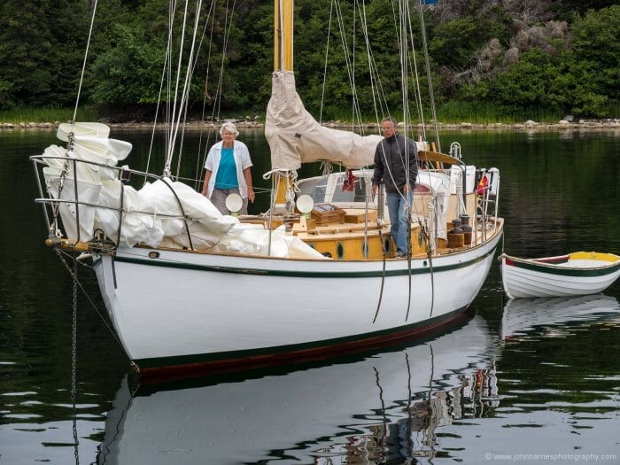
- About The Boat
- Gear & Maintenance
- SailNet is a forum community dedicated to Sailing enthusiasts. Come join the discussion about sailing, modifications, classifieds, troubleshooting, repairs, reviews, maintenance, and more!

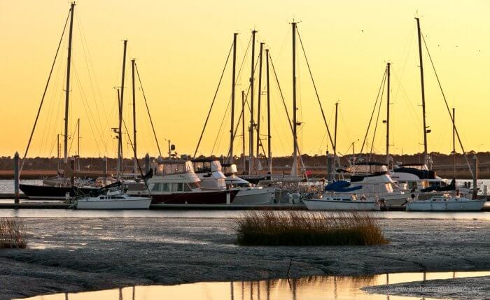
Steel Sailboat Maintenance

- Add to quote
How hard is the maintenance of steel sailboats? How hard is it to keep interior rust under control? How about problems with rust in hard-to-see and reach places like under framing members? Any owners, past owners of steel sailboats, tell us how hard you found the maintenance.
Val?????? Customer.......

Steel boats can rust from the inside out. Because you can't behind all of that cabinetry and ceilings. So if you have any rust starting in the inside of the vessel. It will be hard to attend to even if you know about it. It is phosphoric acid mixed with water in a spray bottle will stand you in good stead. Have worked on steel vessels all of my maritime career and chasing rust, painting and other hull maintenance is normal. but with the newer paints they have out now you work about as hard as you do keeping your teak trimming bright. I have seen wood vessels whose steel fastenings bleeding rust through the paint. and the same with fiberglass boats also. Because of some of the stainless steels do bleed rust.

With a steel boat, expect to spend a good part of your time on board painting . The general rule seems to be "if it doesn't move, paint it - if it moves, paint it 'till it doesn't".. and those nail guns are noisy beasts too!! Aluminium is not much better - it just takes longer for everything to corrode. It's wood and 'glass for me.
I'm not saying that steel boats cannot rust from the inside only that I have experienced more problems out than in. The cabinetry is definitely an area of concern. On Raven none of the cabinets are lined at the back. Inspection of underdeck is a bit of a pain because of headlining and insulation but I doubt that is one of the problem areas. More likely are surfaces where moisture can collect. Have to agree in general that modern steel coatings have reduced much of the maintenance required. I am quite surprised by how little maintenance has been required with Raven. Re the streaks , we have an Alejuela 39 on the mooring next to Raven and she weeps rust stains from her chain plates and stanchions as badly as anything on Raven. Inside, we have kept a constant watch and have only needed to paint one small area where a fresh water inline tap had been rubbing against the hull. The problems outside invariably start with impact e.g dropping a metal winch handle onto the deck is not a great idea even if you catch it after the first bounce and before the final splash. In fact the biggest bummer with Raven is that her topsides need recoating. Having to do this by brush may be beyond my skill as a painter. To have her sprayed is going to be a right pain in the bum, not to mention the expense.

Hartley18 said: BTW, Val.. How ever did they rescue your boat? Lot's of cranes and a new cradle perhaps? ...and why were they moving it with the mast up?? Click to expand...

When it comes to rust on steel boats, my sense is that exterior rust will make the boat look bad while interior rust will reduce its strength. When I worked for Charlie Wittholz in the early 1980's we figured that steel boats had a useful lifespan of 20-25 years or so, depending on build quality and maintenance, before they needed sufficient replating and reframing as to be of negligable value. At that time we were calling for the interior of the boats to be sandblasted white and coated with zinc rich, coal tar epoxy. The zinc was supposed to greatly improve the adhesion of the coating and the coal tar epoxy was very hard stuff that would stand up to abrasion very well. Over the past ten years I have been aboard a number of the steel boats that were built from plans prepared during the period that I worked for Charlie. In several cases I had a chance to examine the interior skin of the boat. In all cases I found that there was as significant rust along the stringers, in places as much as an 1/8" of the plating rusted away, which is not the end of the world on the bigger boats (over 40 feet) that had 5/16" plating, but was certainly not acceptable on the smaller boats with 10 and 11 gauge (roughly 1/8") plating where the strength of the panel was pretty much shot. At least one of the boats that I saw had the interior removed and had been partially replated, sandblasted and recoated. Two years later the rust was back and growing. The broker told me that the seller of that boat had spent more than his asking price to remove the interior, do the plate repairs, sandblast the interior of the steel and recoat it and was now frustrated that the rust was back so quickly. Even discounting for broker hype, the cost of replating a 20-30 year old boat is a very significant number. My problem is not with the small amounts of routine maintenance that has been described above. That kind of work is no different than say maintaining teak oil on the deck trim. You get a routine, and simply do it and its done. My problem is with this insideous rusting of key structural components and connections, and the long term impact on the boat's strength. Jeff
Hey Val....have you noticed that 3 sailboats fell off their stands???
Hey he has a Gori prop...the man knows what is good....

Stipakb, What kind of steel boat are you considering? Professionally built or home built. If it's home built it will probably take more hours and money than you can imagine to keep it in Bristol condition. If professionally built, you need ot know how many steel boats does the yard build in a year and for what purpose are they built (working boats or yachts)? The knowledge, experience and reputation of the builder are critical. With a professionally built boat maintenance is still an effort, but it's more likely to be manageable. See my post at http://www.sailnet.com/forums/sailboat-design-construction/39728-steel-hull-construction-3.html The entire thread is related to your question and there are probably others here at SailNet. Send me a PM if you have specific questions. I've owned a steel boat for 8 years and have found the trade-offs of maintenance vs strength to be very acceptable. Below is a photo of what happens to a well made steel boat when you hit a big rock at six knots (the damage was only cosmetic). I think the impact of this rock strike on a fibreglass boat would have been much more tramatic to boat and crew. Send me a PM if you have specific questions.
Attachments

- ?
- 176.1K members
Top Contributors this Month

- Search forums
- Yachting Monthly's Scuttlebutt
Steel boats - hull maintenance and longevity
- Thread starter Strolls
- Start date 1 Apr 2017
I've seen Scott Fratcher's book Metal Boat Maintenance - A Do It Yourself Guide recommended a few times, and yesterday discovered an extensive preview available on Google Books: https://books.google.co.uk/books?id=peIEMVOvOIQC&pg=PA23 On page 23, Fratcher asserts that the paint on a hull of a new steel boat lasts about 15 years, the first repaint lasts 7 - 10 years, and thereafter repainting the hull must be done every 5 - 7 years. He implies that around this age the pitting is so deep that it soon becomes time to use an angle-grinder to cut corroded sections from the hull and replace them. The interior cabinetry must be removed lest the welding cause a fire, and this is a big job. I guess, based on the aforementioned intervals, sections of the hull would start needing replacement when a steel boat is about 30 years old? I have to say that reading this has rather dulled my enthusiasm for steel boats. All the ones I bookmark are on the market for 3 years before selling for half the listing price - any I could afford would at least need a new paintjob nearly straight away! The posters on Reddit's /r/sailing are very negative about steel boats - "stay away from them, they're a nightmare" - whereas this forum, particularly those who own or have owned steel boats have always seemed more positive and pragmatic. Am I allowing myself to be scared off unduly, or should I stay away from 30 year old steel boats, since I'm inexperienced with a grinder?

Well-known member
Can comment from a motorboat point of view, Having been around and involved with steel and before that with wooden boats,up to 10m for many years and with long term ownership. Have no experience of new boats with super duper modern paints. On older boats with old fashioned coatings,the hull,especially around the external waterline and the interior hidden by internal linings,will require constant monitoring.This is probably not to bad during initial ownership but as time goes on any lack of attention will multiply the problem.Usually its worst where you cannot see it start. Once a simple plate on top of the weak structure would have been OK, now it must be welded in flush. Know of one instance,where so much plate had been added the boat increased its draft by a noticable amount.Where as once every river side locality had a host of welders and fabricators, now the nearest one will have an ad on the web and the workshop will be located in a industrial unit on a farm 50 miles from any water. We have a Pedro on our club moorings,which has not been used for some time,rust has completely corroded through the rubbing band. What ever the disadvantages of composite plastic boats the real problem will be in finding a way of destroying the blimming things. Down here on the Medway,the last commercial yard with any real steel expertise closed but a few months ago.
Active member
>On page 23, Fratcher asserts that the paint on a hull of a new steel boat lasts about 15 years, the first repaint lasts 7 - 10 years, and thereafter repainting the hull must be done every 5 - 7 years. He implies that around this age the pitting is so deep that it soon becomes time to use an angle-grinder to cut corroded sections from the hull and replace them. The interior cabinetry must be removed lest the welding cause a fire, and this is a big job. Pitting can't occur if the hull is painted properly, I have no idea where the author got that from. Also the author is wrong about you need to paint more often I wonder if has ever had a steel boat and is making things up. I got an error 404 not found on the URL.

I think he's trying to sell a book to nieve steel boat owners !

Strolls said: I've seen Scott Fratcher's book Metal Boat Maintenance - A Do It Yourself Guide recommended a few times, and yesterday discovered an extensive preview available on Google Books: https://books.google.co.uk/books?id=peIEMVOvOIQC&pg=PA23 On page 23, Fratcher asserts that the paint on a hull of a new steel boat lasts about 15 years, the first repaint lasts 7 - 10 years, and thereafter repainting the hull must be done every 5 - 7 years. He implies that around this age the pitting is so deep that it soon becomes time to use an angle-grinder to cut corroded sections from the hull and replace them. The interior cabinetry must be removed lest the welding cause a fire, and this is a big job. Click to expand...
Doing my homework to choose the right boat, so far I learned that most steel hulls corrode from the inside. Also, there isn't just mild steel on the market, there is corten, which corrodes slower and doesn't blister like mild steel. Initially I was also very reluctant to buy a steel boat but less afraid of a corten hull, which gives a peace of mind regarding internals, maybe even corrodes a bit slower outside. Besides, that "30 years of no-repaint period" might be a mistake and the whole maintenance scheme would be much more sustainable/last 100+years, if the proper coatings and antifouling are applied already after 10 years. No wonder though, why most "cheap" second hand steel boats age around 30 years...
Strolls said: On page 23, Fratcher asserts that the paint on a hull of a new steel boat lasts about 15 years, the first repaint lasts 7 - 10 years, and thereafter repainting the hull must be done every 5 - 7 years. Click to expand...
PCUK said: If the boat was epoxy coated from new then his comments are total rubbish. The steel will be inert within the coating unless it is damaged. My thirty year old De-groot was good as new when sold (including the two pack gloss that came up like new every time it was polished). When ultrasound checked for the sale survey the worst area of wastage on the hull was 0.1mm so the 4mm plate when new was down to 3.9mm after 30 years and only in one small area. If the book was written 50 years ago then he may have been right, any newer and he's an idiot! Click to expand...

PCUK said: If the boat was epoxy coated from new then his comments are total rubbish...If the book was written 50 years ago then he may have been right, any newer and he's an idiot! Click to expand...
GHA said: Where? Temperature makes such a difference, if your boat was in the tropics then fairly certain things would be different. In the tropics the slightest of nicks will be staining rust straight away, very different to northern europe. My first blast & repaint was about 20 years, now looking at another blast just over 10 years, a chunk of that in the tropics. Maybe he's not such an idiot. Click to expand...
GTom said: Proper flame sprayed zinc after that reblasting? Click to expand...
I would like to share some experience that I have with flame spray. I have friend with a 36 foot steel sailboat that was built in Holland more than 80 years ago . On the inside the boat was flame sprayed with zinc at the time it was manufactured. Insulation in the form of rock wool was installed and over the years got wet. There is not a sign of rust, on the unpainted zinc, in any area that we inspected on the inside of the boat. I can't speak for what was applied on the outside of the boat because there looks to be 80 years worth of paint. I have flame sprayed the inside of my 39 foot steel sailboat with zinc so I have at least a minimal amount of experience with sand blasting and zinc flame spray. I bought a type Y Metco gun and a box full of spare parts on ebay for 140 US$. The gun works perfectly. The pure zinc wire costs around 7US$ per kilo and covers around 5 square meters per kilo. It takes a minute or two to spray a square meter, on a straight run. Add in the cost of gas and oxygen and the cost would come in below 1 US$ per square foot. Compared to epoxy coating systems, primer ... primer. paint. I believe the zinc is the cheaper of the two, or at least in this neck of the woods zinc is cheaper? There are issues about welding over zinc etc. etc. but since this is already longer than most will want to read, I wont go into them. Click to expand...
rogerthebodger
GHA said: Even finding somewhere that does blasting is getting harder. Click to expand...

Strolls said: I've seen Scott Fratcher's book Metal Boat Maintenance - A Do It Yourself Guide recommended a few times, and yesterday discovered an extensive preview available on Google Books: https://books.google.co.uk/books?id=peIEMVOvOIQC&pg=PA23 On page 23, Fratcher asserts that the paint on a hull of a new steel boat lasts about 15 years, the first repaint lasts 7 - 10 years, and thereafter repainting the hull must be done every 5 - 7 years. He implies that around this age the pitting is so deep that it soon becomes time to use an angle-grinder to cut corroded sections from the hull and replace them. The interior cabinetry must be removed lest the welding cause a fire, and this is a big job. I guess, based on the aforementioned intervals, sections of the hull would start needing replacement when a steel boat is about 30 years old? I have to say that reading this has rather dulled my enthusiasm for steel boats. All the ones I bookmark are on the market for 3 years before selling for half the listing price - any I could afford would at least need a new paintjob nearly straight away! The posters on Reddit's /r/sailing are very negative about steel boats - "stay away from them, they're a nightmare" - whereas this forum, particularly those who own or have owned steel boats have always seemed more positive and pragmatic. Am I allowing myself to be scared off unduly, or should I stay away from 30 year old steel boats, since I'm inexperienced with a grinder? Click to expand...
Speaking only as an observer, not an owner, I've seen many steel boats having patches welded in, sometimes multiples. They looked quite reasonable at a glance at the outside but had rotted from within, in areas not normally seen. Main cause was bad building where the stringers hadn't been notched to allow condensation and any water ingress to drain into the bilge.

Most steel boats rot away from the inside. The best modern treatment for a new hull is to plasma spray with zinc i.e. to galvanise it prior to painting. This method is being used on some high quality European canal barges.
Malo37 said: Most steel boats rot away from the inside. The best modern treatment for a new hull is to plasma spray with zinc i.e. to galvanise it prior to painting. This method is being used on some high quality European canal barges. Click to expand...
Other threads that may be of interest
- 11 Aug 2024
- Practical Boat Owner's Reader to Reader
Members online
- justanothersailboat
- Andrew_Fitton
- WhiskeyTownRacer
- WildGoldfish
- Harbourlight
- john_morris_uk
- j3tpropelled
- dolabriform
- highbridgeflyer
- Wandering Star
- munster1967
- fredrussell
Share this page

Steel hull maintenance
by Simon Jollands | Boat Maintenance , Preparation , Yacht ownership

A steel boat owner’s biggest enemy is corrosion. They don’t have to worry about osmosis or rotting timbers, instead rust is the number one issue that will keep them awake at night.
Steel hull maintenance mainly involves checking inside and outside the hull for rust and then dealing with it. This means sanding, chipping, scraping, grinding or blasting rust out until the metal beneath is shining. The metal then needs to be covered up as soon as possible with multiple layers of rust converter, primer and paint.
It is just as important to deal with any corrosion that may be present on the inside of the hull as well as the outside. It is a widely acknowledged fact that steel hulls generally decay from the inside out, so it requires dedication from both the builder and owner of a steel boat to ensure that every nook and cranny inside the hull is cared for almost to the point of fanaticism.
It is worth noting that with modern painting systems, if a well built steel hull is backed up by being properly prepped and painted at the build stage, then it need not be too arduous to maintain. Rigorous attention does need to be given to prevent rust from forming. The time spent doing regular checks and dealing with rust as soon as it appears will reap benefits in the long term.

How to repair rust spots
- Begin by chipping out the rust using a chipping hammer or a grinder with a very coarse16 grit grinding wheel. Remove any loose paint with a putty knife.
- Use a wire brush to clean the surface thoroughly.
- Sand and feather the surrounding paint surface so that it has a smooth edge.
- Clean and degrease the surface before applying a metal primer.
- Apply the epoxy primer and leave it to dry.
- If there are any deep spots these can be filled using an epoxy filler. Apply the filler with a putty knife, smooth it back and leave it to cure.
- Sand the surface smooth using a 200 grit paper. Wipe clean with acetone and apply another coat of primer. Leave to cure and it will then be ready for the topcoats to be applied.
Stripping back larger areas
For larger areas, there are a number of options. Check with your boatyard which of these options they will allow you to use. Note for all these options the use of full protective clothing and eye protection is recommended as they all generate a lot of dust and dirt:

- Needle guns – these tools work use compressed air and are very noisy. They have vibrating needles which chip away at the rust and paint and are particularly good for getting into tight corners inside the hull. Good quality ear defenders and eye protection are essential.
- Shot blasting – there are several types of shot blasters, including dry and wet variations, some which use sand or grit, others which use soda. They all require a compressor to work. As well as getting rid of the rust, shot blasting prepares the surface very well for painting as it scratches the surface, which helps paint to adhere to it.
- Rotary blaster – these come in various forms from drill-mountable rotating discs to dedicated machines complete with guard and dust extractors. They are all designed for the removal of rust, paint, tar and other materials, which leaves the equivalent of a sand blasted surface with a texture suitable for applying protective coatings. For DIY purposes, the rotary blaster is well worth considering as it can be used on most types of electric drill.
- Polycarbide abrasive discs – these are fitted to a standard angle grinder. They are effective at cutting through paint without damaging the steel. They work best over smooth areas but are not as good dealing with deeply pitted areas.
Rust converter and preventer
Apply a rust converter and preventer to the freshly blasted steel surface. Rust preventer is basically phosphoric acid and converts rust to iron phosphate. Leave the rust converter for an hour or two and then brush it over with a hard bristle brush to remove the residue left on the surface. The rust converter provides an insoluble, non-conductive and oxide-free surface over which paint can be applied. The surface will now be ready for priming and painting.

Fairing – sanding and filling
Boat hulls of all kinds will require filling and fairing from time to time. Fairing is a time consuming and arduous process but can substantially enhance a boat’s appearance, as well as providing additional protection for the hull. While the appearance above the waterline is one consideration, beneath the waterline the priority is to ensure that the hull is as smooth as possible in order to offer the least resistance through the water.
Fairing compounds use either polyester or epoxy based systems. In the case of polyester, using a small amount of catalyst results in a hard plastic finish. With epoxy, the resin reacts with a hardener and they form a chemical bond that also results in a hard plastic material. The big difference between the two is that epoxy systems are inherently more water resistant, shrink less when they are cured, are more adhesive and are stronger than polyester resin. Hence epoxy fillers are generally recommended for marine use.
Applying the filler
- On sand blasted metal, first wipe with solvent then apply a pre-coat with a thin solvent-free epoxy resin mix. Then apply the filler mix while the pre-coat is still tacky.
- On primed metal, the surface needs to be sanded and then wiped with quick evaporating solvent to ensure the epoxy filler has a good key.
- For small areas, apply the filler with a plastic spatula or a metal straight edge. Aim for a slight overfill so the repair can be sanded back flush with the surrounding surface.
- On larger areas, apply the filler using a flexible metal applicator that enables you to spread the filler over the surface.
- On larger areas, it usually requires two people to work together with a fairing batten, spreading the fairing compound evenly and smoothly over the surface. The aim is to apply no more than 3-4mm at a time and end up with a slight overfill that can be faired back when the the filler is cured.
Once the filler is fully cured, the objective is for the excess filler to be sanded back to leave an even, smooth surface. This usually needs to be done in a number of stages, beginning with coarser grit paper and finishing off with a finer 200 or 240 grit paper.
Getting this right in one go is not always possible. The solution is to apply fresh fairing compound over any remaining uneven or pitted areas. Once again, after the filler has cured then you can sand it back until you are satisfied with the finish.
And then, it will be time to begin the painting process.

Share on Facebook Share on Twitter Share on Linked In Share by Email
“At this stage of the America’s Cup, you don't want to be too comfortable.” - Inside INEOS Britannia
safe_skipper_apps

Recent Posts
- Navigating Through Rough Waters: Tips for Handling Adverse Weather Conditions in a Sailboat
- Docking a Motorboat
- Boating Etiquette: Do’s and Don’ts on the Water
- Navigating narrow channels

- Boat Accessories
- Where to Buy
Special until July 31st: 24% off all products. Use Code JULY24 at checkout. *restrictions apply
Free ground shipping in the Continental US for any orders over $150!
The Ultimate Sailboat Maintenance Checklist...
The ultimate sailboat maintenance checklist.

Pop quiz: when are you finished with maintenance on your sailboat? It’s a trick question. The real answer is “never,” because a sailboat needs regular care and attention if it’s going to perform at its best. And that care and attention won’t help if it isn’t comprehensive. That’s why we’ve put together this ultimate sailboat maintenance checklist to help keep your ship in top condition:
- Inspect the boat. Survey the bilge, for example. Test the bilge pump and make sure it runs smoothly. Visually inspect the hull. Look for leaks. Check the raw water sea strainers and look at your battery levels on a regular basis. The key word here is “comprehensive.” Remember, without a comprehensive inspection, you won’t know which issues need addressing.
- Inspect your anchorage. Keeping an anchor in proper condition is essential. You don’t want to head out on a journey and find out that your anchor is suddenly flawed. Some experts recommend waiting for clear waters and weather and diving down to check the anchor itself.
- When in doubt, get a second opinion. If you’re not sure about the quality of a particular system, you should bring in an extra pair of eyes—preferably an expert’s pair of eyes. It’s better to know that your sailboat doesn’t have a problem than to wonder.
- Write down your regular maintenance habits. Add a date next to your notes so you know what needs to be done first. You’d be amazed at how much time can pass since you inspect a critical system if you don’t track it. By tracking it, you’ll know which spots on your sailboat deserve the most attention next time around.
- Look at the quality of your sailboat’s wood. A sailboat’s wood is comparable to its lifeblood. You don’t want dry rot to set in and completely change its quality. We recommend a range of Wood Restorers that can help you out here if a total replacement is not needed. Our Git-Rot Kit is particularly helpful. It uses capillary action to penetrate through wood rot and strengthen the wood to make it both sandable and paintable.
- Keep it clean! If there’s one thing inexperienced boat owners often forget, it’s that keeping a clean boat can work wonders. Keeping your sailboat clean will help prevent mildew from developing, which in turn ensures that you don’t end up with a lot of strange odors that become hard to eradicate. We have a full range of Boat Cleaning Products here at BoatLIFE for you to peruse.
- Address maintenance issues as soon as they arise. Don’t put a new issue, such as a strange noise, on the back-burner. You don’t want to find out about a new problem when you’re out on the water. You want to know everything there is to know when you’re safe at home.
Stock Up On Boat Maintenance Products
There is a lot you can do to maintain a high-quality, sea-worthy sailboat—and you’ve read a lot of it here. Make sure to expand your boat maintenance toolkit with our boating products here at BoatLIFE.

Share this:
- Click to share on Twitter (Opens in new window)
- Click to share on Facebook (Opens in new window)
Featured Products
Liquid LifeSeal® Sealant 5.2 fl. oz. Clear
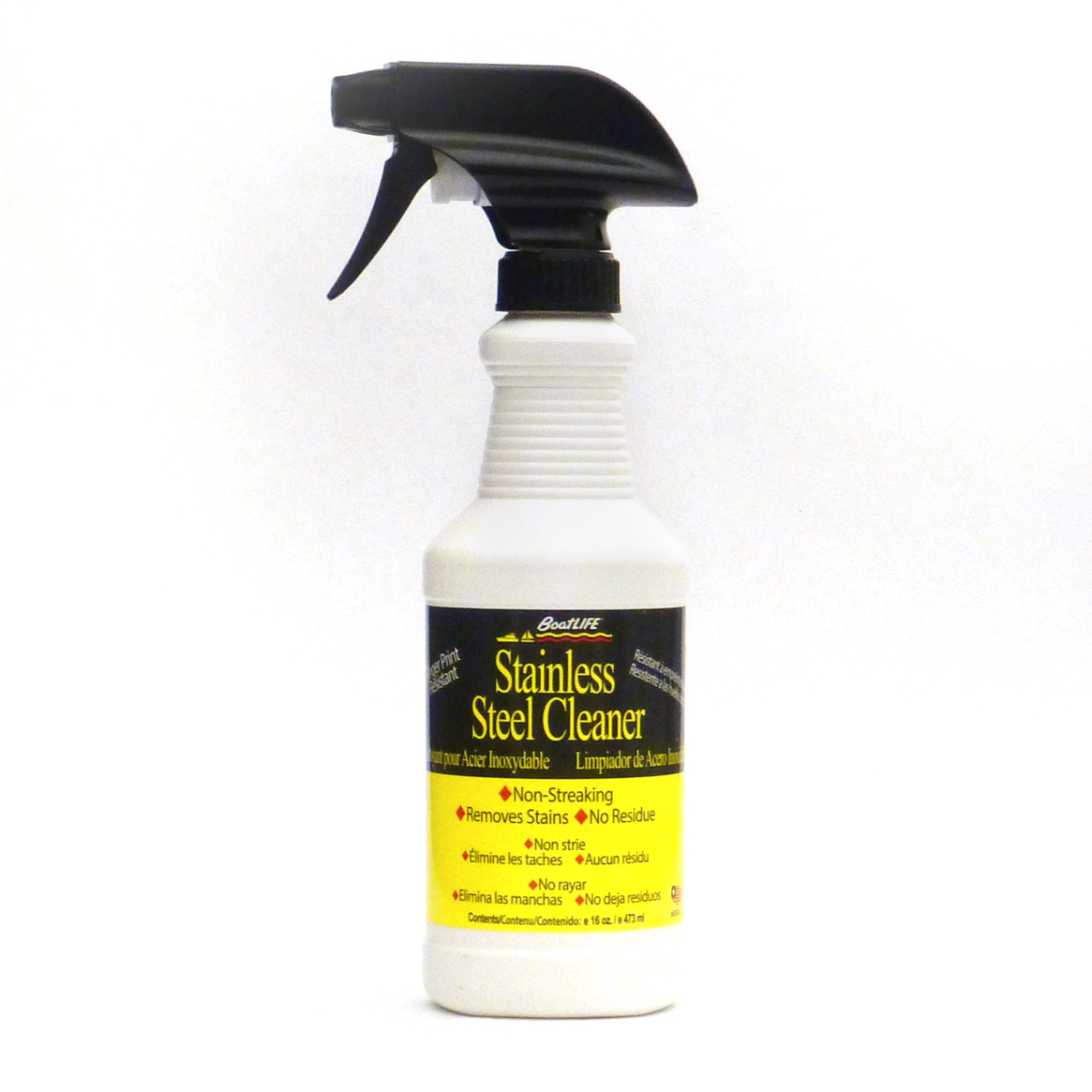
Stainless Steel Cleaner 16 fl. oz.
Related blogs, updated how to use “git”-rot.
**This is an update to a previous post, “How to Use “Git”-Rot””. The presence of wood rot can ruin any […]
Thanksgiving Trivia!
Happy Thanksgiving! Thanksgiving is one of America’s oldest and most loved holidays. Although the story is steeped in a dark […]
Detailing Your Boat
On a warm summer day with the sun shining, there’s no better way to spend your time than by hitting […]
All products proudly made in the usa

Attainable Adventure Cruising
The Offshore Voyaging Reference Site

- Hull Materials, Which Is Best?
As Phyllis and I think about what our next boat might look like, one of the primary decisions is hull material.
We have several chapters in this Online Book about the characteristics of the four general available options, steel, aluminum, wood and fibreglass (see Further Reading below), but that still leaves the question: Which is best, not just for Phyllis and me, but for you, too?
As usual, the answer is the oh so annoying: it depends on what we plan to do with the boat.
But what I can say, is that there are two materials that are pretty easy for Phyllis and me to drop from the hull materials prospect list. So let’s start with that, and then move on to the two left standing to pick a winner.
Hull Material We Won’t Consider
We will not even be looking at boats made of steel or wood—not quite true, we might consider a good wood epoxy saturation build—and that’s also our advice to most of you.
Why neither of those two materials? Both are intrinsically unstable. Or, to put it another way, no matter how well the boat is built, if left to their own devices, wood will rot and steel will turn into a pile of iron oxide.
OK, before you take me to the woodshed in the comments, let me make clear that I understand that good boats can be built of both wood and steel.
One of my good friends has a wooden boat that has given great service (including a bunch of ocean crossings) for decades, and will continue to do so for many more. But he built her himself, has cared for her meticulously, and has incredible skills. But I’m not Wilson (that’s his name) and, in all likelihood, neither are you.
The same applies to steel. If you built the boat yourself, or supervised every step of the build, and then cared for her yourself, it can work. Just look at the amazing voyages made by AAC contributor Trevor Robertson in Iron Bark .
But we are talking about second-hand boats for most of us, so steel and wood are out because it’s difficult to be reasonably sure in a pre-purchase survey on either material that something horrible is not going on deep within the structure. Something that, when discovered, can turn our new-to-us boat into a worthless pile of junk—we are talking the risk of serious wealth destruction here.
Still not convinced? Let’s dig deeper.
There’s another big problem with wood. If we find say a rotten stern post, or any other structural member after purchase, the skills and time to replace it are prodigious. Heck, just replacing a single plank in a way that will actually be watertight takes great skill and perseverance. Way beyond practical DIY for most of us. And I have seen professional replacement of just a few rotten members in a wooden boat cost over US$100,000.
What about steel? Well, on the positive side, repairs require less skill than wood. But the problem is it is very difficult to build a boat of steel under about 45 to 50 feet that will sail or motor well. The reason is that steel plating must be of a certain minimum thickness to be workable and not deform, regardless of boat size, so small steel boats are pretty much always too heavy, at least for the performance that Phyllis and I want.
And, finally, the maintenance of a steel boat is simply no fun—unless you have some perverted love of chipping rust and working with toxic chemicals—and to make that worse, any breach of the coating must be dealt with promptly and properly.
The bottom line is that I know a lot of people who own a steel boat, or have done so in the past, but I have never met anyone who has owned a second steel boat.
All that said, I guess purchasing a steel or wood boat with a history like those I mention above, from someone you really trust, would be OK—particularly if you make clear that if they have lied to you, you will hunt them down and… And the advantage of this course is that you can often get a lot of boat for very little money.
Hull Materials We Will Consider
Where does that leave Phyllis and me, and probably you, too? Yup, with fibreglass and aluminum. Both are intrinsically stable—assuming we don’t do something stupid, and, when built right, a hull of either does not deteriorate just because of the passage of time.
And both can be surveyed prior to purchase to make fairly sure (there is no certainty) that there is not something horrible lurking. Yes, I know there are many horror stories (I have one of my own) about fibreglass boats with hidden faults, but that’s a survey failure, not a material one. (More on how to avoid survey failures coming soon.)
So which is best, aluminum or fibreglass? Brace yourself. I’m going to do it to you again. It depends on what you want to do. Let’s look at each.
As a 30 year aluminum boat owner, I love the material. And if Phyllis and I were planning to go to seriously hazardous places (as we have in the past), aluminum would be our only choice.
But on the other hand, aluminum is a bitch to keep paint on, an expensive bitch. And, by the way, don’t think for a moment that leaving the hull bare solves that. Prepping and painting the deck and cabin of an aluminum boat to the yacht standard that many owners want and want to maintain, will, if done right by professionals, cost as much or more than painting an entire fibreglass boat.
The point being that if you are considering aluminum, you need to do as I do: take your glasses off when you see the paint bubbling. Or, better yet, seriously embrace the industrial look and have no paint on deck or hull, other than non-skid.
Also, although there is no question that most of the horror stories you hear about aluminum are just that—stories—the material does require caring for, including closely supervising anyone who works on the boat. Most boatyard professionals are dangerously ignorant about aluminum and many will make that worse by not appreciating their own ignorance.
So that leaves fibreglass. And for Phyllis and me, who now want a boat that we can safely leave unattended far from home—we are now part-time cruisers—that’s the way to go.
Also, as we age further, we will be paying boatyards to do more and more for us, another plus for fibreglass, since it’s more resistant to unsupervised ignorance—boats with core in the hull, particularly balsa, not so much—than aluminum.
Bottom line, if you are not willing to learn the basics of aluminum boat care and won’t be constantly present to rigorously enforce that knowledge on others, choose fibreglass. On the other hand, the good news is that said aluminum boat care is not hard, and not magic. See Further Reading for our complete guide.
I’m guessing that many of you steel boat owners are now seething and reaching for your keyboards to tear me a new one. Feel free to disagree and tell me why steel is great, but be realistic.
And please keep in mind that we have a lot of readers who do not have a lot of boat ownership experience. So if you blow sunshine about the issues with steel boats, particularly old steel boats, you may make yourself feel better, but you may also tip someone into a life altering decision with substantial negative consequences. Not something any of us need on our conscience.
Further Reading
- How to care for an aluminum boat in 27 easy steps.
- Much more on buying a boat .
- How to care for a cruising boat, once you have bought her.
- The engineering characteristics of hull materials.
- Impact resistance and why it matters .
- More on boats from Boreal .
- More on Ovnis .
Please Share a Link:
More Articles From Online Book: How To Buy a Cruising Boat:
- The Right Way to Buy a Boat…And The Wrong Way
- Is It a Need or a Want?
- Buying a Boat—A Different Way To Think About Price
- Buying a Cruising Boat—Five Tips for The Half-Assed Option
- Are Refits Worth It?
- Buying a Boat—Never Say Never
- Selecting The Right Hull Form
- Five Ways That Bad Boats Happen
- How Weight Affects Boat Performance and Motion Comfort
- Easily Driven Boats Are Better
- 12 Tips To Avoid Ruining Our Easily Driven Sailboat
- Learn From The Designers
- You May Need a Bigger Boat Than You Think
- Sail Area: Overlap, Multihulls, And Racing Rules
- 8 Tips For a Great Cruising Boat Interior Arrangement
- Of Cockpits, Wheelhouses And Engine Rooms
- Offshore Sailboat Keel Types
- Cockpits—Part 1, Safe and Seamanlike
- Cockpits—Part 2, Visibility and Ergonomics
- Offshore Sailboat Winches, Selection and Positioning
- Choosing a Cruising Boat—Shelter
- Choosing A Cruising Boat—Shade and Ventilation
- Pitfalls to Avoid When Buying a New Voyaging Boat
- Cyclical Loading: Why Offshore Sailing Is So Hard On A Boat
- Cycle Loading—8 Tips for Boat and Gear Purchases
- Characteristics of Boat Building Materials
- Impact Resistance—How Hull Materials Respond to Impacts
- Impact Resistance—Two Collision Scenarios
- The Five Things We Need to Check When Buying a Boat
- Six Warnings About Buying Fibreglass Boats
- Buying a Fibreglass Boat—Hiring a Surveyor and Managing the Survey
- What We Need to Know About Moisture Meters and Wet Fibreglass Laminate
- US$30,000 Starter Cruiser—Part 2, The Boat We Bought
- Q&A, What’s the Maximum Sailboat Size For a Couple?
- At What Age should You Stop Sailing And Buy a Motorboat?
- A Motorsailer For Offshore Voyaging?
- The Two Biggest Lies Yacht Brokers Tell

What are the hull and deck panel thicknesses on MC?

As I remember, hull 1/4 to 3/8 in the keel. deck 3/16″. That said just looking at plate thickness does not tell you a lot. For example MC is built with very closely spaced frames and stringers which add a lot of strength but less weight than heavier plate and fewer frames and stringers.

John, I hear your warnings about steel, and I know this might be a complicated route to go. My main reservations about fiberglass boats is that the majority of them come with external keels which is fine for me for a one or two weeks charter but something I absolutely do not want for my own future boat. Encapsulated keel structure (or welded on as with steel hulls), a deep V forefoot, and a rugged skegged rudder, are characteristics that can more often be found with steel hulls as with “plastics”. When going for my survey I plan to come with a fiber optic to inspect all those remote places, and would certainly rule out a boat where I would not have access to most if not all hull places. That said, if I were to buy now, my current favourite on the market is a fiberglass ketch 😉
I would not recommend discarding all external keel boats from your list. Yes, the modern trend to bolting through light skins and then using a glued in web to stiffen things up is intrinsically dangerous, but there are plenty of external ballast boats that are built properly.
And internal ballast is not without problems. Like with most things it all depends on the execution.
And there are good hull forms in GRP too. In fact, in my experience, a lot of steel boats are designed very poorly.
Anyway, I would not take on the risk and maintenance burden of a second hand steel boat for those reasons.

Agree with everything you say about steel boats. When I got back from Vietnam in 1969, I took all of my savings and bought a steel 45 steel schooner and lived on her. I went to work at the Naval base in Pensacola, FL and left my wife to chip, sand and paint the rust spots that seemingly appeared almost every day inside and outside ( no wonder she divorced me! ) I finally sold the boat to a “know it all” and bought a Hinckley 50 fiberglass yawl — problem solved!
Hi Patrick,
Thanks for the report. Another person who has owned one steel boat!

I totally agree with your conclusions on this. No material is perfect but fiberglass has a lot to be said for it overall and aluminum is great when a bit extra is required. Aluminum is actually the only material you have listed that I really don’t have much experience with beyond little skiffs so it is the one I can’t properly comment on but I like the concept.
I have had a lot of interactions with wooden boats including having a good sized one in the family and working aboard several. While I love these boats and think they look great, our boat is fiberglass and that is intentional. For that matter, our boat doesn’t have any wood on deck at all. With wooden boats, like most things, it really comes down to who the owner is. An owner who gets it and stays ahead of maintenance puts in surprisingly little time (still a whole lot) dealing with rot and paint that won’t stick. An owner who is a little less vigilant and deals with a deck leak by hanging a diaper under it rather than getting out their irons to fix it will find the boat falls apart on them incredibly quickly. In my experience which is all salt water based, deck leaks are the biggest killer of these boats by far and they are actually comparably one of the easiest to track down and fix. Even for an owner who farms out the wood work, I would say that if you can’t fix a deck leak and don’t have oodles of money, then it is a disaster waiting to happen.
With steel boats, all I have to say is that I hate the sound of a needle scaler. If you have a ton of money, there are great examples like the Columbia replica but that is not attainable for most of us.
I realize that there are a lot of people who get very nervous with keel bolts (and bolts in general in anchors and other things) and while it is something to watch, I think that it is a good trade-off given the other options. I think that a lot of the issue is that the average person does not know how to evaluate whether a bolted connection is a good connection and there have been an awful lot of poor connections built over the years. An example of a good connection is most connecting rod bolts which have enormous numbers of cycles, vibration and other factors to contend with but yet basically never fail unless there is another underlying issue such as the caps being mixed up. By getting the bolt stretch length long enough, using appropriate materials, having appropriate mating threads and using enough torque/tension, you end up with bolts that don’t back out and do not fatigue. Keels are a bit tricky as very few materials won’t suffer from some sort of corrosion if there is any water and fiberglass creeps so it is difficult to maintain constant tension but I think that you would find an extremely low failure rate on well designed connections and that most of the failures were on connections where an analysis would have shown that the margins were low and best design practices were not followed.
On wooden boats, although I have little first hand experience, as you say, and I see demonstrated by Wilson, a skilled and diligent wooden boat owner can make the maintenance look easy, but let a wooden boat get away from you and there will be tears.
On keel bolts, a question for you? If contemplating buying an old boat with external ballast, would it make sense to insist that before purchase the keel bolts (assuming accessibility) were torqued to the proper value for their material and size?
My thinking is that, assuming the construction and bolts were right when built, the biggest risk, particularly with SS bolts, is that they have wasted at the keel to deck joint due to water ingress, so if they withstand the appropriate torque without breaking we can be pretty sure that that they are not appreciably weakened. Does that make sense?

I would make no such assumption about the keel bolts. They may be seized, in which case you’ll see the correct reading on the torque wrench but the pre-load tension in the bolt will be wrong. They may also be partially corroded, in which case they may withstand the torque but still be capable of failing in tension if the boat were to, for example, ground on a reef.
If it’s possible to get at them to check their torque, it shouldn’t take much longer to completely remove the nuts, one at a time, to check the studs or the cavities for signs of corrosion before re-torquing them to the proper specs. If it’s not possible to do this, then it’ll be difficult for *any* non-destructive examination to reveal what you want to see.
Thanks for coming up on that. How about just loosening a half turn and then torquing to spec? What I’m trying to come up with here is a way to at least check for a really bad keel boat situation in a way that will be acceptable before purchase, and I fear that if we try and actually remove the nuts and backer plates the seller will reject the idea—just torquing the bolts is going to be a hard enough sell.
So, I get that the bolts may still be a long way from original after this test, but at least it will catch the ones that have corroded really badly. Also, I’m not sure that removing the nuts would tell us much since the bad bolts I have seen were corroded where the keel meets the hull, but would have looked fine from above, even with the nuts off.
Bottom line, I get that this is not a great solution, but my thinking is that it’s practical and a lot better than nothing. Would you agree?

Pull a few and inspect is probably the only real way to to be sure. At least this is done on a woodenboat.
Ignoring whether a seller will or should allow retorquing keel bolts, the theory is good but the practice is somewhat more problematic. Proof testing is a well established industry practice that has proven to be pretty effective. Periodic hydrotesting of pressure vessels such as boilers, tanks, etc is just one example of something that has been successful at eliminating a lot of dangerous failures.
The first practical issue is what torque do you apply. I design capital equipment not sailboats so don’t know exactly what is done as there are multiple schools of thought but if I were designing one of these joints, I would figure out my worst case loads, choose a preload of ~2X and then upsize the bolts from there a bunch to give a corrosion allowance but not increase the preload any more. The question is, what was done on the boat you are looking at. The average person does not have the knowledge to calculate what the maximum per bolt load is and then we don’t know the factors from there. I suspect that there are some boats out there where the torque value from the factory is 75% of yield just like most bolts are but I also suspect there are a lot of boats out there where the preload will be more on the order of 30% (I have it written down at home but I believe this is approximately what I calculated for ours with the assumptions I made). In the case where the designer did not leave a corrosion allowance, then a torque to 75% of yield is entirely appropriate but on other boats, you could break a bolt which while corroded was actually still well within allowable parameters or you could crush the laminate if there is insufficient load distribution for the higher tension. All of this can be calculated with fairly simple calculations but having anybody without training apply it is problematic and even then, you are really doing a proof test not just a retorque as you likely won’t know the original torque. If anyone knows of a standard that all designers hold to so a way to avoid the guessing game of the factory torque, I would love to know it.
The other practical issue that comes to mind is the imperfect relationship between torque and tension. Engineers refer to this relationship as K factor which is basically friction between the threads and the faces. When tension is really critical, the standard thing to do is to actually use oil or grease which are more repeatable and represent a lower K factor. If there has been any galling at all which is a real problem with stainless, all bets are off and you could even break the bolts before bottoming out if it is really bad. This is really the long way of saying that it is really inexact if you do it dry, you would really want to clean everything well and then oil the threads. Of course, if you are NASA, then you can actually measure tension on the bolts but everyone else is left using torque as a proxy.
Given all of this, I am not sure that most sellers could be made to agree to a specific torque number unless original build documentation can be found with a number which I don’t think that I have ever seen (unfortunate and kind of scary). Retorquing is definitely not a bad idea and I have done it on our boat, I just don’t know how to implement it simply and quickly unless someone knows that all keel bolts were originally torqued to some % of yield or something equivalent.
Hi Eric (and Matt),
Thanks for going to all the trouble to explain that. As so often happens, I’m a lot wiser after reading your and Matts thoughts. And clearly my idea is not a good one.
The sad part about that is that I think those of us considering an older boat may have a real problem that’s not generally recognized: Having wandered around boat yards a lot lately, I’m seeing a lot of otherwise good looking boats with stains indicating that water has penetrated between the keel and hull. I’m also guessing that a lot of boats for sale have had those stains covered up with paint.
Add in that many of those boats will have stainless steel keel bolts and I’m starting to think that the only good answer with a boat like that is going to be to drop the keel to check the bolts before heading offshore.
Of course we will not be allowed to do that before purchase, so that leaves walking away from a lot of good boats, or assume the risk. And the risk is not trivial. If the bolts are bad, replacement can be a serious matter. One experienced person at a quality builder said that the best and least expensive solution is to recast the keel with new bolts! The point being that most keels have J bolts cast in, and he said that hacking them out is a disaster—he has seen it tried.
So the more I think about this, the more I think that a lot of people who think they have refitted their boat for sea may in fact be sitting on a pretty nasty problem that would be hugely expensive to fix. And that as the years go by, this is only going to get worse. (A lot like the problems with SS in old rudders.)
I would really appreciate any other ideas of how to deal with this, or alternatively reassurance that I’m overthinking this. Also, do you think bronze keel bolts relieve at least some of this worry? With SS all I can think about is those bolts sitting in a wet oxygen deprived environment for 30-40 years! How about industrial x-ray? Expensive, I imagine, but probably a hell of a lot less than a keel bolt replacement.
John, you just elaborated very wisely the reasons why I will certainly not be looking for a boat with an external keel. You just can’t look inside (and I doubt even industrial xray could reliably see cast-in bolts). It is just like playing lottery, and what I learnt is at least that I will never win 😉 You’re right that encapsulated ballasts have their own issues, but at least they cannot fall off during a passage.
Your call, but what I’m finding is that there are so few really good boats out there for sale that even come close to my critical needs that to settle on a single keel construction type would limit my choices. This is particularly true since I want a boat with good performance, which is harder to do with an encapsulated keel, particularly in GRP.
Also, a boat with a bad encapsulated keel can be really bad. Think steel punchings in concrete. If that lot gets cooking and splits the outer sheath (I have seen 3 of these in the last month while wandering around boat yards) the repair would be way harder than new keel bolts. Just think about jack hammering out all that stuff!
Point being there are good boats built both ways, ditto bad boats.
Just to clarify, I was not asking about X-raying the bolts inside the lead. The problems I have seen are wasting in the hull to keel joint and a bit above. Seems like X-rays would pass through the GRP and show the bolt, but then again I have no clue, which is why I asked the engineers. As I remember Matt has worked on medical imaging equipment, so we may easily get a good answer.

Hi John, Your question highlights for me that another valid comparison (apart from hull material) might be long run production boats vs short run / custom boats. Long run production yachts of course favour fibreglass of course and tend to have more than a few things worked out over time – one of which is to make them as “charter friendly” (aka idiot proof), as possible. But am I right in my supposition that for this reason, most long run production boats will have steel keels, secured with stainless bolts tapped down into the metal keel? And short run designs (not generally being for charter markets) take advantage of the performance gain with lead keels, but have studs penetrating up through the hull, with securing nuts? Reading between the lines of Matt and Erics’ responses, it seems you must remove the keel to really check the studs on a lead keel and even then there could be something lurking deeper inside. Conversely, to check the keel bolts in a steel keel yacht, you could simply specify removing say 25% of the bolts at pre-purchase survey time. For total peace-of-mind, replacing all the keel bolts on our Beneteau 473 with original OEM bolts costs about $200 US, available ex-stock from the Beneteau Spares web-site (as are most other parts by the way, even now 15 years since launch). Now I get there are pro’s and cons of lead vs steel keels. But the simplicity and integrity of a steel keel is really hard to beat. I know of a Beneteau 473 that hit a rock doing 8-9 knots under motor, coming to a crash stop. The only damage the surveyor could find on the Monday (up on the hard) was a fleck of anti-foul chipped off. No gap in the hull joint, no weeping at the keel / hull join, no cracking in the anti-foul. Internally, no damage to the lay up or the supporting girders either. No harm, no foul as they say in America. So how about a long run production boat, John? br. Rob ps – no, it wasn’t our B473!
That’s a good point although I do wonder about the actual practicality of unscrewing a keel bolt that’s been imbedded in steel for years without it shearing off. I guess it would depend on how well the original builder had treated the bolt threads with an anti-seize of some type. As usual, we are at the mercy of the builder’s QC since one small mistake in construction can lead to a world of hurt 20 years later.
And good to hear that a Beneteau withstood a grounding so well. However, I would not want the impression left that this is always the case with boats from Beneteau since at least some of their later boats are built with a keel construction technique that is fundamentally dangerous, particularly after a grounding: https://www.morganscloud.com/2014/06/05/cheeki-rafiki-tragedy-time-for-changes/
I also need to point out that if the boat in question was built using the same methods as “Cheeki Rafike” there is no practical way to know for sure that she was not damaged.
(Both are conclusions from the report on “Cheeki Rafike” and engineering done my the Wolfson Unit at Southampton University. https://www.morganscloud.com/2015/06/25/cheeki-rafiki-report-misses-an-opportunity-to-make-boats-safer/
All that said, I have no problem with the idea of a production boat and have thought about several. In fact, as you say, there are a lot of advantages to one, particularly later in the series when the bugs have been worked out.
I think you could get pretty good contrast and detail of a set of keel bolts in cross-section via X-ray, given sufficiently high quality X-ray equipment. And if the X-ray crew has access to a megavoltage source like Co-60, you’ll be able to see the bolts cast into the lead quite clearly.
This is not going to be cheap, however. And whether it tells you anything useful will really depend on the exact design of that particular boat.
You could try ultrasound, but that’s highly dependent on the technician’s skill and on the access situation for that hull.
If stainless steel, or galvanized mild steel, bolts are cast into the keel (forming studs that protrude into the boat), and there’s evidence of water intrusion, then I think dropping the keel a few inches is the only reliable way to tell the extent of damage.
With lead keels, bronze bolts are definitely the correct choice; the bronze/lead combination is basically indestructible for more than the life of the hull.
Galvanized mild steel bolts with a cast iron keel also seem to be OK as long as the bolts are accessible for periodic replacement, and I’d definitely undo one or two to check during pre-purchase survey. Stainless makes me nervous. Bronze bolts with a cast-iron keel make me nervous.
Don Casey has a good article on assessing keel joint issues here: https://www.sailmagazine.com/diy/how-secure-is-your-keel
Thanks for that great information. Sounds like there’s nothing for it but to plan to drop the keel unless it’s bronze bolts into lead. Good to know what the reality is.
Thanks for linking to that article. I’m way better informed after reading it. Casey is the real deal.
Thanks for posting link to Don Casey’s article.
I was worried what you would ask what to do about it. Unfortunately, I don’t have great ideas beyond actually taking a look. I work on the design side of things and so don’t know a lot about non-destructive testing other than where I need to make allowances for it to be done (this is something that is definitely not done in the design of these joints). My experience with X-ray is limited to inspection of welds and castings and I am not sure how it would work on keel bolts so I can’t really add anything beyond what Matt said. I believe that there are also design solutions to make this a much smaller concern that could involve changing materials, designing to be inspectable, designing to be repairable (iron keels that are tapped and bolted from the top being an example), etc but that doesn’t deal with the already built boats.
In my case, there are a few things that made me feel comfortable with our boat. Looking at the ISAF statistics compiled in 2013, of 72 recorded keel failures, only 3 could be attributed to the bolts (important to note that 40 were undefined so the actual number could well be higher). Weld failures, and internal structure failures both had a more than double incidence ratio. I actually find this failure rate pretty low given the number of poorly designed (or designed with low margin for racing), poorly maintained and poorly repaired joints out there. Our boat has a pretty conservative keel attachment, the lever arm is small and the attachment is wide in both directions and the bolts are large. Given that, I calculated the required bolt strength and then looked at the bolt size on our boat and concluded that the designer had been appropriately conservative in upsizing to allow for corrosion. Next, our boat did not show any of the problem signs such as large rust streaks, signs of grounding damage, etc. Finally, I did exactly the test that you were hoping to do which is a torque test on all of these bolts (note, this and all the calculations were done post purchase) to values I calculated and felt comfortable with. Obviously this is not perfect but has mitigated the risk to a level where I feel there are other more important places to put my efforts.
Actually pulling the keel in a properly equipped yard is not that big of a deal, often on the order of what people spend on electronics for the boat. What becomes really problematic is if the bolts are found to be compromised to the point where they must be replaced. Given our location, I would contact Mars Metals if I ever got to this point. For people who do not live near a facility like this, it gets more tricky. I have limited experience installing bolts from the bottom of a keel and I could see it working in some instances but not all.
Thanks very much for expanding on that. Obviously it’s disappointing not to have a generally applicable risk reduction strategy. But then again, when did that every happen around boats!
The good thing is that I now understand the issues and how to reduce the risk to acceptable levels. One thing I would say is that I would need to think long and hard before buying a boat that say had tankage or mast step structure over the keel bolts since that can make the job of dropping the keel from, as you say, comparatively simple, to a much bigger job.
Hi John, thought I should address the keel questions for anyone considering a Beneteau cruiser and reading this. Cheeki Rafiki, was a Beneteau First designed primarily as a racer / cruiser. They have light hulls and rely on a structural liner for much of their hull rigidity, with bulkheads and “furniture” glued in. In the main, the boats are fit for purpose and they don’t have a history of losing their keels, even though there seems to be a serious question over the keel to hull design. I personally wouldn’t sail one offshore but would have no hesitation in owning one around the NZ coast, if I raced more.
The Beneteau Oceanis 473 was designed by Beneteau as their offshore model and as I have heard it told, the model was built to help alter their “bendy Beneteau” reputation. The Clipper Oceanis range (of which the 473 is one), are the last of the all hand laid fibreglass models before European regs changed to enforce epoxy, vacuum bagging and sandwich construction. The hulls were built super-thick of solid glass fibre and more so around the keels and other high stress areas. 473s then have massive supporting girders glassed into the bottom of the hull. The bulkheads are also glassed in not glued. The flanges of these girders are wide to improve the hull bonding and spread the keel load. Around the front and back of the keel area, the girders are only about 250 mm apart. The keel bolts go through both the girder flanges and the hull. Unlike the First, the 473 in particular has a much wider keel base and a double row of bolts (single row on the First). Comparing the two boats for offshore use, is like comparing a Toyota MR2 with a Toyota Land Cruiser – built for two very different things. My experience with owning a Beneteau is the QA processes were (are?) excellent, but I must add inspecting one or two bolts a year to my maintenance list. I haven’t so far because we run a dry bilge and the bolts are like new. And John, therein lies an opportunity for an astute buyer – there are gems in most production yacht manufacturer’s ranges, just as there are bad’uns. It is finding those good’uns that can pay off – the 473 is an absolute diamond. best regards Rob
Good to hear that the 473 has the bolts through the flanges and the grid glassed in. The key to the Cheeki Rafiki disaster is that she and her sisters had neither. Also, the report stated that other boats of her class had keel problems.
I wonder what Beneteau is doing these days with their newer boats.
Also it’s important to realize that Beneteau sold the class that Cheeki Rafiki was a member of as ocean capable. They make the same assertion for most of their current offerings.
Summary: any buyer needs to check to make sure the keel support structures are glassed in (not just glued) and that the bolts pass though the flanges, not just the hull skin. If they find this is not the case, run a mile.
And anyone considering buying any modern boat with a fin keel should read the Cheeki Rafiki report so at to know what to look for.
One more thought. Sorry to be such a pain in the ass on this. But one thing I have learned over the years running this site is that people skim (particularly the comments) not read carefully. They also tend the hear what they want to hear.
The point being that while I fully understand that you are not saying all Beneteaus have safe keels, just yours, I still need to jump in with the realities from the report.

Hi John, Why do sailboat keels smile? Because they are thinking about how much fun it would be to swim freely in the ocean like the dolphins, free of the heavy burden on their backs!

Of course we all know that GRP is forever. Even after you scrap the damn thing it’ll still be recognizable land fill or artificial reef for the next thousand years. Still there is one other material that deserve a passing derisive remark: Concrete. It’s a material used exclusively by amateur builders that never seems to survive the first owner.

Insurance company do not underwrite concrete boats in Canada. Not sure of USA. Since they need civil responsibility, place are limited for an owner. Altough it was a most decent material, well insulated, cheap, partially insulated.
Yes, we have friends with a concrete boat that has served them well. That said, I decided to leave the material out since good concrete boats are pretty rare.

For what it’s worth Joe Adams (the designer of our boat) had his first big success with the original Helsal that was a ferrocement boat. It smashed up records for the Sydney Hobart classic and was forever known as the ‘Flying Footpath’.
http://rolexsydneyhobart.com/news/2012/pre-race/helsal-tribute-to-joe-adams-in-rolex-sydney-hobart/
What a great name!
Ask any physicist about the stability of Aluminum alloy and they will say ; the aluminum stability derive from its oxyde layer which is the strongest material on earth after diamond. Thus any object built of aluminum alloy should make sure that oxyde layer is preserved. A simple piece of wood on an aluminum plate staying outside in the rain will get holed in a few months and will prove you that it can be attacked easily once the Al2O3 layer is depleted in oxygen poor environment. And aluminum is born of electricity and can be destroyed by electricity.
The ebook should have started with the french joke: Circumnavigators knows that 50 % of the boat going around the world have a metal hull, the remaining are US boats.
Each aluminum boat is a unique closed loop battery and had to be kept under cathodic state under all conditions. Some boat well builts have it naturally, some others don’t and with maintenance mistakes, this is were horror stories come from.
I am not found of polyester boats because the environnmental cost of getting rid of those tons of plastic polluants at the end of life have never been taken into consideration is the first price. Polyesther fiberglass is not recyclable. We are just pushing the problem forward to the next generations. One day not to far someone will wake up and put environnemental cost on the new GRP production boat and people will realise its not cheap.
Wood as said before, is only up to the maintenance made. My marina neighbor has a magnificient wood boat that he built himself, on the plan of Joshua. He told me last weekend, 6000 to built and 6000 hours to maintain since 30 years. A tribute to those brave men.
Steel… if only the genius of the french architects who recommended to build hulls in steel and the deck and infrastructure in stainless would have been more commonly communicated, we would have less steel boats relics today. 95 % of the paint maintenance of a steel boat is on the deck. A steel hull/stainless deck has about 1 hour of touch up maintenance every year (for all those logs and obstacles hit on the water)
Thus for metallic boats ultimately the material is not the problem, its the way it has been put together and maintained. A production aluminum sailboat could be the perfect boat for circumnavigators. For some specific usage, only steel can survive. This special boat is quite an achievement, almost 20 years in the polar sea: https://vagabond.fr/en/vagabond/
(Of course i am biased i have a year of mechanical engineering classes in material resistance and my full welding certification for both Aluminum alloys, Steel and 304 and 316 stainless on conventional SMAW and also on GMAW and GTAW.)
My experience over nearly 30 years is that the aluminium alloys used in boat building are a lot more durable than you indicate. For example my boat had teak decks and toe rails for the first 12 years of her life. And, despite the fact that water had got under the teak in many places and been there for years, we found only a little surface corrosion of no consequence when we removed the wood.
Yes, as I said in the article, it’s important to follow the rules with aluminium, but that’s far from rocket science and occasional mistakes do not result in a wrecked boat in a few weeks, as many will tell you.
Also the horror stories of wrecked aluminium boats are in my experience pretty much all of the “my cousin has a friend who knew someone who…” variety rather than reality. In fact I have yet to see an aluminium boat trashed by corrosion of any type and I have seen a bunch that have been horribly neglected.
I think the key point in all of this is that marine grade aluminium is far more durable that the grades most people have experience with in other uses.
And it’s also worth keeping in mind that aluminium has a higher strength to weight ratio than steel, so in fact a stronger boat can be built in aluminium on a practical bases. That said, aluminium is not as abrasion resistant as steel.
As to the environmental issues with GRP, I hear you but I don’t think it’s that simple. For example steel boats use a lot of really nasty coatings and insulation. Also those coatings must be renewed at a regular basis. And the making of both steel and aluminium plate have a pretty big environmental impact. Point being, it would take an in-depth study taking all these factors into account to determine which, over the life of the boat, inflicted the most environmental harm.
Hi John at the marina were my boat is (Québec city) we had to get rid of an old 30 feet fiberglass sailboat unused and leftover. The city environmental personnel came in and said we could not use the city garbage service and it had to be destroyed on site and buried in a special area (city owned) for about 100$ per ton. It ended up costing us 2000$ to get rid of this boat. If it would have been alu or steel people would have paid to pick it up.
If course Quebec is very serious with garbage and landfill management and not all jurisdictions are equal. But the trend has started here…
As for alu alloy indeed 5083 is a magic material if properly maintain. I did own a 34 feet powerboat for 6 years in my auxiliary coast guard previous life and there was a corrosion meter on the dash of it (silver anode isolated under water connected to the hull) and the owner book went to great lengths explaining the potential issue. At sea no problems because electrolytic voltage are low. But I had a AC current leak from the battery charger once and I noticed a month later(boat in water) tiny droplets of water appearing at the inside of the hull in the engine room just over the propeller. I wiped it everyday and when I hauled the boat out it could be seen from outside that the aluminum was severely pitted at 3 places… almost 1/8 depth. I had to replace and reweld the plate… it was full of tiny holes. I had magnesium anodes on the boat ant they were untouched. So it was galvanic corrosion at its worst. One season…
I agree it’s a worst case scenario but I was a first line witness of it. In this case the corrosion meter didn’t showed any problem although a problem was occurring.
Do you have a corrosion meter on MC?
This being said I would not be nervous of having another aluminum boat built of marine grade alloy by professionals- it’s is certainly the best boat material if properly built and maintained.
The meter you you had would not have warned you about that particular problem. Also, my guess is that the boat was not fitted with an isolation transformer, which is absolutely required for any aluminium boat plugged into shore power.
For a complete guide to aluminium boat ownership, including a gauge that would have warned you immediately about the current leak, see the links under further reading.
Having a strong electronic/electrical background like John, I’d like to reinforce his point on isolation transformers. It’s my view they should be mandatory on all metal boats, and considered highly desirable on all others. They serve at least three safety critical purposes:
1. The obvious one is that they isolate the ground loop to the shore power ground. Essential to prevent electrolysis and ensuring swimmer safety.
2. They provide inherent shore power reverse polarity protection. This is often an overlooked and not very well understood benefit.
3. The secondary of the transformer effectively becomes a ‘local power source’ and the neutral bonded to the boat hull ground. This provides a rock solid ground path for the boat that is independent of the shore power ground. This is essential to ensure any Earth Leakage/Residual Current Balance protection devices will work reliably. Depending on a shore ground loop that may have multiple cables and connectors, all subject to corrosion and miswiring, is a hidden and underestimated danger.
While the first attribute is highly relevant to metal boats, the second and third are common to all. Probably most boats don’t have an isolation transformer, and if they all were beautifully wired to a high standard it’s a compromise I’d be more sanguine about. But isolation transformers aren’t expensive in the wider scheme of things, and from an electrical perspective I regard them as the single most valuable investment you can make.
I agree. I would never own a metal boat without an isolation transformer, and would even seriously consider one for a GRP boat.
Hi John indeed it didn’t had an insulation transformer, and i took care of installing a Victron one on my steel sailboat. The anodes barely work on my boat i have the same since 2011 🙂

Andre, GRP is recycled in Europe and on an industrial scale. Additionally GRP boats are deposited in land fill, cut up, as it is considered inert. In the UK land fill sites are now sealed for future reclamation as well as the avoidance of leaching. Regarding recycling, it is not commercial for smaller batches but tends to be the waste streams from large GRP users. Alastair
Thanks Alastair for the information, Europe is in advance on us ! Indeed fiberglass is most inert … but 10 000 years later we don’t know… probably it would still be there !

You have [predictably] left out Ferro Cement – order should be (I owned a Ferro Cement yacht for many years so speak from experience)
Fibreglass Ferro Cement Aluminium
Although I have friends with a very good ferro cement boat I did not put it in because there are so few good FC boats available. Also, to say FC is “better” than aluminium is to ignore each materials characteristics. For example aluminium has a much higher strength to weight ratio and is far more ductile.

As my wife reminds me every time I look at a “beautiful” steel boat: “Rust never sleeps”
Donald that is also true for everything apart gold, platinum,titanium and a few other incorruptible elements.
We human live in the bottom of an air ocean and the O2 is a powerful oxydant. By chance is it diluted in nitrogen because otherwise we would have all burned including everything around.
Oh and that brings a point. A steel and férocement boat would survive a fire but others not. GRP is like a gallon of gasoline waiting for its match…
One of the secrets to a good life: marry a wise spouse.

I’ve had three steel cruising boats, two of which I’ve cruised extensively with. Each were bought used, 20 or more years after they were built. If I was in the market for another boat, I’d definitely consider a steel one.
Everything depends on how the boat was built and maintained.
My current steel boat was built very well, with no longitudinals to trap water, and–more importantly–flame-sprayed with zinc inside and out (properly-prepped & applied epoxy coatings can be almost as good as this). Rust is not a problem with this boat.
Yes, there are poorly built and/or maintained steel boats that will require a lot of work to go sailing (and may not be worth restoring). I think that holds true for any hull material–a couple of years ago I was offered a once-beautiful boat, professionally-built of fibreglass, effectively for free. I turned the offer down. The boat had been neglected, and while the solid fibreglass hull was undamaged, the plywood bulkheads and most of the interior had rotted due to water sitting inside the boat (it was left unattended in a boatyard for a few years).
A steel boat with: * properly-applied coatings, * easy access to most areas (to all areas would be best, but realistically, you’re unlikely to remove tanks to inspect the plating under them unless you suspect a problem), * few or no areas where water can sit, shouldn’t be a maintenance problem.
Everyone I’ve met with a stainless steel deck, as Andre mentioned above, has had good things to say about them (none of my boats had stainless steel decks, so I don’t speak from personal experience, here).
It is true (and important) that damaging the coating on a steel boat requires fixing it promptly (how promptly depends on temperature–corrosion happens very slowly below freezing). Zinc coatings on the steel have some advantage here (if underwater), as the zinc migrates to the bared area electrolyticly, but this is only for small scratches. POR-15 (buy some small cans before leaving North America, as it isn’t all that widely available), a coating developed for the antique car restoration market (which deals with thinner steel plate), makes maintenance painting of damaged areas much easier, since it doesn’t require sandblasting before applying.
>This is the reason that by far the majority of experienced high latitude sailors have aluminum boats. Are you sure of that? When I went thru the NW Passage, there were more steel boats than aluminum boats. In Antarctica, I don’t recall aluminum boats outnumbering steel boats. In Patagonia, I saw more fibreglass boats, and roughly equal numbers of steel and aluminum ones.
Steel probably isn’t suitable for you, because you are looking at buying a considerably smaller boat than the one you have. But for someone looking to cruise long distances, high latitudes and remote places, a used steel boat could be a good choice. It all depends on the construction and maintenance that has been done, and that’s something that mostly can be determined before buying.
Best regards, Richard
Hi Richard,
Thanks for a great report from someone who clearly knows. Clearly you are the exception to the second steel boat crack I made!
As to my assertion about high latitude sailors. No, I don’t know for sure, although it has been my experience, but of course that’s not definitive. One thing I have noticed is that several high latitude sailors with substantial steel experience ended up with aluminium. Skip Novak and Hamish Laird are two that come to mind.
One thing I would say is that I would have no worries about you buying another steel boat, but I don’t think that alters my concern about buyers without your experience taking one on.
Yes, two professional, high-latitude sailors, Skip Novak & Hamish Laird have moved to aluminum charter boats after extensive experience with steel ones. I think most people who own steel boats would consider or have considered aluminum boats.
I don’t think there is any definitive list of boat types that are out doing high-latitude cruising. Records are kept of vessels that go through the NW Passage. I did a quick search of the sailboats that went through the NW Passage in 2017. I counted 4 of aluminum, 4 of steel, 3 of fibreglass, 2 of wood, and 8 that I was unable to determine the construction of. Of the two sailboats that went thru in 2018, one was ferrocement, and I don’t know about the other one. The NW Passage is very much a high-latitude trip, and anyone who has gone through it has at least that much high-latitude experience (and, I would greatly hope, a lot more experience than that before they attempt it!). Those NW Passage numbers are pretty recent, and are in accordance with what I have observed while cruising. So I respectfully disagree with the statement, which the article puts in bold print, ‘by far the majority of experienced high latitude sailors have aluminum boats’.
Some people considering a metal boat will find themselves in the situation of feeling they can afford to buy a steel one, but can’t afford to buy an aluminum one, and see their choice being to own a steel boat or not own a boat. I would encourage people considering a steel boat to read books about them (‘Steel Away’ and Tom Colvin’s ‘Steel Boatbuilding’ were both of much use to me when I was a beginner), talk to people who’ve owned steel boats, and talk to boatbuilders, yards and surveyors that work with them. I don’t know of any particular site on the internet to recommend for information on steel boats.
I agree that steel boats are not for everyone, but disagree that they are only suitable for those who have owned them before–steel boats can be learned about.
I agree, a hard to define stat. I should have written something like “most of the high latitude boats I have encountered are aluminium” or some such.
That said, I still think that steel is a tough material to own, particularly for those new to boat ownership.
I changed the line in the post. Thanks.
Thanks, now we’re in agreement.
Jut some musings.
There is an aluminium boat from 1936 still floating around and the oldest aluminium boat builder started building aluminium hulls in 1898, Savage Aluminium Boats. I think there are GRP hulls from the early ’50s still pottering about today.
I read that a typical, modern 40’ish GRP yacht has around £5000 worth of materials to make it. Today we see new and old GRP yachts sailing around the globe frequently, managing the stresses and strains of the Souther Ocean and plenty of arctic and antarctic voyages. A colleague ran his Contessa 34 onto a boulder lee shore, F5, big damage, the boat dragged off and significant repairs; owner of a Sigma 41 ran into a rock and snapped the steel toe of the hull flange from the keel all theta through, as well as significant hull damage, I too rammed a ledge at spring tides at speed and busted GRP stringers etc, none of these yachts sank. One thing that GRP has going for it, is that it flexes considerably on impact before it yields, although the area will have been significantly stressed and weakened. The same for aluminium, recently at Ardfern Marina, a modern aluminium yacht was on the hard, after the owner ran her over rocks and bashed the hull significantly at the turn of the bilge, I guess the aluminium though would have maintained a lot of it’s strength. The skills were not available to fix and she was being prepared for road transport back to the builders yard in France when I saw the boat; GRP on the other hand can be fixed easier, I suggest. The point I wish to make, is that GRP is a strong material, it has resilience and a history of surviving neglect and abuse. This is what makes it a superior material in my opinion. Sailing is a minority pastime, the vast majority of participants will have reasonable funding and GRP has proved to be very cost effective and allowed some fantastic low cost, extreme voyages to be made by amateurs. I don’t particularly value steel or aluminium for their strength in hull choice as avoiding the sort of impacts that damage hulls should be the name of the game for any serious voyager. If one is in a situation that impact damage is happening, then it is luck that is stopping the hull from foundering. I think hull design with collision bulkheads and water tight compartments is more relevant for security against foundering than GRP v aluminium v steel. It is this sort of design feature that buys time and allows options to be worked. There are always exceptions of course.
John, I think your reasons for going GRP are very valid. I am a lazy hull cleaner, preferring to let the waves do the washing. But about every 3 years I polish and wax the hull and it comes up beautifully.
Hi Alastair,
Lot’s of interesting points. One thing I differ a bit on is GRP repair. Yes, you can repair a GRP boat easily, but, and it’s a big but, it’s very difficult to be sure that said repair is properly bonded, at least without using epoxy, which has its own difficulties. Secondary bonding is a far bigger problem is generally recognized. More in a future post.
Also, metal boats have another advantage, other than just strength, and that is it’s much easier to make them stiff, and that in turn makes it much easier to make them watertight for the long haul.
And finally, strength is very important in the high latitudes where, no matter how careful, sooner or later we will hit something, either ice or an uncharted rock.
In summary, having owned both for long periods, I don’t think that GRP is “better” than aluminium, just better for my needs going forward.

We chose steel because we saw the boat we purchased had been prepared properly and we were aware of the need for prompt maintenance. Everything in “adventure cruising” being a compromise, the key to happiness is, we feel, this awareness. We are a few weeks from leaving on what we hope will be a five-year circ with an emphasis on independence from the shore and the ability to do our own repairs save for major refitting. Few people get to do this, irrespective of hull material. The wisdom of our choice will soon reveal itself, one way or another. Now, if you’ll excuse me, I have to wire up a fridge compressor…
Hi John, A few vignettes;
Steel: Bernard Moitesser’s Joshua; Washed ashore in a hurricane in Cabo San Lucas– filled with sand. Given away to two guys walking on the beach. Pumped out and motorsailed all the way up to the Pacific Northwest where she became a dock mate to my Cape George 36. Every fiberglass boat that washed ashore on the same beach was cut up and hauled away.
Brewer Atlantic 45: Built by a well know Canadian yard. Sailed around the world and arrived in Trinidad with several overlaid hull patches. Spent a year being “completely” re-plated and re-decked while sitting outside as is the practice there. (and rusting all over again) Repainted and looked “smooth as glass.” Sold to a naive young couple who panicked the first time they hoisted sail. I was offered it for $15,000 and turned it down.
Classic 110 ft. Feadship In our yard for a complete restoration. Hull built with overlapping strakes — every overlap rusted out. Re-plated the majority of the hull, re-powered and restored interior to new. Fixable, but at tremendous cost.
John Guzzwell was one of the earliest pioneers of cold molded wood boat construction. I met him when he hauled his Laurent Giles ketch out in our interior storage area. It was built in the days before epoxy— he used resorcinal glue just like the Spruce Goose. Planking was mahogany rather than the more rot resistant Alaskan cedar. And the hull sheathing was Dynel in polyester resin. John spent the winter removing the old sheathing and replacing it with glass cloth and epoxy out of concern over moisture penetration from the resin. I made it a point to chat frequently to pick John’s brain and learn everything possible about cold molding. When he finished bringing “Treasure” back to bare wood there was only a small area of discolored wood— the planking was as sound as new and she was ready to receive her new modern sheathing.
I built my Cape George 36 deck without fasteners, epoxy bonded over an epoxy/glass base over Port Orford Cedar. Lived for 36 years outside with no covering and little care by multiple owners, but was still watertight and serviceable.
So yes, properly built wood boats can be durable.
At the same era the PT Shipwrights Co-op worked on a caravel planked boat that was built in 1898. She required a new stem timber and about 40% of the bow planking replaced. The repairs probably cost little more than all the Beneteaus that were being peeled and glassed under warranty at the same time.
So yes,traditional wood boats that have been properly built can be repaired over and over again so they last forever.
Fiberglass:
A J130 that has a perfect black paint job, new carbon sails, the latest electronics, and a custom $30,000 factory upgrade interior just sold for $15,000! Underwater delamination and extensive wet core. My proposal was to completely re manufacturer the hull bottom with epoxy resin infusion and close spaced foam/carbon ribs and stringers and no core. The end result would be the best J 130 in the world.. Some extensive rebuilds actually make sense!
And not all fiberglass boats last forever! Especially if they have a balsa core underwater.
All good examples that can teach us a lot. As you say, many of these problems can be solved. But, at least to me, the key take away from all those stories is that the fixes take huge expertise and if done wrong the result can be huge wealth destruction. Bottom line, I would have no worries about you taking on any of the above situations, but for the average person my advice would be “not a good idea”.
Hi John My little stories weren’t chosen as examples of good projects for do-it-yourself dreamers! What I was trying to illustrate is that good (and bad) boats can be built of all materials. I could have included an aluminum Italian motor yacht with black AC current “peppercorns” in the hull that you could push a screwdriver through, or a 90′ fiberglass motor yacht where the underwater exhaust outlets had burned all the resin completely away from the adjoining area and was a single wave away from sinking.
The skill level required to undertake repairs runs the entire range:
John Guzzwell’s 24 year preventive maintenance project required a strong back and weeks of work with a heat gun and scraper, but technically anybody could learn how to do it with a couple of weeks of practice. The guys who nursed the battered Joshua up the Pacific coast were adventurers, not shipwrights. Hundreds of graduates of wooden boat schools know how to re-plank a traditional wood boat– that skill has not entirely disappeared. A teak deck originally built like my Cape George only takes a day with a grinder to be ready to be glassed over, unlike the can of worms in a screw fastened fiberglass, aluminum, or (heaven forbid) steel boat teak deck.
On the other hand, the hull rebuild I suggested for the J 130 is probably more technical than building an entirely new boat and requires engineering and solutions not found in the typical professional boat yard.
All in all, i am not sure the hull material is a strong discriminating factor in a purchase. If i my boat would be lost and have to shop for another one, the first criteria for me would be a metallic hull. Because it is a metallic hull it can have also a safe swing keel and a flat bottom to go on the beach or where there is tides. Shopping for a boat is a matter of luck for the availability of what we want. And age is important also. i have 58 and plan to use my boat for another 20 years if God helps. But suppose my boat would be lost and i would be 70 – knowing that in 6 to 8 years the boat will have to be sold back would mean a very important criterion would be to be able to sell the boat rapidly and profitably. For this reason i would opt for a good aluminium sailboat or if a catamaran then GRP. Not because technically they are better (in my humble opinion) but rather because its easy to sell. I thinks its also the thinking of many prospective buyers….

I submit that it is possible to find a world cruising sailboat for under $100K that is not a project boat: http://www.cruisersforum.com/forums/f152/aluminum-30-ted-brewer-cutter-for-sale-202692.html This is also a not too subtle plug for checking out Cruisers Forum when researching said topics. Full disclosure, this has been my beloved boat for nine years, and AAC is the first site I recommend to not only aluminum hull boaters, but every boater. Thanks John, Phyllis and crew
She certainly looks to fit the specification and supports the my thinking that when constrained by that budget the best alternative is to go a bit smaller than the 40′ that seems to be the new “standard”. Better a smaller good boat than a bigger crap boat.
And thanks very much for the kind words.
Also, if you feel like sharing, it would be interesting to know what comes next for you after she sells?

Hello John, I guess I’d like to also throw in my little “grain of salt”. I am one of those “idiots” who is on to his second steel boat…The first one, a 1975 van de Stadt ketch, I spent 10 years rebuilding, while living on board and working full time, in the heat and humidity of the Florida Gulf coast. I never finished! However, my second boat, a one-off Treworgy 38 built in 1995, is of a combination you haven’t mentioned, but which is used in a large proportion of the luxury mega-yachts, as well as military and work ships: Steel hull and aluminium deck and superstructure. They are built using a flatbar, called a Datacouple, that has one side of steel imploded onto the other side of aluminium. This is welded to the steel hull and the aluminium deck, and the junction being a very fine micro-line, presents absolutely no electrolytic corrosion problem whatsoever, is 100% watertight, maintenance free, and very strong. It allows the eternal problem of maintaining steel horizontal surfaces to disappear, and lowers the weight topsides. Isolation transformers: Obviously a must, although most GRP boats can get away with a galvanic isolator. One thing to be careful of: The Marinco deck receptacles for the AC connection, as they come out of the box, have a small chromed metallic jumper that connects the ground terminal with the casing. Pleas make sure this is removed! Last but not least, no one has mentioned lightning! With 20 years working professionally on boats in the Tampa Bay area, which is also know as the lightning capital of the US, I can assure you that when you are living aboard full time, and have these daily and very scary lightning storms pass right over you, such that you know is a lottery and at any moment one of those blasts will be right on top of you, having a metal boat is a big reassurance. It won’t keep equipment from being damaged, but it will certainly keep you from being damaged if inside the boat. Very cozy! Best regards and thanks for the great website. Jonathan
Hi Jonathan,
Yes, I have a friend with a boat with a steel hull and aluminium deck, who is, or was (we have lost touch) happy with the boat. That said, I personally would prefer to go all aluminium if considering another metal boat. And yes, I agree that metal is really nice when the flashing and banging starts.
I agree, a really good paints system goes a long way on steel. (On aluminium its just cosmetic.) That said, getting to that point on steel is seriously hard: https://www.morganscloud.com/2012/02/16/why-not-steel-part1/
And, judging from what I see out there on the water, a paint system that good is not that common.
Dear John your comment is not scientific… the sample of steel boats you might have seen doesn’t necessarily represent the reality. We should not compare amateur built steel boat versus commercial built aluminum boats.
When I built my boat I visited a professional alu boatbuilder who had learned in French yards his skills. Although I had welding skills I find out that I was not capable of building correctly without experience a first aluminum boat. I turned to steel with the compromise of a stainless steel deck and superstructure and using commercial Amercoat primers and finishing paints + a certified paint inspector. The sandblast + paint costed me 18000$ CAD in 2008 which account to approximately 3 % of the total cost of the boat.
And frankly unless the builder as in your example as strictly adhered to products and applications guides an as proof or it we should not even consider it in a fair comparison.
This being said, almost all semi professional and professional yards have turned to aluminum in the last 20 years.
In the commercial world, steel boats, freighters, petrol carriers, liners etc.. all got a paint system valid for their 50 years of life. We don’t have the number but I guess that if we count all the ships in the world the number of square feet built of aluminum would be less than 0.01% (probably even less) of the worldwide commercial fleet.
Demonstrated valid protection system exist for steel immersed in sea water with 50+years of useful life.
Conclusions: 1-We should compare apples to apples in our discussion otherwise we get lost in armchair stories.
2-Shopping for an amateur built steelboat should involve much more scrutiny than a professional made steel or aluminum boat.
I never claimed it was scientific, that why I said “judging from what I see”.
Yup, Colin did a great job on that piece. As you say, they did a great job on the boat. That said,I would not class it as “over and above” but rather the minimum required to be a happy steel boat owner, and that in turn is why I don’t recommend second had steel boats. Just easier for most of us to own GRP or aluminium.
Hi John Judging from what I’ve seen, a really good paint job on an aluminum boat is not that common either! The difference with steel construction is that the most important area for protection is on the inside where perfection is the hardest to achieve and recoating is difficult or impossible. Thats’ why steel boats rust out from the inside. And why there are so many home built rust buckets.
re aluminum boat structures: As you mentioned in an earlier comment, an aluminum design with multiple frames and stringers covered by relatively thin plate like MC and aluminum race boats is stiffer per pound than one with thick plate. However I’ve never seen that method of construction result in a surface with so little distortion that it doesn’t require fairing and paint to look decent. Isn’t that the reason you’ve never stripped MC back to bare aluminum?
I’ve worked on two heavily framed aluminum boats— a 12 meter designed to Lloyds scantlings and a 300,000# motor sailor where the owner insisted that the longitudinals be continuously welded on both sides “to make it stronger.” The 12 meter had 3/8″ of mud in some places, and the megayacht had so much accumulated welding stress that it crushed the decks and engine room overheads.
At the other extreme of aluminum construction, my friends Garcia Passoa was built with 12mm plate up to the waterline because they wanted to be able to set it down on rocky bottoms in Patagonia without damage. Back in those days Sr. Garcia used a massive roller to shape 50′ long curved aluminum panels that were so fair you could paint directly onto them and it would look like molded fiberglass. Or you could leave them bare and marvel at his craftsmanship. As I recall the ribs were over a meter apart, and served more to attach bulkheads to than to add stiffness. Different boats for different folks– and purposes.

Thanks, John, for featuring a lovely photo of us and our boat at the beginning of this post. However, and with great respect for all the contributors, I think that the discussion of the “best” hull material misses a couple of essential points.
Most of us build, own and sail boats simply for the pleasure they give. For me at least, a large source of pleasure lies in the boat’s look and feel. Does the boat look good from afar and up-close? Is it pleasing to your eye and comfortable under your bum as you sit in the cockpit with drink in hand? Is the cabin warm, dry, and cozy? Do passers-by offer compliments? Does it perform well under way and at rest?
Hull material strongly influences the look and feel of the boat. Metal boats tend to the industrial strength go-anywhere-any-time look that can be very impressive and pleasing if well executed. Wooden boats tend to fall into the fussy, look-but-don’t-touch category or, at the other extreme, the hairy old, gaff and baggy-wrinkled character boat group, irresistible to some, anathema to others. Fibreglass is the most adaptable of materials but seems to be dominated by a white desert of angular shapes and shiny metallic trim.
My suggestion is to consider “best” material in the context of the ways in which you expect to gain pleasure from your boat. Don’t buy/build something that is built of a material that can survive pounding on lee shore rocks or banging into ice floes unless the resulting look and feel and knowledge of its strength will please you every time you climb aboard.
Our boat is made of wood because that’s what I know and like. I have confidence in its strength and durability for the type of sailing we have done and dream of doing. Countless times we have had folks say to us something along the lines of “what a beautiful boat, but it must be a lot of work”. Well, it is a lot of work, but keep two things in mind. First, I enjoy the work and annual rhythm of varnishing and painting (at least most of the time). If I didn’t like that work, I would have a different boat. Second, structure and finishes that attract onlookers’ initial response are relatively small parts of the whole boat in terms of initial cost and ongoing effort. Our wooden boat has the same needs as any other boat in terms of underwater paint, rig, sails, electrical and mechanical systems, ground tackle, safety, and other gear.
So, my advice is to get a boat that will give you pleasure in the overall scheme of things and consider hull material within that context, not as a starting point.

Hi Wilson, Nicely put and a wise way to look at things. My best, Dick Stevenson, s/v Alchemy
As Dick said, well put. However, I still think that you are discounting the importance and the level of your own skills and how that affects your enjoyment of owning a wooden boat. Or to put it another way, I stick by my assertion that wooden boats can be heart breakers for those with less skill and dedication.
All I was doing in my comment was explaining that one can’t view plate thickness in isolation. I was not saying that the light plate many frame construction technique was a better idea, just different. As to paint on aluminium, I agree, in fact I made that point in the article above.
But the key point in all of this is that a good paint job on aluminium is cosmetic, on a steel it’s a matter of boat preservation.
No disagreement from me. I was just trying to point out that there are always connections: in this case the relationship between how an aluminum boat is engineered and whether it is a good candidate for bare aluminum finish.
You make a very good point. I have never enjoyed the boat part of cruising so much as when sailing on an extended family member’s beautiful wood S&S. As someone who has worked on several nice wooden boats, I always felt a bit awkward when I would answer the inevitable question of which yard takes care of the boat and I would explain that it was not yard kept and also that no, I couldn’t claim credit for most of it either, I was just lucky enough to get to enjoy it.
When getting our current boat, we really thought hard about whether we should take over stewardship of that boat. In the end, we went to the opposite end of the spectrum and decided to get as low a maintenance fiberglass boat as possible. We certainly have given up something that is hard to describe but the design is much more suited to the actual sailing we do and we can keep up with doing all the maintenance ourselves. I am someone who enjoys metalwork but does not enjoy the more artistic elements of woodwork which means that while I can spile a plank just fine, I have trouble motivating making elements that require an “eye” and as a result they don’t come out very well. Every time I see a picture of that boat, I wonder whether we made the right call as the feeling of being aboard was just so wonderful despite it lacking the creature comforts of newer boats.
Great way of describing the Real Purpose of owning a boat! If she doesn’t warm your heart every time you row out to her at anchor, perhaps it would be best to invest in a motor home with the obligatory wavy graphics on the side!
While talking to Larry Pardey years ago on the dock a passerby commented: “what a beautiful boat, but it must be a lot of work” LOL Larry didn’t say anything for a minute, having heard the same comment a thousand times in a hundred harbors. “Well, we don’t have anything else to do” he said. (having just crossed the North Pacific from Japan in a self-built wooden boat with a 24′ waterline)
Nobody has raised the difficulty of getting a good antifouling for an aluminum hull, when i was building i remember the ban on TBT taking place in Europe. Is there good protection available today ? (this article is old) for current owner of alu boats what is the current state of the art antifouling ?
https://www.practical-sailor.com/issues/37_17/features/10783-1.html
Steel hull is very easy to protect with a simple copper oxide suspension.
We have a good solution that we have been using since the end of tin: https://www.morganscloud.com/2009/06/18/zinc-based-antifouling/
E Paint also does consistently well on tests at Practical Sailor and has the other advantage that it’s less environmentally damaging that copper based paints.
Colin is also having very good results from a new copper free paint from Petit.
Hi Rob, I find your report of a Beneteau 473 hitting a rock at 8-9 kn and then a surveyor finding no damage extraordinary. I know you were discussing lead vs steel keels, but, less others think that sailboats can get away with that, I will share a couple of observations. For years I lived near a boatyard in a town with a very seductive rock a few miles away. Most every year, boats would limp in having hit that rock. Every one (or almost every one, I can’t remember) that hit that rock at hull speed with an external keel was considered a total write off by surveyors and the insurance companies. Usually the killer was structural damage of the fiberglass just aft of the keel, sometimes forward, as the keel tries to lever its way off the hull. Beyond that there always was near to the keel bulkheads pulling their tabbing from the hull and furniture etc. being dis-lodged. That was usually enough for the complete insurance write-off. Now, a steel keel would, I would think, transmit the forces more abruptly/directly into the hull as lead has a bit more “give” to it. I suspect the difference altogether may not be all that great. It is my understand that the average boat will not survive a keel to rock grounding at hull speed. I have been told, by those who know about these things, that it would be very hard (read expensive) to have a boat that could withstand an external keel to rock grounding at hull speed (I suspect full keels and some shoal draft could come closest). My best, Dick Stevenson, s/v Alchemy

We saw a Beneteau 50 (2004 ish) hit a rock at speed last year and damage the hull with water ingress. Damage was as described, fore and aft of keel, stringer damage. I think after removing the interior, reglassing and putting everything back, it was around 50-70k ish which the insurance company paid.
Hi William, Absolutely horrible thing to witness as a sailor I’m sure. I think I am right in saying the Beneteau 50 you refer to above is a completely design to the B473 I referenced above. I have never sailed one, but from the pieces I have read, it seems to share the hull liner design of the lighter First models, like Cheeki Rafiki. I am sure the hull would be thinner, too. That doesn’t in anyway detract from your corroboration of Dick’s point about many boats being massively damaged or written off by such impacts. It just doesn’t mean that well designed production boats and in particular the Beneteau 473s and their smaller sister-ships 423 and 393 have the same issue with their external steel keels. br. Rob
Would it really be that hard to engineer a keel joint to survive routine impacts at hull speed?
Today in 3 Minutes of Rough Physics Approximations:
Say it’s an 8 knot boat…. round that to 4 m/s. Displacement 10,000 kg. Draught 2.5 m (of which 0.5 m is hull and 2 m is keel). The keel tip hits a rock, the boat pitches forward, she comes to a dead stop in half a metre (measured at the waterline), average acceleration 16 m/s2. About 80 kJ of kinetic energy needs to be dissipated. Impact forces are on the order of 160 kN at the keel tip, for a pitching moment of 320 kN.m. Couple that through a keel root joint with a 2 m chord length that’s already supporting maybe 5 tonnes of keel, and simplify to pseudo-point loads at leading and trailing edges, assuming the middle part does nothing. That looks like about 190 kN of tension shared among the leading keel bolts and 140 kN of compression on the trailing edge of the keel root joint.
So the question “is it possible to make a 10,000 kg fin-keel boat with a 2m keel survive an 8-knot hard grounding on solid rock” is reduced to “is it possible to share 19 tonnes of tension among the first few keel bolts, and carry 14 tonnes of compression from the trailing edge of the keel joint into the hull, plus appropriate safety factors”. 19 tonnes is below the proof load of four M16x2.00 – Class 5.8 bolts, which seem considerably undersized for a boat of this class. 14 tonnes from a point load can easily be spread through a tapered U-shaped rib/frame about 20-30 cm in moulded depth, or a partial bulkhead, spanning most of the beam of the boat.
I think it’s not a matter of “that’s hard” or “that’s expensive”, but rather a matter of “we build to the scantlings in the class rules and they don’t consider this load case to be routine”. But it seems to me like, at build time while the hull is still in the mould, you’re talking maybe a three-digit dollar figure for this kind of reinforcement.
Hi Matt, how right you are! The boat in question (Beneteau 473) has internal “U” shaped tapered beams almost exactly as you describe, but with thick, wide flanges. The beams are probably slightly over 30cm at their deepest, in the centre, near the bilge and the keel bolts, tapering to not very much at the turn of the bilge (fairly flat bottom especially around the back of the keel). The beams are very close together at the front and back of the keel and about 20 cm wide. These beams are so tough that during our pre-purchase inspection, the surveyor’s hammer bounced off them like they were steel. He called me over to remark on their size and thickness and how many there were around the keel area. Being an ex-yacht designer, offshore sailor and boat builder he didn’t seem the sort to be easily impressed. We both thought they might have a steel core, but I later discovered they are 100% moulded fibreglass. Matt, I think these beams may have cost a little more than a three digit number more, but as you say – not a lot. But I have heard that due to EU heath regulations, such hand lay-up techniques can’t be used anymore, and that most large items like beams would be epoxy injected and vacuum bagged, then cured and simply glued in. I wonder if this is not as inherently impact resistant. Do you have a view on this? br. Rob
The Cheeki Rafiki report makes clear that a glued in grid is intrinsically dangerous and, if memory serves Matt has already agreed with that in our original discussion about said report.
Bottom line, your boat may be a battleship, and that’s great. But I need to make sure others understand that extrapolating that construction to any other Beneteaus, without carefully checking, might be a very big mistake, particularly in light of what you heard about EU regs.

This is my biggest problem with modern fiberglass boats. Boatbuilders that still exist are exceedingly good at value engineering. The ones who weren’t went bankrupt decades ago.
Value engineering requires warranty claims for its feedback mechanism: make something weaker, and if there aren’t any claims then it’s still too strong.
But most pleasure craft spend nearly all their time floating next to a dock, plus an occasional few hours underway in Force <5 conditions.
So value engineering is walking boats down to the point where they're good at floating next to a dock and occasionally sailing in benign conditions—plus Class.
But Class is controlled by manufacturers, and they'll continuously make the case that real world experience shows that Class is too conservative. So Class is value engineering with a delay, and that's how we end up with (for instance) brass thru-hulls and glued matrix liners.
Yes, sadly, I think you are right in every detail on that one. Definitely narrows things down. I’m starting to think the sweet spot is around the 90s when better techniques became available but value engineering had not kicked in quite as much as it has today. Also I totally agree that class is inadequate and in fact has just become a fig leaf to cover up poor boat building:
https://www.morganscloud.com/2015/06/25/cheeki-rafiki-report-misses-an-opportunity-to-make-boats-safer/
Dick, If you go to YouTube and search for “Crash Test – Dehler 31 yacht” you can see Dehler ramming their yacht against all sorts of objects at hull speed. It’s a GRP hull with a standard fin bolted to the hull, not a bonded in grid or encapsulated. The video is worth watching all the way for all the ramming scenarios this boat is going through, including a keel strike against a breakwater base. I am not doubting your observations. My position is that GRP hulls can be designed strong enough for extreme loads at sea, and that inherently makes them strong enough for many types of impact. As design changes over time we now see hull designs with very efficient keels that meet a performance criteria with some sacrifice in strength and are less resilient. I do agree that steel can be stronger but I think GRP can be relied on as safe and secure material, where the design demonstrates that. I won’t post the link here as I am not sure if that is allowed. Regards, Alastair
Hi Alistair, I fully agree that fg hulls can be built to withstand almost anything the sea may challenge it with. I also agree that fg hulls can be built strong enough so that the keel to hull joint is not compromised by anything the sea has to offer. In fact, it is my take that most are. It is a non-sea event that I was referring to: hitting a rock at speed low down on a conventional keel. It is a predictable event for a certain (hopefully small, like lightening) percentage of those who put significant miles on their boats. It is my take and observation that the average sailboat can’t tolerate hitting a rock down low on a keel (possibly excepting shoal draft and full keel where the lever arm is mitigated to a large extent) without substantial damage and often leading to total loss. As to the video, you cited: hitting floating wood objects and log booms should leave only a dent and did leave gauges as shown in the video. But that should be all the damage. I believe the video shows the boat hitting the rock wall with the underbody leading up to the keel high up on the keel, not low where the lever arm is most powerful. This is augmented by the video of a keel placed well aft and the boat rising at first and then largely stopping dead with very little tipping forward. A boat hitting the bottom of their keel at hull speed looks like it will pitchpole. It is incredibly dynamic and looks to eject the people in the cockpit into orbit. This hitting the breakwater was gentle by comparison and says they were sliding up the hull, absorbing the loads till they got to the keel. Very little was shown of keel dents or evidence on the forward underbody where I suspect there was contact. Also, the keel to hull footprint is one of the tiniest I have ever seen on a fin keel boat: harder still to believe it could survive unblemished a bottom of the keel rock grounding at hull speed. Your Dehler video was not, to my observation telling or compelling: it was an advertising stunt. (Reminded me of the old Hunter destruction tests done back in the day: I am not a fan of manufacturer testing.) Now, I am largely unfamiliar with Dehler boats and they may make great boats, but I am not impressed by the video as evidence that a conventional fin keel boat can survive a bottom of the keel rock grounding at hull speed. My best, Dick Stevenson, s/v Alchemy
Hi Dick, that was my understanding entirely, so I fully understand your note of surprise. This was also the owner’s expectation at the time – the boat was rushed back to the nearest haul out facility, with crew in life jackets, coastguard on standby and bilge pumps primed. Most people are reticent about admitting things like going aground, never mind crashing into a rock at full tilt. So I have no reason to doubt a first hand account of the incident, from the owner to me, on board their boat some months later. At the time of the impact the owner was down below, having handed over the helm to a friend to check something. The rock concerned is well marked by a beacon and for some inexplicable reason, the EXPERIENCED sailor and friend took the beacon on the wrong side – hey stuff happens. The crew were lucky to avoid injury. Please see my answer to John above, on the way Beneteau Oceanis 473s are built for the reason why I think they could withstand such force, without any visible damage. Not that I am looking to test it mind. Inside the hull the keel bolts, girders and hull are all completely visible by simply removing a few floor boards. All easily checked by an experienced surveyor. I have to say if it was me, I would have insisted the insurer pay for the keel to be removed, keel bolts changed and the whole thing re-seated at a minimum, and this may well have been done – I don’t have the detail of that. By the way, I do wonder that marine insurers don’t sponsor more marine buoyage. We have a notorious rock near us, that collects about four launches a season. br. Rob
Just to clarify, the Cheeki Rafiki report makes clear that after a grounding it is extremely difficult, perhaps impossible, to determine if dangerous damage has been done to this kind of construction.
So to say “Inside the hull the keel bolts, girders and hull are all completely visible by simply removing a few floor boards. All easily checked by an experienced surveyor.” is simply not correct.
The report also goes on to show that with this type of boat repair is not cost effective and so to be safe the boat will probably be written off.
I think it would be a really good idea if you would read said report, and the associated Wolfson unit report.
Sorry to be so harsh, but this is important stuff and further me constantly arguing with you and quoting the report is only going to get us crosswise, which would be sad.
Hi Rob, It sounds like you have a very solid boat and you must be re-assured to have it validated especially if you were not the one doing the testing. My interest in responding to your initial letter was primarily to point out that, in my experience and in talking with others, most of the regular sailboats out there could not survive unblemished what you described. And I concur with your thought of further examination of the keel. Internal furniture etc. are one thing, but I would also be concerned about the shock load’s effects on the rig, chainplates etc. My best, Dick Stevenson, s/v Alchemy
Hi John, I am not convinced that the average offshore boat buyer need be so pessimistic and precautionary about keel to joint integrity. For those boats being considered for offshore use (for ex., Malo, Hylas, Rival, Valiant, J Boats etc.), I would think that a good survey, boat history (no evidence of groundings), general consideration of the quality of boat construction (including details on the keel to hull joint, caulking, bedding etc.) and the history of sister ships would reveal a lot and make it likely that the keel would stay attached during her sailing life. I think for most boats nowadays (including those mentioned above), all bets are off for untoward events like groundings. That said, I think there is a good long way to go ensuring that new builds are better done in this area and in inspecting those that have been around awhile. My best, Dick Stevenson, s/v Alchemy

Hi Dick, I agree with your conclusions. However I have some interesting information, several fg yachts with fin keel in Scandinavia are built so strong that they can tolerate to hit a stone with the keel in good speed. The ones I have sailed are X Yachts of Denmark, Arcona Yachts of Sweden and Baltic Yachts of Finland. The keel construction of this three are all different, but looks very strong and stiff. You can find the drawings on the net. They all sail well. I like to sail in uncharted waters and then you must be prepared to meet this problem every year. Then it is not so difficult, but most fin keeled fg boats are not built to handle this difficulty.
Hi Svein, Thanks for the info. When sailing your part of the world, I saw those boats pretty regularly and thought they looked fast and well built, like J boats from the US, but had no other contact with them. I was unaware they were robust enough to tolerate hitting a rock at cruising speed unscathed. My best, Dick

I have just bought my *third* steel boat – so there you go, you do know of at least one person who has bought more than one!
One of these is coming up to 100 years old and has not had a spot of rust on the undersides in the last 15 years – though to be fair, she sits in freshwater.
The game changer for steel is proper grit blasting and professionally applied two part epoxy paints. Done properly, it lasts for decades.
Steel is a nightmare if not maintained and if poor quality preparations / coatings are used. A pure DIY life of grinding and painting rust is indeed a mugs game. With proper blasting and painting however, you have an extremely strong, durable and low maintenance system.
My latest steel boat is 30 years old and the paint failed about five years ago so there is some remedial work. With that done and a visit to a Dutch yard for an SAE3 blast and glass flake epoxy paint job (when I can afford it!) – I expect it to go another thirty years. How many fiberglass boats can confidently expect to last 60 years?
Hi Richard well said. Here in USA/Canada people are afraid of steel boat..European are not and they have made plenty still traveling the globe. We should not forget “attainable” in the adventure cruising. I’m talking of used boats of course as I made it clear that all professional yards have turned to aluminum and I’m fine with this.
People look after non metallic boat as a magic bullet for secure world traveling but there are all sort of dangers awaiting: rocks, corals, UFOs, containers, fire, and the most dreadful and invisible… the 1 million cycle of flexing in the ocean after a few years. Attainable cars still have their coil-springs and chassis made of steel. Every polyester boat owner have experienced the need tighten up the rig after a rough passage…
I would have no problem of buying another steelboat if mine one day would be lost. You are right that with proper preparation steel in marine conditions can go many decades – just look at the oil rigs they are built for 40 years up.
Thanks for the informated post!
Just to be pedantic, what I wrote was:
I know a lot of people who own a steel boat, or have done so in the past, but I have never met anyone who has owned a second steel boat.
As I suspected would happen, we have had a bunch of comments from steel boat owners defending the material and extolling steel’s virtues. These comments make many good points. The most important being that steel when properly coated can have a long and useful life.
That said, I do need to make clear that none of this alters the basic fact that steel is a fundamentally unstable materiel, or as one commentator said “rust never sleeps”.
As I said in the article steel can work for those with the knowledge, time and dedication to care for it properly.
“If you built the boat yourself, or supervised every step of the build, and then cared for her yourself, it can work. Just look at the amazing voyages made by AAC contributor Trevor Robertson in Iron Bark.”
And there is no question that a buyer can often get a lot of boat for a good price in steel. But for most of us steel boats, and particularly old steel boats, are not the best option. Nothing I have heard changes that.
As a steel boat owner I understand why people have their reservations. The way in which an old steel boat can crumble before your eyes is disheartening and if that kills your confidence in it then that is that. And as another person mentioned, the fear of old steel boats does seem more prevalent in North America than elsewhere; there may be good reasons for this.
Personally I’d love a good aluminium hull, but all the ones I could access in Australia were well out of my budget. And many of the fibreglass ones came with other problems, osmosis, cracks, delamination, water logged cores and so on. Or they were really heavy old designs that sailed like slugs.
Plus I really wanted rigidity, as an engineer this attribute seemed fundamental to me, so in the end I went with steel despite knowing full well that rust never sleeps. And truly modern coating systems really are remarkable and quite surface tolerant. They’re designed for aggressive industrial applications where ideal surface preparation isn’t possible or economic.
If I could build new it would be a steel hull with no horizontal stringers, stainless deck, integral tanks, total bilge access and a full noise Jotun or International paint system. Thirty year life easy.
Still I don’t feel any pressing need to defend steel; it’s not as good as aluminium and it will never be as popular as fibreglass. Besides there aren’t that many really good steel hulls out there and those of us who like them wouldn’t want to see them become too much in demand 🙂
A good analysis, thank you. I agree particularly about the stiffness advantage of steel.
And, even though I’m an aluminium fan, I would not say it’s simply better than steel, just better for most usage profiles. That said, steel is easier to weld and more abrasion resistant than aluminium.

Hi I would love to meet and talk hulls, but that would ruin your “I never met” a second steel boat owner. I am on my second steel boat. I have owned steel, fiberglass and wood boats in my sailing life. My first steel boat was an Ebbtide 36, built like a brick shithouse as they say, in the UK. As a newbie to cruising, I read Jimmy Cornell’s “Ocean Cruising Survey” where most long term cruising boat owners preferred metal. I sailed it hard across the Atlantic and Pacific and points in between (over 35k passage miles in 5 years). I even had the opportunity of living through an experience of driving it ashore in a strong wind. My (now ex) wife fell asleep on her watch and let us drive it directly into a rocky shore of an island in the Caribbean at about 7 knots. The boat was eventually hauled off and the dents in the hull needed to be repainted. No leaks, no lost keel, and after, no rust. My current steel boat is a Folkes 42. I had the electrical system completely rebuilt after my purchase. On a trip from WA state mainland to the San Juan islands, we had a voltage regulator (brand new, just installed Balmar regulator) fail, start on fire and allow two batteries to explode before the fire suppression system blew the fire out. We had to abandon ship into our dinghy. The boat did not sink, but was totaled per our insurance company. After many months negotiating with Balmar they finally admitted fault and paid for a complete rebuild of our boat. As we gutted the interior to bare steel we got a chance to check for interior rust and found none. Now (three years later) we are back on the water sailing again. With modern coatings and a minimum of maintenance chasing after any scratches a properly built steel boat offers an inexpensive (relative to the other metal choice-aluminum) safe and strong boat. I think the boat has to be properly built originally (professionally) and then properly coated inside and out. One other advantage of steel is that it can be repaired anywhere in the world. Charley s/v Hongvi
As I am still considering buying some (used) steel boat in a couple of years time this tells me one important lesson – access to the inside of the hull must be able _everywhere_, at least good enough for proper inspection using some fiberoptic or the like. Even (and especially) below tanks, or similar built-in structures. It is quite easily possible to blast and recoat the outside, and doubtful areas on the outside can be easily spotted. But it must absolutely be possible to routinely inspect the complete hull area from the inside as well, without too much ado. If (heaven forbid) there would be some blasting and recoating necessary it is still a chore removing parts of the internal structures, but you need to be able to detect it first.
And the story about your exploding batteries makes me shiver. What had you done if your boat was from plastics?
There would be a different ending to the story.
Yes, I think that’s the key: inspect every square inch of the inside of the boat. The trouble is I’m pretty sure that’s a lot harder than many people will have you believe. But it must be done since I understand from people that know that steel boats die from the inside out, so re-coating outside does not solve much.
Very good advice John, all boat need total inspection capability. Unprotected steel can rust, aluminum should be kept free of any standing water (wood is terrible in contact with bare alu) that can attack the oxyde and start up a crevice corrosion.
On any metal boat the bilges should be dry all the time.
Aluminum corrosion protection is not a simple science…if only aluminum could be alone but the problem start when attached to another metal or with itself sometime.
On the periodic table of element Aluminum is a much more active element (less stable) than iron. But neither are used on a boat, it is rather in alloy: Alu 5083 is an alloy, Steel is an alloy and the same for 304 and 316 stainless. All have their corrosion issues and can be attacked with the proper conditions/oxidant.
I have read on Collin post that his Alubat seacocks are in plastic…what are yours John on MC ? Mine are stainless steel and for the plastic speed and depth transducer i have built a safety chamber over it. I would NEVER leave a plastic seacock alone (without side impact protection or safety chamber) on a metal hull.
I think we are starting to go in circles here since I have coved all of this on aluminium and sea cocks in other articles and comments.
As I have written before, I have never had problems with aluminium from standing water or contact with wood, and I have owned an aluminium boat for nearly 30 years.
As to dry bilges, simply not practical once the water temp gets below about 8C, due to condensation. The result is that our boat’s bilges have been wet for most of her sailing life and still we have no significant corrosion problems.
As for plastic seacocks, the good ones are very good, and I would choose them over any other material if building a boat from scratch. Nor would I worry about a safety chamber, as long as they were properly installed. And, as a general rule I don’t like stainless steel below the waterline.
Hi Charles,
Wow, if I had been through the same two experiences I would be living on a farm…in Saskatchewan!
One thing I do need to clarify. Generally a Steel boat is only less expensive that aluminium is both boats are painted. Leave the aluminium boat bare, except for the underwater surfaces, and I’m pretty sure the equation reverses.

Hi John, I also have had 2 steel yachts. The first had no corrosion issues as it had only paint on a rather bare internal fitout. Surprisingly, in Sydney Australia it had almost no condensation due to adequate ventilation. It was 6 t, and 20 years old. The second yacht had a full internal fitout but the hull was done in corten steel which only ever showed minor surface rust. However the mild steel frames in the anchor locker were rusted out to half their original size. It was 20 t , and 28 years old. It should be noted that Lloyds would not let me build in Corten due to its brittleness in subzero temperatures. If I were looking to buy another yacht I would look for another steel one with these provisos. 1/ a good design. Backyard builders don`t pay for a high quality design 2/ The price has to allow for a total strip out, sandblast and paint ,and refit, rewire etc. 3 If the insulation is sprayed on foam then walk away. According to the US Navy their paint systems are good for 25 years. My third yacht was an alloy 55 ft 1969 racer. At 14 t it always felt fragile and it`s motion too lively. In asking what alloy they used I could not say, but probably not the modern 5083 and not the old duralium.
Hi William,
That’s interesting about corten, thank you. Just spent an interesting 10 minutes reading about corten. I had heard of it, but really did not know much about it. Always more to learn.
And a good point about design. I never understand why anyone would cut corners on that vital step.
Lloyds is out to lunch. Old Corten A was brittle (which is why USS sold Corten B) but modern A588/A606 has excellent cold notch toughness for an HSLA and is significantly better than A36.
A588 is sold primarily for bridgemaking and is an excellent structural material in most conditions.
To be fair to your mild steel frames: they almost certainly sacrificed themselves to the corten, which is more noble than mild steel.

Hi, what about plywood builds? Would you consider them an option? What would your conditions be, what would you survey? My first reaction when I read your specifications for your next boat was “that’s a RM1200!”. I’m not stating that they are perfect: they definetly have some drawbacks, and I wouldn’t be able to assess if one is a safe buy. But their twin keels are well-designed (just as the twin rudders of the Boréals, maybe!), and make for boats that are quite good upwind, despite being roomy, light, and of moderate draft.
Depends what you mean by “plywood”. If we are talking about cold molded with epoxy, then yes, certainly an option. And yes, I agree RM1200 is a really interesting boat. Thank for pointing her out.
Just to clarify, the Boréals have single rudders, and two dagger boards aft.
Ouch, plywood without epoxy? I don’t even want to know about this!
Sorry for the mistake regarding Boreal: I meant “aft daggerboards” and not “rudders”, of course. The point being that, as far as I know, the RM were the first twinkeel boats on which the keels are properly angled, so as to reduce leeway when sailing upwind.
I was pretty sure you knew that, but just had to clarify.
Fun facts, back in the day some quite good boats were made with “tortured plywood” in much the same way as metal boats with chines are made. I think this was one: https://www.sail-world.com/Australia/Ragtime-Revisited/-28564?source=google
Also, I have a very faint memory that there were some early IOR race boats with toed in boards to help with pointing. We also experimented with auto jibing centreboards in the 505 class, with the same idea. As I remember, it was a trade off because drag goes up as we angle the board—you point higher but go slower.
Thanks for the information! I didn’t know about tortured plywood.
I see on the internet that the best trade-off for an auto-jibing 505 centerboard is around 2.5-2.8°. And something I didn’t suspect: if the daggerboard is well-made, slightly lifting it brings it back to the centreline! Which would be ideal downwind. The keel angle on RMs and similar designs is less than that (around 2.0°?), but keels have to be kept in place when not sailing upwind! In my experience, the advantage of this is not that you could point higher, but that, for the same angle between the wind and your route, the hull can point a little further from the wind, yielding 1) a better hull shape through the sea (there is another saying about sharp edges: when the sharp edge opens the way, it works better!) and 2) a little more distance between the two sails, which seems to help, too. I know it may sound like I’m overmaking this, and 2 degrees may not seem that important, but the difference is quite visible, especially with 15kts of wind and a flat sea (it becomes all the more visible if you heel too much, but that’s not advisable anyway).
Yup, the 505 boards in my time were made so they only jibed when all the way down.
As to the exact mechanism of how jibing boards works, way beyond my pay grade, but if the 505 fleet are still using them clearly they do work since the boat has always attracted some of the best minds in sailing.
Tortured Plywood? A Kamanu catamaran built with the Hughes Cylinder Mold process has been in daily commercial service in the rough Hawaiian waters for THIRTY YEARS. That is perhaps equivalent to 100 years use for the average full time cruising yacht.
Fairly recently an entire half hull of a 70′ CM catamaran was built in the Philippines in a single day using the process. It is a full curvature hull shape, not a chine boat like Rags.
A few years ago I met the skipper of a 55′ CM cat built 20 years ago for Lake Tahoe. It sits outside in the snow every winter and carries passengers every summer. The best story over beers was about the time a jet ski hit it at full throttle and ended up inside of the hull. Sailed it to the dock, pulled the jet ski out, scarfed in a new hull section, and went back to work carrying tourists.
Tortured plywood, a phrase you won’t hear anywhere but AAC!
Thought all you metal heads would like to know that a new process for refining wood has been developed in the lab. All the lignin is chemically removed, and then the remaining fiber massively compressed. The resulting material is stronger than steel on a weight basis. May never be a boat building material, but who knows!
Hi John, As a metal head, my perfect hull material is SAF 2205 ( DUPLEX ) stainless steel. It has a yield strength 3 times that of mild steel and excellent corrosion resistance, as well as great fatigue resistance. See sv tanielle Thanks Jordan Bettis for the update on Corten
Better Sailing

Sailboat Maintenance Checklist
Whether your sailboat is stationary for a long time, or whether you live and travel with it, there are several key things to keep an eye on. Regular maintenance of your sailboat will ensure more years of use and better performance. Furthermore, your sailboat will be safer and it will keep its value longer. Below you’ll find a checklist for routine mission-critical checks. Some of these checks have to be performed both daily and monthly. Others require monthly and annual checks, but always make sure to inspect everything, thoroughly. Follow the steps of the list and ensure trouble-free sailing.
The engine of your sailboat is something that requires a lot of care and attention. Inspect regularly the condition of the engine and look for corrosion, as well as make sure that the outboard motor is securely in place. Daily maintenance of the engine consists of:
- Check the engine’s oil level.
- Check the belt tension.
- Transmission fluid level.
- Inspect pulleys as well as the alignment.
- Alternator and water pump belts have to be tight.
And now we’re moving on to the monthly maintenance of the engine which includes:
- Change the oil and filter of the engine.
- Clean the thru-hull.
- Clean the siphon break.
- Fill up coolant and antifreeze if needed.
- Check pump, impeller, and raw water strainer.
Finally, let’s see the annual maintenance of your sailboat’s engine:
- Test the batteries.
- Check the diesel tank for damages.
- Inspect the shaft and propeller.
- Change primary and secondary fuel filters.
- Bleed the fuel system.
Check the Bilge and Bilge Pump
The bilge is situated at the bottom part of the sailboat and collects excess water. The bilge pump is the piece that removes water from the bilge. If the bilge pump is damaged, your sailboat can even be sunk! In order to keep yourself and your boat safe, check the pump hoses for debris that could cause clogs. In case you find a leak, the first thing you should do is to taste the water. Is it freshwater or saltwater? So, every few days survey the bilge for oil, water, or fuel leaks. Moreover, it’s important to lift a central floorboard often just to ensure that the bilge is dry. Leaks can be caused by different areas. For instance, leaks that come from holes in the deck, loose hatch seals, or improperly sealed windows.

>>Also Read: Common Sailboat Problems and How to Fix Them
Always inspect probable damages to your sailboat, even if it’s in a well-maintained condition. It’s recommended to make monthly and yearly checks to make sure it stays in perfect condition. Firstly, inspect the hull, keel, and rudder and look for any damages, cracks, and blisters. Then, make sure that the drain plugs are in place. Apply gel coat restorer or a rust inhibitor to the scratches or to the rusting of your sailboat’s bodywork. Moreover, you will also need to remove your sailboat from the water, once a year. It’s easier to do this during the winter months and although this can be a costly thing to do, is really worth it. Like this, you’ll get a better image of the hull’s condition and fix anything that needs repair. Finally, remember to annually carry out anti-fouling and any re-painting or zinc replacement.
Raw Water Strainers and Freshwater Levels
Don’t forget to check your seas strainers! If you’re running your generator, heat/air conditioning, or anything that requires saltwater or raw cooling system to function, you might want to surveil your strainers. Furthermore, inspect the water flow on all of the raw water cooling systems. You have to see an easy flow of heating, Genset, refrigeration, and aircon cooling water out of the system. If the freshwater system, which is pressurized by an accumulator tank gets too low, then it throws the whole system out and thus it will not be working properly. So, it’s imperative that you never let your water tanks empty.
As for the electrical system it is recommended to check it every month. Check the condition of the wires, if they’re neatly secured, dry, and inspect their casings to see if they are intact. However, there are some sailboats that have their generator running periodically to charge them up. So, keep an eye on your battery’s charge levels. Also, the electrical lines must be in good condition to keep the electrical system on your sailboat up and running. Any damaged lines could provoke a fire hazard. To prevent electrical lines from erosion, remember to keep them clean, and use a digital multimeter to make sure everything’s working properly.
Without the battery, which is the heart of your sailboat, the engine won’t start, nor the electrical components will work. So, take good care of the battery and check it once a year, or more often, i.e. during the boating season. Keep in mind that batteries naturally degrade over time, so this is a must task to perform. You can check the battery’s charge with a digital multimeter, and the connections for corrosion. Moreover, test the batteries and check if they’re clean and dry. There are sailboats that have solar and wind power that continuously tops up the batteries. Other sailboats depend on having the generator running periodically in order to charge them up.
In case you’re running the generator you will need to check its vitals at least once a week. So, check the oil, belt, water level, and inspect for leaks and loose connections. You can see the leaks easier if you keep the Genset clean.
Oil and Filter
Remember to regularly change the oil and oil filter. In case you don’t, then it is possible to provoke damage to the engine parts. In order to change the oil, let the engine run for about seven minutes, then turn it off. Subsequently, place a container under the drain plug. Take out the drain plug and loosen the screw that is located above. Then, let the oil drain out for about 30 minutes. During this process change also the oil filter. After the oil drains out, replace the drain plug and tighten the screw. Finally, fill the engine with the proper oil.
Fridge and Freezer Temperature
The effectiveness of a fridge often depends on the temperature of the sea. Many boat refrigeration systems get a charge over time which makes them less effective. Therefore they slowly reduce the temperature gauge. So, it is recommended to change the temperature gauge at least once a week. The temperature of the fridge has to be below 5 degrees and the freezer below freezing.
Sails and Rigging
Sails and rigging have to be checked at least once a month. Firstly, look out for any chaffing where the headsail sheets attach to the clew, and also to the traveller and boom vang. Secondly, examine thoroughly if there’s any wear on the mainsail. Then, check if the cotter pins and shroud are in place and in good condition. Finally, make sure that the turnbuckles and pelican hooks on the lifeline are in good condition.
Summary- Maintenance List
Your sailboat’s maintenance needs to be taken seriously. When you’re regularly maintaining your sailboat, you also ensure its life spanning. Some basic items that require constant maintenance are the generator, the battery, the plumbing, the bilge, oil, and the fridge and fluid levels, among others. However, there are others that require monthly or yearly maintenance, such as the engine, the electrical system, the sails and rigging, the propeller, zippers, hinges, upholstery, etc. In case you can’t repair or check the condition of these parts, then consider contacting a professional to help you with the maintenance process.

Peter is the editor of Better Sailing. He has sailed for countless hours and has maintained his own boats and sailboats for years. After years of trial and error, he decided to start this website to share the knowledge.
Related Posts

Atlantic vs Pacific: Which is More Dangerous for Sailing?

Why Do Sailboats Lean?

How Does a Boat Sail Upwind? Unveiling the Mechanics of Against the Wind Sailing

How Does Sailing Work? The Physics of Sailing
- Buyer's Guide
- Destinations
- Maintenance
- Sailing Info
Hit enter to search or ESC to close.
10% Off Hobie Parts / 15% Off Rigging / 10-15% Off Select Kayaks - SHOP NOW
- Call Us +1-503-285-5536
- Sign in & Register
- Recently Viewed
Guide to Proper Sailboat Maintenance
The key to staying on top of your boat maintenance is a good routine and schedule. At no point is it really rocket science, so if you just know what to check, and at what interval, you should be able to prevent any day-ruining failures or inconveniences. Below is a general guideline which should work just as well for an Opti as it would for a Farr 40.
In order to be effective at maintaining your equipment, you should have some sort of annual calendar and log for your kit. This will help you prioritize the upkeep and track wear and tear. The next page is a basic outline of a maintenance calendar – feel free to use this to begin a log and make a plan for your boat.
The first thing you should do is have a look at your equipment. No sense wasting time replacing a brand-new fitting if it does not need replacing. Time to grab your log and record some notes from your inspection date.
Let’s go big ticket items first, your hull, rig and structure. Generally speaking, once a year, you should give your hull and boat structure a good look. Keep your eyes peeled for cracks, bubbled paint or surfaces, soft spots, and deep scratches. If you have any of those, consult a professional to be sure you don’t have a major issue. Check for leaks anywhere applicable.
Once you have had a good look at the hull, lets move to the mast. Look for cracks, corrosion, bent areas, and looseness in the mast, standing rigging, and attachment points. Anywhere there is a rivet, screw, t-ball, or any other fitting that is in the mast or key structure, be sure they fit perfectly and show no signs of cracking or corroding. Check your halyard sheaves to make sure they run smooth and do not jump or play in the block or box.
Next up is movable fittings. Check your steering systems. Dinghies have this one easy, put your rudder and tiller in the boat and move it around. Action should be smooth without wiggles. Check your tiller extension fittings for cracking and signs it may break soon. Bigger boats, check your steering cables and rudder bearings at least annually.
Last here but not least, check your hiking straps or lifeline fittings. Lifelines are named that way for a reason and they need to be regularly inspected. For hiking straps, no one likes looking around saying “Yay, I’m in 1 st !” to then moments later be blowing bubbles with your feet in the air wondering what happened.
If it looks good, there is a decent chance it works well too. Cleaning is something that is never really anyone’s favorite part, but I can guarantee that if you have some good rituals and keep at them, it will be less work overall and your boat will look spectacular. Salt, dirt, and corrosion are the three major ingredients we battle on a daily basis. Not only do they look gross, they are all around abrasive. A corroded turnbuckle looks terrible and I can almost guarantee it will not turn at all. Keeping things clean is an important part in keeping them functional.
For dirt, a small amount of biodegradable boat soap (not Dawn) and water will go a long way in keeping dirt off of the paint and out of your hardware. Use a brush on flats and a rag, sponge, or cleaning glove for more complicated surfaces and bits. If you want to keep the spots off and get all fancy, follow your final rinse with a shammy (you can also use a rubber squeegee for large flat surfaces).
Cleaning paint can be challenging if you let it go too long. There is a difference between a polish and a wax and it is important that you use the correct product for your boat’s finish. Simple cleaner waxes and sealer waxes used once a year will make your finish look better and last longer.
Stainless steel and other metal components will most likely need to be polished at least once a year. Unmaintained metals will oxidize, pit, and weaken if they are not maintained. The addition of a sealer wax which is a quick final step will help keep that component in tip top shape longer as well.
Hardware servicing depends on the equipment, manufacturer spec, use, and how well you store it. Some winches can go a couple of years without needing a service. On the other hand, some racing spec winches with lots of use and a specific tune up may need to be serviced after number of uses. An easy guideline that will keep you certain you know what is going on with your boat is: plan to inspect and service every moving part at least once a year . If you do that, you will very rarely have a massive failure. Consult with professionals and manufacturer manuals for the best service guidelines for your equipment.
Subscribe To Our Newsletter
Sign up for our newsletter to receive exclusive discounts, new product announcements, and upcoming sales.
Steel Sailboats: The Ultimate Guide
Introduction:.
Embarking on a voyage of exploration, where the horizon stretches endlessly before you, requires a vessel that embodies the spirit of adventure. Enter steel sailboats, the rugged champions of the maritime world. In this article, we delve into the exhilarating pros and cons of steel hull sailboats, revealing their unmatched potential for daring adventurers and their ability to conquer the most treacherous waters on Earth.
Pros of Steel Sailboats:

Unyielding Strength:
When it comes to traversing untamed waters, the formidable strength of steel hulls becomes your most trusted ally. These vessels fearlessly navigate through icy Arctic fjords, daringly cut through gales of the roaring Southern Ocean, and elegantly glide across tropical lagoons. With their robust construction, steel hull sailboats provide unparalleled resilience against the elements, instilling unwavering confidence in explorers.
Conqueror of Varied Terrain:
Steel hull sailboats are versatile workhorses of the seas. They can gracefully sail through oceanic expanses, weave their way through winding rivers, and venture into shallow coastal areas inaccessible to other vessels. Whether you yearn for the wild isolation of remote islands or the tranquil beauty of hidden coves, a steel hull sailboat will carry you there, unveiling breathtaking vistas that remain hidden to those with lesser means.
Guardian of Safety and Security:
As an explorer, your peace of mind is paramount, and steel hull sailboats excel in providing just that. Their solid steel armor shields you from the unexpected perils lurking beneath the surface. From the menacing jaws of sharks to the unpredictability of floating debris, your steel hull sailboat acts as your faithful protector, allowing you to navigate with confidence and embrace the untamed beauty of uncharted waters.
Enduring Customization:
Steel hulls offer a blank canvas for explorers to imprint their dreams upon. Seamlessly adapting to your desires, these sailboats can be transformed into floating homes equipped with the latest technology, enabling you to fully immerse yourself in the expedition. Create additional storage for essential supplies, craft luxurious living spaces, or incorporate cutting-edge navigation systems—the possibilities are limited only by your imagination. Your steel hull sailboat becomes an extension of your indomitable spirit.
Cons of Steel Sailboats:

Embracing The Weight and Speed on Steel Sailboats:
It’s true that steel hulls tend to be heavier than those made from other materials, such as fiberglass or aluminum. The additional weight can slightly reduce the overall speed and agility of the sailboat. However, let it be known that the pursuit of adventure and exploration is not solely about speed. It’s about savoring the journey, immersing yourself in the surroundings, and relishing the sense of discovery. The steady grace and unwavering presence of a steel hull sailboat evoke a timeless spirit that resonates with true adventurers.
Tending to Maintenance:
Steel hull sailboats require diligent maintenance to prevent corrosion. Exposure to saltwater can accelerate the formation of rust, necessitating regular inspections and protective coatings. Yet, the care bestowed upon a steel hull sailboat is not a burden but rather a labor of love—a testament to the enduring relationship between an explorer and their vessel. The dedication invested in preserving its strength and beauty forms an unbreakable bond, strengthening your connection to the journey.
Considering Cost:
Steel hull sailboats are generally more expensive to build and maintain compared to vessels constructed from other materials. The initial investment for acquiring steel, skilled labor, and specialized equipment may be higher. However, the value of a steel hull sailboat lies not only in its monetary worth but in the experiences it grants you. The ability to conquer new horizons, witness breathtaking landscapes, and forge indelible memories—the cost becomes insignificant when weighed against the unparalleled adventures that await.
Unleashing the Potential: Where Steel Sailboats Can Take You

Roaming the High Seas in Steel Sailboats:
Steel hull sailboats boldly embrace the vastness of the open ocean. From circumnavigating the globe to exploring remote archipelagos, these vessels can take you to the farthest reaches of the world. Traverse the roaring forties, conquer the fabled Cape Horn , or witness the stunning migration of marine life across entire ocean basins. Your steel hull sailboat becomes a conduit to connect with the raw power and grandeur of the world’s oceans.
Exploring Inland Waterways:
Inland rivers and waterways unveil their secrets to intrepid explorers aboard steel hull sailboats. Journey through ancient river systems, winding through lush rainforests and towering canyons. Conquer the mighty Amazon, venture into the heart of Africa along the Nile, or navigate the tranquil canals of Europe, immersing yourself in diverse cultures and captivating landscapes along the way. With a steel hull sailboat, the world’s interior waterways become your personal playground.
Conclusion:
Steel hull sailboats epitomize the very essence of adventure and exploration. Their unwavering strength, unrivaled versatility, and indomitable spirit unlock a world of possibilities for daring voyagers. These vessels fearlessly navigate treacherous waters, embracing the unknown and guiding you to the most awe-inspiring corners of the Earth. Embrace the call of the wild, set sail on a steel hull sailboat, and let the winds of discovery carry you to destinations beyond your wildest dreams. The seas are waiting, and with a steel hull sailboat as your vessel, you are destined to conquer the uncharted and emerge as a true explorer of the world’s wonders.

Previous Post Van Life to Boat Life: Millennials Living on the Water
Next post the herreshoff legacy: yacht design and innovation pioneers, related posts.

The History of the S.S. Pomona: Porthole to the Present

Sailing is a breeze once you've got the hang of it! And with just a little know-how, you can use the power of the wind to venture out on thrilling outdoor adventures.
But what happens when you're not just the sailor but also the owner? It's a whole different ballgame. And sailboat maintenance can be overwhelming for many boaters. But don't worry; this sailboat maintenance guide will explain everything you need to know.
The Essential Sailboat Maintenance Checklist
To keep your boat in top shape, follow this sailboat maintenance checklist to ensure maximum performance and longevity.
1. Inspect the Overall Boat Structure
First, it's a good idea to inspect the boat thoroughly and ensure everything is in shipshape. It's wise to check the hull for any visible damage at least once a year or every few months. Look for any signs of problems like leaks, cracks, paint issues, scratches, or weak areas.
If you spot any red flags, it's wise to seek advice from a professional to ensure there are no hidden issues. (It's always wise to err on the side of caution!) And make sure to check your bilge weekly for any water, oil, or fuel leaks. It's critical to stay on top of maintenance.
And finally, pay attention to the other essential parts of your boat, like the mast and steering system. Visually inspect all the different components that keep it sailing smoothly.
Read Next: Sailing Safety Guide
2. Keep a Record of All Sailboat Maintenance
If you haven't already, keeping a notebook with records every time you inspect your boat is a good idea. It'll come in handy! You'll be able to keep tabs on what's effective, what needs replacing, and what's working now but might need repairs in the future.
3. Test Equipment
After completing the visual check, verifying that the bilge pump is in automatic mode and operating smoothly is essential. And remember to check the raw water cooling systems and inspect the sea strainers. During this time, you'll want to empty any strainers and ensure the water flows smoothly out of the boat.
4. Check The Anchor and Chain
When it comes to sailboat maintenance, checking your anchor underwater may not be the most exciting task, but it's necessary every once in a while. However, make sure to wait for clear waters before diving in!
Below the waterline, check the anchor and chain's condition to ensure nothing unusual is happening. Because now and then, the chain gets all twisted up, or the anchor decides to take a little detour.
5. Charge Your Batteries
Additionally, remember to check the battery levels during your sailboat maintenance checklist. Ideally, sailors would check any batteries daily. You'll thank yourself later for taking precautions to ensure those batteries won't die, especially mid-voyage!
6. Test the Rigging
Take the time to check your rigging at least once a season. It's important! Pull the mast down, inspect it, and run a quick test. Check for signs of weakness or decay and any broken strands or corrosion patterns. That should do the trick.
7. Clean and Photograph Sails
One of the most essential parts of your boat is the sails . Remember to rinse sails with fresh water regularly and dry them thoroughly before storing them. Washing them allows you to inspect for visible signs of wear and tear.
Additionally, make a point of photographing your sails while cleaning! It's an excellent way to keep track of your sailboat maintenance efforts and stay organized. Plus, visual benchmarks can help monitor the status of any boat part over time.
8. Regularly Clean During Sailboat Maintenance
Lastly, keeping a clean vessel is crucial to sailboat maintenance. And it helps ensure everything is functioning perfectly.
Regular cleaning also prevents the buildup of mildew, salt, dirt, and corrosion, which can cause various issues. Stick with biodegradable boat soap and cleaning products specifically designed for water use for optimal results.
Sailboat Maintenance Costs
Like any vessel, ownership comes with more costs than the initial price tag. Fortunately, your sailboat is a cost-effective and low-maintenance alternative to a powerboat of the same size. (Fuel is on the house!)
The average annual sailboat maintenance costs fall somewhere between $2,000 to $5,000. Boat maintenance costs are often around 10% of the purchase price. Naturally, larger boats require more maintenance, and fancier amenities come at a higher cost.
Read Next: Costs of Boat Ownership
Ready to Cast Off? Don't Forget This Sailboat Maintenance Checklist
Hopefully, this overview has provided a clear understanding of the essential aspects of routine sailboat maintenance. When you don't want to do maintenance on your sailboat , remember that the more you keep it clean and preserved, the longer it will last. And it'll work like a pro!

Join Our Newsletter!
Get community news, buying bargains, and how-to guides at your fingertips.
- BOAT OF THE YEAR
- Newsletters
- Sailboat Reviews
- Boating Safety
- Sails and Rigging
- Maintenance
- Sailing Totem
- Sailor & Galley
- Living Aboard
- Destinations
- Gear & Electronics
- Charter Resources
- Ultimate Boat Giveaway
Save the Steel
- Updated: August 7, 2002
Steel ship designers see rust as a reality. Steel yacht designers often must assume that their vessels will not rust at all. The former thicken plates and framing material to allow for a certain percentage of corrosion to take place without jeopardizing the structural integrity of the vessel. Steel sailboat designers, on the other hand, can’t afford the extra weight of thicker plate, and when it comes to 10-gauge topsides, decks and cabin houses, there’s no tolerance for rust at all.
In theory, a thick, hard-impervious paint coat should protect mild steel forever. In practice, there are no perfect coatings, but some are much, much better than others and every metal boatbuilder, pro as well as amateur, agonizes over just how much of the budget to commit to rust prevention.
Before stirring the paint pot, there is one step that should never be left to chance: surface preparation. Lack of it brings down many a fine steel boat. During the fabrication process, mild steel plate and framing stock develop a surface scale rust that must be removed in order to protect the steel properly from further oxidation.
The best coating approach – flame spraying – is also the most physically demanding. It’s a process in which the boat is “white metal” sandblasted in stages, followed by immediately flame spraying hot zinc onto the bright shiny surface. The thick metal coating is virtually soldered, sealing out moisture and oxygen. The zinc also has a good galvanic relationship to steel. This leapfrog blasting and blowing molten zinc onto the metal skin makes grinding out fiberglass blisters seem like a fun sport. Steel boat lovers, there’s no better way to extend the relationship.
Chemical companies have come up with some wonderful coatings that can be applied over a zinc-sprayed skin or in lieu of it. The current trend is toward epoxy primers with intermediate and topcoats of linear polyurethane. To get proper protection, manufacturers recommend that certain mil thickness buildups must be achieved, and proper between-coat preparation is a must. Paint manufacturer allegiance is important, and sticking with one vendor’s line of products from the first primer coat to the last topcoat will pay off in the long run.
Epoxy primer coatings are near-miracle products with just a few bad habits. For example, if they are applied late in the day, the dropping temperature associated with the onset of nightfall can cause a phenomenon referred to as “amine blush.” This haze can impede the adhesion of future coats and should be wet sanded and washed off the surface before another coat is applied. It’s also important to remember that, no matter how good a coat of epoxy looks on the topsides, it should never be the final finish. Ultraviolet light attacks epoxy paint, and in a very short time the glistening satin white skin will start to rub off like talcum powder.
Fortunately, epoxy undercoaters love to bond with linear polyurethane paints. A slick, glossy, easy-to-clean finish is quite achievable. However, keep in mind that the glossier the paint the more noticeable any surface imperfections will be. Flattening agents can be added to the topcoat paints to tame down the gloss a bit. It’s best not to go too wild with this additive because it does tend to cause the coating to chalk prematurely compared to the same paint with no additive.
Inorganic zinc primers, chlorinated rubber paints and other non-epoxy/LPU alternatives are often used on commercial ships and workboats. They protect well but do not afford the same level of cosmetic finish that can be achieved with LPU topcoats. I prefer spray application of coating materials because large-mil thickness buildups are often required, and by spraying, better control of the material can be achieved. Roughly applying a primer and then sanding half of it off to achieve a smooth surface is counterproductive.
The cost of coating a 40-footer can range from under $1,000 for the bargain basement do-it-yourselfer satisfied with oil-based primer and house enamel, content to slap on a short-lived finish with a hairy roller, to the fastidious extreme that can cost $30,000 or $40,000 for a fair-as-glass automotive finish over a zinc-sprayed white-metal-blasted hull.
Belowdeck, steel must be as well protected as it is on the topsides. Often serious damage is caused by corrosion in the hard-to-get-at nooks and crannies that trap moisture. Before all the trim gets put in place, the interior of the boat should be white-metal blasted and coated. This is an important time to be present in the yard to see that appropriate attention to detail remains in the minds of the blaster and paint crew. For best results, the painter should immediately follow the sandblaster. In situations where blasting is done on Friday and the interior painted Monday, there’s a high likelihood of trapping too much scale and moisture beneath the paint film.
I have cut apart many 10- to 20-year-old spade rudders constructed with mild steel cores and found shiny metal once I scraped away the urethane foam. Properly foaming the interior on a steel boat can add both insulation and corrosion protection. Unfortunately, foaming over a rust-scaled surface can hide some serious future problems. Much of what goes on in the coating process revolves around how things are done, not just what is being done.
Longevity depends on how you maintain the boat. If the skin was not zinc sprayed, every scrape and nick will rust if not quickly repaired. Below the waterline, exposed zinc can behave like a sacrificial anode. When exposed, it will galvanically corrode, leaving bare metal to corrode.
Rust is a steel boat owner’s toredo worm. Steel is anything but maintenance-free, but by paying attention and following through with touch-up work when necessary, a steel cruising boat can be kept in her prime for decades.
————————————————————————— Ralph Naranjo is Cruising World’s technical editor.
- More: DIY Sailboat Projects
- More How To

Rigging Redo: A Switch to Synthetic

Top Tools for Sailboat Cruising: Must-Have Gear for 2024

Made for Shade: Cockpit Cover Options

Blackwater Wisdom for Holding Tanks

Caribbean Cruising: Wind Woes in the Grenadines

Mustang Survival’s Quadra Dry Suit

Sailboat Preview: Elan GT6 Explorer

North Sails Parent Company Buys Doyle, Quantum
- Digital Edition
- Customer Service
- Privacy Policy
- Terms of Use
- Email Newsletters
- Cruising World
- Sailing World
- Salt Water Sportsman
- Sport Fishing
- Wakeboarding
Yachting Monthly
- Digital edition

Boat maintenance: the 55-point skipper’s checklist
- Katy Stickland
- April 27, 2021
The ultimate boat maintenance checklist to make sure your yacht is ready for launch and the start of the sailing season

Check your rudder for hairline cracks or damage
Boat maintenance: Mast & Rigging

Check all your standing rigging connections. Credit: Colin Work
- The mast cap is out of sight, out of mind 99% of the time, but serves multiple functions: backstay, forestay, cap shrouds, radio antenna, nav lights, halyard sheaves. Rotate mast and boom sheaves to check they are not misaligned or worn by a bad halyard lead. Lubricate sheaves with WD40 or silicone grease.
- Spreaders, gooseneck, mast heel, kicker, mainsheet and topping lift connections all need checking for wear, damage or corrosion.
- Check for galvanic corrosion between different metals.
- Check electrical connections, deck and spreader lights.
- Wax mast tracks and luff grooves with candle wax or Teflon spray.
- Standing rigging: Look for areas of wear or stranding on the wire. Check mast tangs, T-ball joints and rigging screws.
- Wash furling drum and swivel and check they move freely. It’s common for the top swivels to become stiff and sometimes seize, which can compromise the forestay wire.
- Running rigging: check for chafe and that the shackles aren’t seized. Sheets, halyards, warps: wash in fresh water to get rid of salt and grime.
- Deck winches : strip down, wash parts in paraffin, wash off with soapy water and lightly regrease .
- Windlass : if manual, check it’s working, clean and tighten. For powered versions check foot switch for water, clean and use Vaseline on the connections.
- Anchor chain : Re-mark lengths if faded, or add chain markers. Check for condition and wear.
Head, bilge & gas

Check bilge pumps it might sound ok but is it actually attached to a hose?
- Check impeller on bilge pumps and grease with water pump grease only (Vaseline will rot impellers)
- If you have an automatic bilge pump, check float switches work.
- Dry bilges thoroughly then if water appears after relaunch you’ll know you’ve got a leak.
- Fill water tank and add purifier such as Puriclean or Milton
- If the pump on the heads is stiff look to service and lubricate with silicon grease.
- If you have a gas sensor, check it works.
Boat maintenance: Below waterline
Hull and skin fittings.

Check jubilee clips for rust. Credit: Bob Aylott
- Most vessels have DZR (dezincification-resistant brass) seacocks. Look for any signs of corrosion on the skin and tail joints, which are common points of failure.
- Ensure all valves are greased.
- All hoses should be double-clipped. Check jubilee clips for rust . Do you have wooden plugs attached in case of emergency?
- Check skin fittings are free of blockages/ growth or antifouling.
- Check anodes have plenty of life . Don’t forget prop shaft and saildrive anodes.
- Check leading, trailing and lower sections for damage or hairline cracks.
- Check for play in bearings, stock or quadrant. Movement should be minimal. Grease steering cable.
- Check for stress cracks or movement internally and externally – especially at the keel root and around the internal framing or matrix, and around fastenings and backing washers.
Prop shaft & stern gland
- To check bearings, grasp prop in both hands and try moving it up and down and from side to side. There should be little, if any, movement – no more than 2mm.
- Check P-bracket for stress cracking from misalignment or damage.
- Stern gland packing. Many yachts have some form of deep-seal arrangement that has a service life of around seven years. Those that have a proper stuffing gland will need to be greased to prevent drying out and getting brittle. The gland may need pulling down or repacking at some point.
- If you have a saildrive, check the condition of the seal and the metal ring that holds it in position. Again, note the seals have a life expectancy of between five and seven years depending on manufacture.
Boat maintenance: Mechanics

Check all filters
- If you didn’t change the oil when you laid up, change it now.
- Change fuel filters.
- Remove rags stuffed in outlet pipes from winterisation.
- Impellers – if removed at lay-up – reinstall with a smear of water pump grease.
- Reinstall the engine belts and check tension: there should be no more than half an inch of play.
- Check oil levels. Check durability of the gaiter seal. Check rubber faring and reseal if necessary.
- Change internal engine anode.
- Check engine mount is secure.
- Check diesel tank for water from condensation . Drain off or replace fuel. Add an appropriate biocide to help kill off diesel bug .
- Check inaccessible wiring, such as bonding wires from the anode and earthing wires from the starter motor. Clean the terminals and smear them with Vaseline or silicone gel.
Batteries and electrical systems
- Check electrolyte level if yours is an open lead acid battery; tighten battery securing straps and make sure vent for gases is clear. Clean terminals and coat with Vaseline. For sealed batteries, check the condition of indicator light, or other charge indicator.
- Switch on instruments and use backlighting to help reduce any condensation.
- If the anode looks serviceable for another season, check bonding and wires. If they haven’t worn at all they may not be working so check Ohm resistance max 0.2 from propeller to anode.
- Check for chafe, wayward stitching and tears. Do you carry a sail repair kit?
- Take to a sailmaker if the sacrificial strips is worn out.

Make sure your navigation apps are up to date
- Update charts from Notice to Mariners .
- For electronic charts, check with your supplier how to update. New chartplotters can connect to WiFi, or you may need to connect the chart chip to your PC at home and download the update.
- Download operating software updates for your chartplotter and instruments.
- Make sure your subscriptions for navigation apps on phone and tablets are up to date with the latest charts.
- Check age of hoses. If they are over five years old, they should be replaced. Check for kinking or wear in gas hosepipes. If in doubt, replace.
- Check hose clips are tight. Hoses behind cookers should be armoured.
- Check thermal cut outs on hob, grill and oven work.
Harness/lifelines
- Check stitching and get repairs done by a sailmaker if necessary.
- Jackstay and Danbuoy lines: check condition and points of security.
- If you have the traditional type, check the bulb, battery and that it actually works. The new types have various ways of testing, and all have an expiry date.
Lifejackets

Is your lifejacket fit for purpose and in good condition? Credit: Theo Stocker
- Inflate using mouth tube. Leave inflated overnight to check for leaks .
- Wash with fresh water
- Weigh cylinder and check lights if fitted.
Stanchions/lifelines
- Check stanchions and make sure lifelines are still suitably secured at each end and cords and pins are in good order.
- Watch out for wire failing if you have plastic sheathing.
- Make sure these are in date, in a watertight container and are easy to reach. It’s worth having gloves and goggles to hand too.
- Make sure these are in date and registered with the correct contact details.
- Ensure this and the hydrostastic release are within the service date, and you are aware of its contents .
- If its secured with a rope, consider if you could release it in an emergency with ease.
- Make a grab bag up with essentials
Enjoyed reading Boat maintenance: the 55-point skipper’s checklist?
A subscription to Yachting Monthly magazine costs around 40% less than the cover price .
Print and digital editions are available through Magazines Direct – where you can also find the latest deals .
YM is packed with information to help you get the most from your time on the water.
- Take your seamanship to the next level with tips, advice and skills from our experts
- Impartial in-depth reviews of the latest yachts and equipment
- Cruising guides to help you reach those dream destinations
Follow us on Facebook , Twitter and Instagram.
Average Sailboat Maintenance Costs (with 4 Examples)
A lot of new boat owners overlook the maintenance costs of sailboats - and maintenance can get pricey quickly. To save you from surprises, here's a full overview of costs you can expect when owning a sailboat.
What is the average sailboat maintenance cost? The average annual maintenance cost of sailboats is between $2,000 - $3,000. However, larger boats of 30 feet and up will cost considerably more. The actual total annual cost is $3,000 to $7,000, due to other recurring costs like docking and insurance fees.
However, what you'll actually pay really depends on the type of boat you have and what you do with it. Not all maintenance is as important. If you're on a budget, you can maintain your boat reasonably well for just $1,000 / year. I'll explain how below.

On this page:
Breakdown of yearly maintenance cost, different costs for four situations, seasonal maintenance, recurring longterm maintenance, incidental maintenance costs, other costs to keep in mind.
Let's start by getting a good overview of the different maintenance costs. Here's a full overview of all the recurring maintenance from most to least frequent. I'll explain each line item in detail later on.
The average maintenance cost will be roughly $255 dollars per month for boats under 30' or just under $3,000 per year.
| Maintenance item | Frequency | Cost |
|---|---|---|
| Winterizing | each fall | $500 |
| Dewinterizing | each spring | $100 |
| Bottom paint | 2 years | $500 |
| Batteries | 4-6 years | $600 |
| Running rigging | 5-10 years | $5,000 |
| Sails | 5-10 years | $2,000 - $5,000 |
| Standing rigging | 10 years | $4,000 |
| Safety equipment | 10 years | $500 |
| Engine | 20 years | $5,000 |
| Deck hardware | 20-30 years | $1,500 |
As you can see, most of these costs are longterm recurring maintenance costs. Some of these might not apply to your situation. Also, there are a lot of costs you can save on substantially if you do simple maintenance yourself or have a simple boat. Let me explain.
The total maintenance cost varies a lot, depending on the following factors:
- length of the boat
- saltwater or freshwater use
- racing, cruising, or liveaboard use
- sail area and rig type of the boat
Still, we want a general feel of what to expect. That's why I've calculated the average maintenance costs for four different types of boat below:
Maintenance cost for four boat types:
| Situation | What do you do? | Average cost |
|---|---|---|
| 40 ft bluewater cruiser | everything except winterizing | $3,225 |
| 24 ft daytripper | seasonal maintenance, hull, engine, rigging | $1,600 |
| 34 ft liveaboard | batteries, hull | $1,550 |
| 30 ft budget | only bare essentials | $275 |
Your specific maintenance cost will vary depending on what type of boat you have and how you'll use it. Below, I'll go over four different situations and explain what type of maintenance you'll most likely will and won't do, and what the price tag is for each situation.
24 ft Daytripper
Most people starting out will get a smaller size boat and use it for day trips and weekend trips. These boats have less moving parts and less critical parts. It will be important to maintain a couple of parts, though:
- seasonal maintenance
With a first boat, you most likely won't invest in new sails or the standing rigging if you don't have to.
The total maintenance cost for a small daytripper will average around $1,600 per year or $133 per month.
| Maintenance item | Frequency | Cost |
|---|---|---|
| Winterizing | each fall | $50 |
| Dewinterizing | each spring | $50 |
| Bottom paint | 2 years | $500 |
| Batteries | 4-6 years | $600 |
| Running rigging | 10 years | $5,000 |
| Sails | 10 years | $4,000 |
| Standing rigging | 20 years | $4,000 |
| Safety equipment | 10 years | $500 |
30 ft Budget Sailboat
What would be the maintenance cost if you were on a tight budget? Well, for starters, I'd recommend doing most small maintenance yourself and ignore all non-essential. On sailboats, however, there aren't a lot of non-essential parts. But here are some things we could do out to save some big bucks:
- don't set aside money for long-term recurring maintenance (rigging, sails, hardware, and batteries)
- don't outsource engine maintenance, instead do oil changes ourselves
- antifoul less frequently (every 4 years)
- budget DIY winterization
Winterizing your boat yourself can cost you as little as $50 for antifreeze and an oil change afterward.
The total maintenance cost on a tight budget can get as low as $275 per year, or $23 per month.
| Maintenance item | Frequency | Cost |
|---|---|---|
| Winterizing | each fall | $50 |
| Dewinterizing | each spring | $50 |
| Bottom paint | 4 years | $500 |
| Safety equipment | 10 years | $500 |
34 ft Liveaboard
Liveaboards that don't really sail that much have less maintenance to do in one way, and more in another. The sails, rigging, and engine will be less critical if you won't take her out very often. Also, you'll have plenty of time doing odd jobs yourself, since you'll be living on the boat. On the other hand, it will be very important to maintain hull health, as even small leaks will lead to condensation and mold, which is horrible for your health and living standard.
Replacing electronics won't be very important - however, your batteries will need to be replaced more often.
Important maintenance:
- hull cleaning and painting
- replacing batteries
If you live on a boat in a location where it falls below freezing temperature (good luck!).
| Maintenance item | Frequency | Cost |
|---|---|---|
| Winterizing | each fall | $500 |
| Dewinterizing | each spring | $100 |
| Bottom paint | 2 years | $500 |
| Batteries | 4-6 years | $600 |
| Safety equipment | 10 years | $500 |
| Engine | 20 years | $5,000 |
The total maintenance cost for a liveaboard will average around $1,550 per year or $129 per month.
40 ft Bluewater Cruiser
If you own a bluewater cruiser, your maintenance cost will go up a lot. Saltwater is a lot more corrosive, and the stress on your rigging and sails will be higher. Sun wear and constant use will wear down the sails and rigging even more. Your engine will wear out faster, and you'll need more incidental repairs as well.
The interval of longterm maintenance will increase dramatically in these conditions.
On top of that, maintaining your boat properly is critical. In marine environments, everything can go wrong exactly one time for it to be critical.
You want a reliable boat, which means you'll fix anything that needs fixing immediately.
Your sail area will most likely also be larger, which means your sail replacement will be more expensive.
One advantage is that you might not need to winterize if you're a fulltime cruiser since you'll probably spend your winters in Bermuda.
| Maintenance item | Frequency | Cost |
|---|---|---|
| Bottom paint | 2 years | $500 |
| Batteries | 4 years | $600 |
| Running rigging | 5 years | $5,000 |
| Sails | 5 years | $4,000 |
| Standing rigging | 10 years | $4,000 |
| Safety equipment | 10 years | $500 |
| Engine | 10 years | $5,000 |
| Deck hardware | 20 years | $1,500 |
The total maintenance cost for a bluewater cruiser will average around $3,225 per year or $269 per month.
There are three types of maintenance:
- seasonal maintenance - yearly recurring jobs
- long-term recurring maintenance
- incidental maintenance
Let's go over each type and break down which costs to expect exactly.
Winterizing
Winterization is an often-overlooked cost, but it can be one of the largest expenses each year. If you're like me, and not so lucky to live in Florida, you need to winterize your boat.
Failing to winterize it will increase your maintenance cost over time, as the engine wears out more quickly, and your plumbing and equipment will fall apart. Winter storms and ice can damage the hull and mast as well. Learn all about the dangers of failing to winterize here .
It's the best way to protect your boat in wintertime, period.
It consists of two parts:
- Winterizing - costs $500 to $1000 - This is the preparation for winter storage. You flush the cooling system with anti-freeze, and the boat gets wrapped in a shrink wrap cover.
- Winter storage - costs $50 per ft on average
Here's the full winterizing checklist
For dry storage, part of the process can be to shrink wrap your boat. Now, this is expensive, and it is hard on the environment. Some boaters don't shrink wrap in the winter because of it.
Here's the average cost to shrink wrap a boat
Antifouling
Your boat will need bottom paint roughly every 2 years (could be longer, but to be safe, let's keep it at two). It's also called antifouling paint because it helps to protect your hull from weeds, barnacles, and so on. Barnacles can slice through your boat's bellow! So you don't want them on there.
On average, it costs about $15 to $20 per foot to get your sailboat hull painted professionally.
For a 26' sailboat, that's just 500 bucks. Money well spent.
Read more on the cost of antifouling your boat
Batteries have a limited number of charge cycles. Deep cycle batteries (which are best for household functionality) need replacing every 4-6 years and will cost roughly $600. If you use your batteries extensively, they will most likely need replacing after 3-4 years, for example, for liveaboards or full-time cruisers.
Replacing the sails
Good quality cruising sails will need to be replaced every 10 years or so.
The cost of new sails is on average:
- 26' Bermuda Sloop rig will cost you about $1,000 - $2,500.
- 34' Bermuda Sloop rig will cost you about $3,000 - $5,000.
I won't go into detail, but I have written an in-depth article about the cost of new sails (opens in new tab). It's a really helpful post (with a formula) if you want to know what to expect.
Replacing the standing rigging
Most people that own a sailboat will have to replace the sails and rigging at least once in their lifetime. Replacing the mast is uncommon, but if you're unlucky and get demasted, it will need to be fixed. So I've added it to the "be aware this might happen" list - but won't add it to the monthly recurring costs.
Standing rigging are the cables that support the mast. Click here for a full walkthrough with diagrams.
If you need to replace the mast and boom, prepare to spend anywhere between $15,000 - $25,000.
The cost of replacing the standing rigging is, on average, $4,000 every 10 years.
Running rigging
The running rigging consists of all the lines, sheets, and so on that is used to haul and operate the sails. It wears with time due to UV exposure, flogging, strain from the wind, and regular use. In most cases, you'll only have to replace your running rigging every 5-10 years, but it will cost you $5,000 on average.
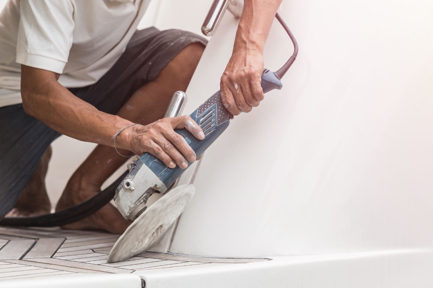
Deck Hardware
Deck hardware consists of the bullseyes, tiller , eye straps, cleats , and so on. All this small hardware needs to be replaced every 20-30 years and will amount to about $1,500.
Engine & Engine Parts
Gas engines run for about 1,500 hours, diesel engines run for 5,000. After that, you'll need to change them out.
Most engines will last you about 20 years, depending on the amount of use and whether you use it properly. Gas engine will last a lot less long than diesels.
A standard 15HP or 20HP outboard gas engine will cost you about $5,000 - $6,000 and needs replacing every 20 years or so. If you do the work yourself, it's more something like $1,000 - $1,500.
Read more on the lifetime expectancy of marine diesels here
Replacing the engine
- sailboats with inboard engine: $5,000 - $10,000
- sailboats with outboard engine: $1,000 - $1,500
- most powerboats (inboard engine): $15,000 - $35,000
- small outboard engines (2-5 hp): $1,000 - $1,500
- large outboard engines (100+ hp): $10,000+
- installation cost: $200 - $2,000
Installation Prices
The installation of the engine will cost a few hundred to a couple of thousand dollars. With inboard engines, this is not something you can easily do yourself - it isn't just unscrewing a motor and screwing a new one in.
The deciding factor of how much will this cost exactly is whether you can simply bolt the new engine in or whether you have to adjust all other parts, including shaft logs, exhausts, electrics, and so on.
Of course, if you have an outboard engine the installation price will be nothing more than a few drops of sweat, swearing, and back pain for a day or two.
Read more on boat engine replacement costs here.
Risers and Manifolds
- cost of 1 riser : $140 - $200
- cost of 1 exhaust manifold: $150 - $300
- cost of labor: $500 - $1,500
Most people need 2 risers + 2 exhaust manifolds. Parts total: $600 on average That's just what it is. Where you can really save some money, is on the labor. Labor total: $1,000 on average It's about a days worth of work. A professional needs roughly 8 hours to get the job done.
Read more about the cost of replacing risers and manifolds here.
Boat starter replacement
Inboard engine (and generator) starters cost from $40 - over $1,000 depending on the engine. Outboard starters run from about $100 - $500. Skilled marine technicians charge from $75 - $150 per hour. Your costs will range from a couple of hundred dollars for a small outboard up to over a thousand for a large or difficult to reach inboard.
That's a broad range, but if you know what you need for your boat, then you can get a better idea of the cost. The final price depends on two things - what type of engine you have, and how hard it is to get to the starter.
Read more on the average cost to replace a boat starter here.
Replacing safety equipment
USCG safety regulations require you to replace safety gear regularly.
- Lifejackets have to be replaced every 10 years.
- Flares have to be replaced every 42 months. You could consider buying a LED electric distress light instead, which will last you a lifetime.
- If you carry a life-raft you'll need to replace that every 12 years as well.
Adhering to the minimum safety requirements shouldn't cost you more than 150 - 250 dollars every 5 years. But if you want the good stuff, need more fire extinguishers, plan on spending more like $600. If you want a life raft, that's another $1,500.
To avoid you have to go cheap on your safety gear, I've put it in the budget for $500.
If you want to know exactly what the USCG safety requirements are, including checklists , definitely check out my article here.
- Hull repairs
- Electronics update
- Recovering a sunken boat
- Sailboat mast replacement
- Keel repairs
- Rudder repairs
- Replacing or refabricing boat cushions
One-time costs:
- Registration : costs of registration differ per state, but usually run anywhere from $3 - $10 per foot.
- Taxes : differs per state and country. Most governments want you to pay property tax and sales tax. Sales tax is usually about 5%. Property tax varies and is more complex, so I'll leave that up to you to figure out.
- Trailer : $1,000
- Sailing club initiation fee : $1,500 - $4,000
Recurring costs:
- Mooring : $10-15 per foot per year (can be much higher for prime locations)
- Insurance : typically 1.5% of the total value of the boat. So a $50,000 26' cruiser will cost 750 bucks.
- Maintenance : a good rule of thumb is 10% of the boat value. Expect to spend anywhere between $500 - $2,500 per year for small to mid-sized boats.
- Fuel : depends on how much you use the boat and the engine, but on average something between $100 - $150. - Find out how much fuel a sailboat uses in my article here (opens in new tab).
- International License : if you want to sail on international waters, you have to get your ICC (International Certificate of Competence ). Plan on spending anywhere between 400 to 500 dollars.
- Safety equipment : plan on spending anywhere between 150 to 600 bucks for lifejackets, first aid kit, and distress signals.
- Winterize boat : $2,000
- Sailing club: $800 - $1,500
Vonnie Harrington
Dear improvesailing.com webmaster, Your posts are always well-supported by facts and figures.
Tressa Valencia
To the improvesailing.com admin, Your posts are always well-referenced and credible.
Leave a comment
You may also like, how much sailboats cost on average (380+ prices compared).
Turns out that owning a sailboat is pretty affordable. OK, it isn't cheap, but it can absolutely be done on a budget. In this article, I'll show you exactly what to …

How Much Does it Cost to Dock a Boat for a Year?

How Much Do New Sails Cost?

The Average Cost to Shrink Wrap a Boat (per foot)

The Cost of a Boat Engine Replacement
Visit our Popular Forums
- Monohull Sailboats
- Multihull Sailboats
- Powered Boats
- General Sailing
- Antares Yachts
- Fountaine Pajot
- Lagoon Catamarans
Cruising Business
- Boat Classifieds
- General Classifieds
- Crew Positions
- Commercial Posts
- Vendor Spotlight
Life Aboard a Boat
- Provisioning: Food & Drink
- Families, Kids, & Pets Afloat
- Recreation, Entertainment, & Fun
- Boat Ownership & Making a Living
- Liveaboard's Forum
Seamanship, Navigation & Boat Handling
- Seamanship & Boat Handling
- Training, Licensing, & Certification
- Health, Safety, & Related Gear
- Rules of the Road, Regulations, & Red Tape
Engineering & Systems
- Const. / Maint. / Refit
- Product / Service Reviews
- Electronics: Comms / AV
- Electrical: Batts / Gen / Solar
- Lithium Power Systems
- Engines & Propulsion
- Propellers & Drive Systems
- Plumbing / Fixtures
- Deck Hdw: Rigging / Sails
- Aux. Equipment & Dinghy
- Anchoring & Mooring
Photo Categories
- Member Galleries
- Life Onboard
- Sailing in the Wind
- Power Boats
- Cruising Destinations
- Maint. & Boat Building
- Marine Life
- Scuba Diving & Divers
- General Photos
Recent Photos

Listing Categories
- African Cats
- view more »
- Crew Wanted
- Crew Available
- Enhance Your Account
- Meet the Mods
- Meet the Advisors
- Signup for The Daily Cruiser Email

| |||||||||||||||||||||||||||||||||||||||||||||||||||||||||||||||||||||||||||||||||||||||||||||||||||||||||||||||||||||||||||||||||||||||||||||||||||||||||||||||||||||||||||||||||||||||||||||||||||||||||||||||||||||||||||||||||||||||||||||||||||||||||||||||||||||||||||||||||||||||||||||||||||||||||||||||||||||||||||||||||||||||||||||||||||||||||||||||||||||||||||||||||||||||||||||||||||||||||||||||||||||||||||||||||||||||||||||||||||||||||||||||||||||||||||||||||||||||||||||||||||||||||||||||||||||||||||||||||||||||||||||||||||||||||||||||||||||||||||||||||||||||||||||||||||||||||||||||||||||||||||||||||||||||||||||||||||||||||||||||||||||||||||||||||||||||||||||||||||||||||||||||||||||||||||||||||||||||||||||||||||||||||||||||||||||||||||||||||||||||||||||||||||||||||||||||||||||||||||||||||||||||||||||||||||||||||||||||||||||||||||||||||||||||||||||||||||||||||||||||


COMMENTS
Images: 8. Steel Hull Maintenance. Still on the long winding path of finding a sailing boat here . Just got some info on a steel monohull boat, about 38' long - with a recent survey. I've read lots about steel on CF and generally like the idea, and I've read a bit about the maintenance side. But I'm trying to get a better feel for ...
Steel Sailboat Maintenance. Jump to Latest 25K views 16 replies 10 participants last post by Stillraining Apr 29, 2008. stipakb Discussion starter 52 posts · Joined 2006 Add to quote; Only show this user #1 · Apr 26, 2008. How hard is the maintenance of steel sailboats? ...
Not a steel boat owner but I did work for 40 years in the steel industry and am a boat owner of 30 years too. You can expect a steel boat to be maintenance heavy - steel and salt water dont mix but the outside is the easy bit. Much more difficult will be dealing with internal rusting from bilge water and condensation.
A steel boat owner's biggest enemy is corrosion. They don't have to worry about osmosis or rotting timbers, instead rust is the number one issue that will keep them awake at night. Steel hull maintenance mainly involves checking inside and outside the hull for rust and then dealing with it.
And that care and attention won't help if it isn't comprehensive. That's why we've put together this ultimate sailboat maintenance checklist to help keep your ship in top condition: Inspect the boat. Survey the bilge, for example. Test the bilge pump and make sure it runs smoothly. Visually inspect the hull. Look for leaks.
95 % of the paint maintenance of a steel boat is on the deck. A steel hull/stainless deck has about 1 hour of touch up maintenance every year (for all those logs and obstacles hit on the water) Thus for metallic boats ultimately the material is not the problem, its the way it has been put together and maintained. A production aluminum sailboat ...
Make sure the inside was well painted before foaming.Lack of inside painting is the only reason a steel boat would rust from the inside out. My maintenance is about an hour or two a year. Welded down fittings don't work loose, or leak. Brent. 10-08-2009, 17:06. # 9.
Clean the thru-hull. Clean the siphon break. Fill up coolant and antifreeze if needed. Check pump, impeller, and raw water strainer. Finally, let's see the annual maintenance of your sailboat's engine: Test the batteries. Check the diesel tank for damages. Inspect the shaft and propeller.
Check your steering systems. Dinghies have this one easy, put your rudder and tiller in the boat and move it around. Action should be smooth without wiggles. Check your tiller extension fittings for cracking and signs it may break soon. Bigger boats, check your steering cables and rudder bearings at least annually.
Tending to Maintenance: Steel hull sailboats require diligent maintenance to prevent corrosion. Exposure to saltwater can accelerate the formation of rust, necessitating regular inspections and protective coatings. Yet, the care bestowed upon a steel hull sailboat is not a burden but rather a labor of love—a testament to the enduring ...
Sailboat Oil and Filter Maintenance. To change the oil, allow the engine to run for 6 to 8 minutes and then turn it off. Place a container under the drain plug and allow the oil to drain for about 30 minutes. Once the oil has fully drained, replace the drain plug and fill the engine with oil.
To keep your boat in top shape, follow this sailboat maintenance checklist to ensure maximum performance and longevity. 1. Inspect the Overall Boat Structure. First, it's a good idea to inspect the boat thoroughly and ensure everything is in shipshape. It's wise to check the hull for any visible damage at least once a year or every few months.
Rust is a steel boat owner's toredo worm. Steel is anything but maintenance-free, but by paying attention and following through with touch-up work when necessary, a steel cruising boat can be kept in her prime for decades. Ralph Naranjo is Cruising World's technical editor. Steel ship designers see rust as a reality.
Check electrical connections, deck and spreader lights. Wax mast tracks and luff grooves with candle wax or Teflon spray. Standing rigging: Look for areas of wear or stranding on the wire. Check mast tangs, T-ball joints and rigging screws. Wash furling drum and swivel and check they move freely.
The average annual maintenance cost of sailboats is between $2,000 - $3,000. However, larger boats of 30 feet and up will cost considerably more. The actual total annual cost is $3,000 to $7,000, due to other recurring costs like docking and insurance fees. However, what you'll actually pay really depends on the type of boat you have and what ...
My specific question would be, how long can a steel boat be left alone in a tropical marina, before I have time to jump down for a rust-hunt? _____ Useful as a fireproof bottom paint... 05-09-2017, 03:35 ... Steel Boat Maintenance: ViribusUnitis: Monohull Sailboats: 24: 20-08-2009 04:10: Advertise Here. Recent Discussions: WARNING! SCAMMERS ...
Boat cleaner: A cleaning solution designed to remove dirt, grime, and other contaminants from the boat's surface. Some boat cleaners are formulated to target specific types of buildup, such as salt deposits or oxidation. Boat wax: A protectant that helps protect the boat's gelcoat and enhance its shine. Boat wax can be applied to the boat ...
Our Trawler Living Aboard Vlog while performing Steel Boat maintenance on our Steel Motorsailer Ketch. This Sailing Vlog is our full Liveaboard Life story!⛵C...
Khanty-Mansi Autonomous Okrug — Yugra [a], commonly shortened to Khantia-Mansia, is a federal subject of Russia (an autonomous okrug of Tyumen Oblast).It has a population of 1,532,243 as of the 2010 Census. [4] Its administrative center is located at Khanty-Mansiysk.. The peoples native to the region are the Khanty and the Mansi, known collectively as Ob-Ugric peoples, but today the two ...
I'm not trying to slag off all steel boats, but the risks associated with buying an older one seem far greater than those associated with many other forms of construction. ... Steel Boat Maintenance: ViribusUnitis: Monohull Sailboats: 24: 20-08-2009 04:10: Lifting One Hull for Maintenance: svcattales: Multihull Sailboats: 13: 28-06-2009 15:42 ...
Khanty-Mansi Autonomous Okrug — Yugra, commonly shortened to Khantia-Mansia, is a federal subject of Russia (an autonomous okrug of Tyumen Oblast). It has a population of 1,532,243 as of the 2010 Census. Its administrative center is located at Khanty-Mansiysk. Khanty-Mansi Autonomous Okrug - WikiMil.
The largest cities of Khanty-Mansi Autonomous Okrug - Yugra are Surgut (396,000), Nizhnevartovsk (280,800), Nefteyugansk (128,700), Khanty-Mansiysk (106,000), Kogalym (69,200), Nyagan (58,500). Today, only about 32,000 people are representatives of indigenous peoples: Khanty, Mansi and Nenets. Half of them live in the traditional way.
The Khanty-Mansiysk Autonomous Area (KhMAO) was established in 1930. Its name comes from two main northern indigenous peoples - the Khanty and the Mansi. From 1944 it was legally part of the Tyumen Region, but in 1993 the Area received autonomy and became a full-fledged territorial entity of the Russian Federation.